Gila Crossing, Arizona
| Gila Crossing, Arizona O'odham: Kuiwa | |
|---|---|
| CDP | |
 | |
 Gila Crossing, Arizona Location in the United States | |
| Coordinates: 33°16′34″N 112°10′1″W / 33.27611°N 112.16694°WCoordinates: 33°16′34″N 112°10′1″W / 33.27611°N 112.16694°W | |
| Country | United States |
| State | Arizona |
| County | Maricopa |
| Population (2010) | |
| • Total | 621 |
| Time zone | MST (no DST) (UTC-7) |
Gila Crossing (O'odham: Kuiwa) is a census-designated place (CDP) in Maricopa County, Arizona, United States, located in the Gila River Indian Community. The population was 621 at the 2010 census.
Demographics
As of the census[1] of 2010, there were 621 people residing in the CDP. The population density was 714.5 people per square mile. The racial makeup of the CDP was 84.06% Native American, 3.38% White, 0.81% Black or African American, 1.13% from other races, and 10.63% from two or more races. 14.65% of the population were Hispanic or Latino of any race.
References
External links
![]() Media related to Gila Crossing, Arizona at Wikimedia Commons
Media related to Gila Crossing, Arizona at Wikimedia Commons
Municipalities and communities of Maricopa County, Arizona, United States | ||
|---|---|---|
| Cities | 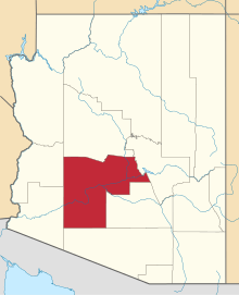 | |
| Towns | ||
| CDPs | ||
| Unincorporated communities |
| |
| Indian reservations | ||
| Ghost towns | ||
| Footnotes | ‡This populated place also has portions in an adjacent county or counties | |
This article is issued from Wikipedia - version of the 6/28/2015. The text is available under the Creative Commons Attribution/Share Alike but additional terms may apply for the media files.