Natchaug State Forest
| Natchaug State Forest | |
| Connecticut State Forest | |
 | |
| Country | |
|---|---|
| State | |
| County | Windham |
| Towns | Ashford, Brooklyn, Chaplin, Eastford, Hampton, Pomfret |
| Elevation | 568 ft (173 m) [1] |
| Coordinates | 41°52′45″N 72°11′16″W / 41.87917°N 72.18778°WCoordinates: 41°52′45″N 72°11′16″W / 41.87917°N 72.18778°W [1] |
| Area | 13,438 acres (5,438 ha) [2] |
| Established | 1917 [3] |
| Management | Connecticut Department of Energy and Environmental Protection |
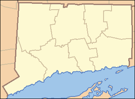 Location in Connecticut | |
| Website: Natchaug State Forest | |
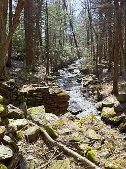
Natchaug State Forest is a Connecticut state forest located in six towns including Ashford, Chaplin, and Eastford.[3] The Natchaug River runs from north to south along (and in a few cases through) the western border of the main forest parcel. James L. Goodwin State Forest abuts Natchaug State Forest to the south. One of the forest units abuts Mashamoquet Brook State Park in Pomfret.
Environment
The forest lies within the Northeastern coastal forests ecoregion.[4]
Recreation opportunities
The forest's extensive trail system includes the Natchaug Trail and CCC Loop.[3] Trails are used for hiking, horseback riding, mountain biking, cross-country skiing, and snowmobiling. Camping facilities are available for backpackers and equestrians.[5] The forest is also the site of a small state park encompassing the birthplace of American Revolutionary War militia general Nathaniel Lyons.
See also
| Wikimedia Commons has media related to Natchaug State Forest. |
References
- 1 2 "Natchaug State Forest". Geographic Names Information System. United States Geological Survey.
- ↑ Legislative Program Review & Investigations Committee (January 23, 2014). "State Parks and Forests: Funding" (PDF). Staff Findings and Recommendations. Connecticut General Assembly. p. A-3. Retrieved March 20, 2014.
- 1 2 3 "Connecticut State Forests Seedling Letterbox Series - Clues for Natchaug State Forest". State Parks and Forests. Connecticut Department of Energy and Environmental Protection. Retrieved July 21, 2014.
- ↑ Olson, D. M, E. Dinerstein; et al. (2001). "Terrestrial Ecoregions of the World: A New Map of Life on Earth". BioScience. 51 (11): 933–938. doi:10.1641/0006-3568(2001)051[0933:TEOTWA]2.0.CO;2.
- ↑ "Natchaug State Forest". State Parks and Forests. Connecticut Department of Energy and Environmental Protection. Retrieved July 21, 2014.
External links
- Natchaug State Forest Connecticut Department of Energy and Environmental Protection
| ||