List of Pennsylvania state historical markers in Perry County
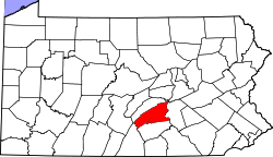
Location of Perry County in Pennsylvania
This is a list of the Pennsylvania state historical markers in Perry County.
This is intended to be a complete list of the official state historical markers placed in Perry County, Pennsylvania by the Pennsylvania Historical and Museum Commission (PHMC). The locations of the historical markers, as well as the latitude and longitude coordinates as provided by the PHMC's database, are included below when available. There are 15 historical markers located in Perry County.[1]
Historical markers
| Marker title | Image | Date dedicated | Location | Marker type | Topics |
|---|---|---|---|---|---|
| Carson Long Military Institute | May 9, 1987 | N. Carlisle St. at school, New Bloomfield |
Roadside | Education, Military, Military Post-Civil War | |
| Centre Church | February 13, 1948 | Junction Pa. 850 & Pa. 274, 2.1 miles W of Loysville (Missing) |
Roadside | Buildings, Early Settlement, Religion | |
| Dr. Reifsnyder | July 30, 1947 | U.S. 11 & 15, Liverpool 40°34′25″N 76°59′24″W / 40.5735°N 76.9899°W |
Roadside | Medicine & Science, Professions & Vocations, Religion, Women | |
| Fort Robinson | April 28, 1947 | Junction Pa. 274 & 850, 2. 1miles W of Loysville 40°21′31″N 77°22′48″W / 40.35867°N 77.38012°W |
Roadside | Forts, French & Indian War, Military, Native American | |
| James A. Beaver |  |
April 19, 1948 | Market & Sunbury Sts., in median at Sq., Millerstown 40°32′58″N 77°09′18″W / 40.54955°N 77.15495°W |
Roadside | Civil War, Government & Politics, Government & Politics 19th Century, Governors, Military |
| John Bannister Gibson | 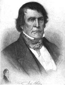 |
July 25, 1947 | Pa. 850, 1.2 miles W of Dromgold 40°21′07″N 77°12′42″W / 40.3519°N 77.21167°W |
Roadside | Government & Politics, Government & Politics 19th Century, Governors |
| John Bannister Gibson - PLAQUE | |
September 1929 | PA 850 at Mill Rd., 1 mile W of Dromgold |
Plaque | Government & Politics 19th Century, Professions & Vocations |
| Lightning Guider Sleds | July 8, 1992 | 722 N. Market St., Duncannon 40°23′53″N 77°01′23″W / 40.3981°N 77.02307°W |
Roadside | Business & Industry, Sports | |
| Millersburg Ferry | 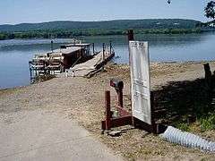 |
May 20, 1973 | U.S. 11 & 15 S of Liverpool, near junction Pa. 34 40°32′37″N 76°59′16″W / 40.5437°N 76.98773°W |
Roadside | Business & Industry, Oil & Gas, Transportation |
| Pennsylvania Canal (Susquehanna Division) | June 12, 1952 | US 11 & 15 at Island Rd. (Haldeman Is. entrance), just N of Rt. 322 interchange, N of Duncannon |
Roadside | Canals, Government & Politics, Navigation, Railroads, Transportation | |
| Pennsylvania Canal (Susquehanna Division) | June 12, 1952 | U.S. 11 & 15 just N of Amity Hall, Duncannon (MISSING) |
Roadside | Canals, Navigation, Transportation | |
| Pennsylvania Canal (Susquehanna Division) | June 12, 1952 | U.S. 11 & 15 just N of Liverpool (MISSING) |
Roadside | Canals, Navigation, Transportation | |
| Perry County | 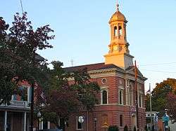 |
October 21, 1982 | County Courthouse, on Square, New Bloomfield 40°25′12″N 77°11′13″W / 40.42°N 77.18687°W |
City | Government & Politics, Government & Politics 19th Century, Governors |
| Rockville Bridge | 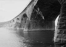 |
September 21, 1986 | U.S. 11 & 15 at N end of Marysville |
Roadside | Bridges, Transportation |
| William Bigler (1814-1880) |  |
July 3, 1951 | Junction Pa. 34 & 850, Dromgold |
Roadside | Government & Politics, Government & Politics 19th Century, Governors |
See also
- List of Pennsylvania state historical markers
- National Register of Historic Places listings in Perry County, Pennsylvania
References
- ↑ "PHMC Historical Markers Search" (Searchable database). Pennsylvania Historical and Museum Commission. Commonwealth of Pennsylvania. Retrieved 2010-07-19.
External links
Municipalities and communities of Perry County, Pennsylvania, United States | ||
|---|---|---|
| Boroughs | | |
| Townships | ||
| Unincorporated communities |
| |

This article is issued from Wikipedia - version of the 7/4/2015. The text is available under the Creative Commons Attribution/Share Alike but additional terms may apply for the media files.