Millerstown, Pennsylvania
| Millerstown, Pennsylvania | |
|---|---|
| Borough | |
|
House in Millerstown | |
| Motto: Perry County's Oldest Planned Town | |
 Millerstown, Pennsylvania | |
| Coordinates: 40°33′03″N 77°09′17″W / 40.55083°N 77.15472°WCoordinates: 40°33′03″N 77°09′17″W / 40.55083°N 77.15472°W | |
| Country | United States |
| State | Pennsylvania |
| County | Perry |
| Settled | 1780 |
| Incorporated | 1849 |
| Government | |
| • Mayor | John Kerns |
| • Secretary/Treasurer | Karen Knellinger |
| • Solicitor | Steven Miner |
| • Tax Collector | Kimberly Savercool |
| Area | |
| • Total | 0.9 sq mi (2.4 km2) |
| Elevation | 459 ft (140 m) |
| Population (2000) | |
| • Total | 673 |
| • Density | 788.7/sq mi (304.8/km2) |
| Time zone | Eastern (EST) (UTC-5) |
| • Summer (DST) | EDT (UTC-4) |
| Zip code | 17062 |
| Area code(s) | 717 |
| Website | Millerstown, Pennsylvania |

Millerstown is a borough in northern Perry County, Pennsylvania, United States located (via road) 29 miles (47 km) northwest of Harrisburg and 29 miles (47 km) southwest of Selinsgrove. The population was 673 at the 2010 Census.[1] The borough is part of the Harrisburg–Carlisle Metropolitan Statistical Area.
History
Millerstown is located on a tract of land originally sold to James Gallagher on September 23, 1766, however, there is evidence that a small town named "Smithfield" was founded by him before then.
This plot of ground was later sold to David Miller on September 1, 1780, who filed for a patent in 1790 for the "laying out of the town," thus making Miller's Town the first town to be plotted for sale in the territory at that time comprising Perry County. Miller's Town was later combined to form Millerstown.
Millerstown Borough was incorporated February 12, 1849, and the first meeting of the newly formed town council was held on April 14, 1849. Abraham Addams was the first chief burgess (mayor), and John M. Cauffman, Christian Beck, James R. Gilmer, and Jacob Emerick, were members of the first Borough Council. Thomas P. Cochran was the first council clerk with a salary of $2.50 a year.
Millerstown is home to many old stone houses, some dating back to the 18th century.
Geography
Millerstown is located at 40°33′3″N 77°9′17″W / 40.55083°N 77.15472°W (40.550884, -77.154659),[2] along the Juniata River in northern Perry County, at the junctions of U.S. Routes 22 and 322 and Pennsylvania Route 17. It is 33 miles northwest of the state capital, Harrisburg.
According to the United States Census Bureau, the borough has a total area of 0.9 square miles (2.3 km2), of which, 0.9 square miles (2.3 km2) of it is land and 0.1 square miles (0.26 km2) of it (6.52%) is water.
Demographics
| Historical population | |||
|---|---|---|---|
| Census | Pop. | %± | |
| 1840 | 371 | — | |
| 1850 | 389 | 4.9% | |
| 1860 | 378 | −2.8% | |
| 1870 | 533 | 41.0% | |
| 1880 | 652 | 22.3% | |
| 1890 | 594 | −8.9% | |
| 1900 | 555 | −6.6% | |
| 1910 | 549 | −1.1% | |
| 1920 | 616 | 12.2% | |
| 1930 | 689 | 11.9% | |
| 1940 | 684 | −0.7% | |
| 1950 | 682 | −0.3% | |
| 1960 | 675 | −1.0% | |
| 1970 | 612 | −9.3% | |
| 1980 | 550 | −10.1% | |
| 1990 | 646 | 17.5% | |
| 2000 | 679 | 5.1% | |
| 2010 | 673 | −0.9% | |
| Est. 2015 | 675 | [3] | 0.3% |
| Sources:[4][5][6] | |||
As of the census[5] of 2000, there were 679 people, 275 households, and 196 families residing in the borough. The population density was 788.7 people per square mile (304.8/km²). There were 292 housing units at an average density of 339.2 per square mile (131.1/km²). The racial makeup of the borough was 99.12% White, 0.29% African American, 0.15% Asian, and 0.44% from two or more races. Hispanic or Latino of any race were 0.88% of the population.
There were 275 households out of which 32.0% had children under the age of 18 living with them, 60.4% were married couples living together, 9.1% had a female householder with no husband present, and 28.4% were non-families. 24.4% of all households were made up of individuals and 14.9% had someone living alone who was 65 years of age or older. The average household size was 2.47 and the average family size was 2.95.
In the borough the population was spread out with 24.0% under the age of 18, 9.0% from 18 to 24, 26.5% from 25 to 44, 23.6% from 45 to 64, and 16.9% who were 65 years of age or older. The median age was 39 years. For every 100 females there were 79.6 males. For every 100 females age 18 and over, there were 81.1 males.
The median income for a household in the borough was $43,750, and the median income for a family was $53,173. Males had a median income of $37,159 versus $24,732 for females. The per capita income for the borough was $22,289. About 2.0% of families and 5.0% of the population were below the poverty line, including 6.1% of those under age 18 and 2.5% of those age 65 or over.
Public services
The borough and most surrounding townships are served by the Greenwood School District.
Millerstown is served by the Millerstown Fire Department & Ambulance League.
Notable People
- James A. Beaver, 20th Governor of Pennsylvania, born in Millerstown
- Cameron Mitchell, famous actor in the mid to late 1900's
References
- ↑ U.S. Census Bureau, 2010 Census
- ↑ "US Gazetteer files: 2010, 2000, and 1990". United States Census Bureau. 2011-02-12. Retrieved 2011-04-23.
- ↑ "Annual Estimates of the Resident Population for Incorporated Places: April 1, 2010 to July 1, 2015". Retrieved July 2, 2016.
- ↑ "Census of Population and Housing". U.S. Census Bureau. Retrieved 11 December 2013.
- 1 2 "American FactFinder". United States Census Bureau. Retrieved 2008-01-31.
- ↑ "Incorporated Places and Minor Civil Divisions Datasets: Subcounty Resident Population Estimates: April 1, 2010 to July 1, 2012". Population Estimates. U.S. Census Bureau. Retrieved 11 December 2013.
External links
Municipalities and communities of Perry County, Pennsylvania, United States | ||
|---|---|---|
| Boroughs | 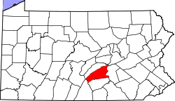 | |
| Townships | ||
| Unincorporated communities |
| |