Shermans Dale, Pennsylvania
| Shermans Dale Sherman's Dale Sherman Valley | |
|---|---|
| Unincorporated community | |
| Coordinates: 40°19′27″N 77°10′24″W / 40.32417°N 77.17333°WCoordinates: 40°19′27″N 77°10′24″W / 40.32417°N 77.17333°W | |
| Country | United States |
| State | Pennsylvania |
| County | Perry |
| Township | Carroll |
| Elevation | 468 ft (143 m) |
| Time zone | EST (UTC-5) |
| • Summer (DST) | Eastern Daylight Time (UTC-4) |
| Area code(s) | 717 Exchange: 789 |
Shermans Dale is an unincorporated community in Carroll Township, Perry County, Pennsylvania, United States,[1] along Sherman's Creek. It was originally settled by Scots-Irish settlers before the American Revolutionary War. Its ZIP code is 17090.
The public school that serves Shermans Dale is West Perry School District.
Religion
Mt. Gilead United Methodist Church is located here. It is also the site of a former Presbyterian church with a pioneer graveyard. Although this church is no longer used for weekly services, it is maintained for use for weddings and funerals.
References
 |
Dromgold | Crums Corners | Dellville | |
| Spring Township | |
Grier Point | ||
| ||||
| | ||||
| Carlisle Springs | Sterretts Gap, Donnellytown |
Municipalities and communities of Perry County, Pennsylvania, United States | ||
|---|---|---|
| Boroughs | 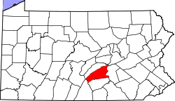 | |
| Townships | ||
| Unincorporated communities |
| |
This article is issued from Wikipedia - version of the 9/4/2016. The text is available under the Creative Commons Attribution/Share Alike but additional terms may apply for the media files.