Blain, Pennsylvania
| Blain, Pennsylvania | |
|---|---|
| Borough | |
|
Restored depot | |
 Blain, Pennsylvania | |
| Coordinates: 40°20′14″N 77°30′38″W / 40.33722°N 77.51056°WCoordinates: 40°20′14″N 77°30′38″W / 40.33722°N 77.51056°W | |
| Country | United States |
| State | Pennsylvania |
| County | Perry |
| Settled | 1846 |
| Incorporated | 1877 |
| Area | |
| • Total | 0.3 sq mi (0.9 km2) |
| Elevation | 676 ft (206 m) |
| Population (2000) | |
| • Total | 252 |
| • Density | 714.1/sq mi (278.0/km2) |
| Time zone | Eastern (EST) (UTC-5) |
| • Summer (DST) | EDT (UTC-4) |
| Zip code | 17006 |
| Area code(s) | 717 |

Blain is a borough in Perry County, Pennsylvania, United States. The population was 252 at the 2000 census. It is part of the Harrisburg–Carlisle Metropolitan Statistical Area.
History
Early settlement began around the mill built by James Blaine in 1778, from whom the borough took its name. The final "e" was dropped at some point, although there are records of county newspapers using the "Blaine" spelling through at least 1868. Early in the 1800s, Blaine's mill came into the possession of William Douglas, who had a post office established with the name "Douglas' Mills". A subsequent owner of the mill, Anthony Black, had the name of the post office changed to "Multicaulisville", after the mulberry tree (morus multicaulis), in which he had a financial interest during a speculative bubble in the tree. Lots were platted for sale in 1846 and the name of the post office was changed to "Blain".
At one time, Blain was noted for being the smallest borough in Pennsylvania to own its own water plant and electric street lighting system. Jacob Wentz was instrumental in the construction of the first water plant in about 1869 or 1870. The borough was incorporated by an order of the Perry county court on November 3, 1877.[1]
Geography
Blain is located at 40°20′14″N 77°30′38″W / 40.33722°N 77.51056°W (40.337233, -77.510525).[2]
According to the United States Census Bureau, the borough has a total area of 0.3 square miles (0.78 km2), all of it land. Population is 286 (2000). Its highest point is Conegeuege mountain (1872 feet) its elevation is 750 feet on average.
Demographics
| Historical population | |||
|---|---|---|---|
| Census | Pop. | %± | |
| 1880 | 270 | — | |
| 1890 | 249 | −7.8% | |
| 1900 | 326 | 30.9% | |
| 1910 | 326 | 0.0% | |
| 1920 | 310 | −4.9% | |
| 1930 | 291 | −6.1% | |
| 1940 | 280 | −3.8% | |
| 1950 | 315 | 12.5% | |
| 1960 | 336 | 6.7% | |
| 1970 | 287 | −14.6% | |
| 1980 | 274 | −4.5% | |
| 1990 | 266 | −2.9% | |
| 2000 | 252 | −5.3% | |
| 2010 | 263 | 4.4% | |
| Est. 2015 | 262 | [3] | −0.4% |
| Sources:[4][5][6] | |||
As of the census[5] of 2000, there were 252 people, 96 households, and 67 families residing in the borough. The population density was 714.1 people per square mile (278.0/km²). There were 102 housing units at an average density of 289.1 per square mile (112.5/km²). The racial makeup of the borough was 96.43% White and 3.57% African American.
There were 96 households out of which 30.2% had children under the age of 18 living with them, 58.3% were married couples living together, 11.5% had a female householder with no husband present, and 29.2% were non-families. 22.9% of all households were made up of individuals and 12.5% had someone living alone who was 65 years of age or older. The average household size was 2.63 and the average family size was 3.15.
In the borough the population was spread out with 28.2% under the age of 18, 4.0% from 18 to 24, 29.0% from 25 to 44, 23.0% from 45 to 64, and 15.9% who were 65 years of age or older. The median age was 36 years. For every 100 females there were 98.4 males. For every 100 females age 18 and over, there were 103.4 males.
The median income for a household in the borough was $32,500, and the median income for a family was $39,750. Males had a median income of $35,313 versus $21,875 for females. The per capita income for the borough was $16,223. About 11.6% of families and 12.6% of the population were below the poverty line, including 18.3% of those under the age of eighteen and 10.3% of those sixty five or over.
Notes and references
- ↑ Hain, Harry Harrison (1922). "Blain Boroughs". History of Perry County, Pennsylvania. Harrisburg, PA: Hain-Moore company. p. 927. Retrieved 2011-09-03.
- ↑ "US Gazetteer files: 2010, 2000, and 1990". United States Census Bureau. 2011-02-12. Retrieved 2011-04-23.
- ↑ "Annual Estimates of the Resident Population for Incorporated Places: April 1, 2010 to July 1, 2015". Retrieved July 2, 2016.
- ↑ "Census of Population and Housing". U.S. Census Bureau. Archived from the original on 11 May 2015. Retrieved 11 December 2013.
- 1 2 "American FactFinder". United States Census Bureau. Archived from the original on 2013-09-11. Retrieved 2008-01-31.
- ↑ "Incorporated Places and Minor Civil Divisions Datasets: Subcounty Resident Population Estimates: April 1, 2010 to July 1, 2012". Population Estimates. U.S. Census Bureau. Archived from the original on 17 June 2013. Retrieved 11 December 2013.
Municipalities and communities of Perry County, Pennsylvania, United States | ||
|---|---|---|
| Boroughs | 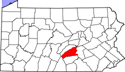 | |
| Townships | ||
| Unincorporated communities |
| |