Bac Mòr
| Gaelic name | Bac Mòr |
|---|---|
| Meaning of name | large bank or obstacle |
 | |
| Location | |
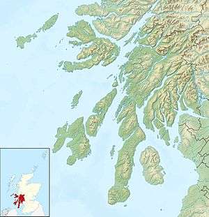 Bac Mòr Bac Mòr shown within Argyll and Bute | |
| OS grid reference | NM243387 |
| Physical geography | |
| Island group | Treshnish Isles |
| Area | ha |
| Highest elevation | Dutchman's Cap 86 m |
| Administration | |
| Sovereign state | United Kingdom |
| Country | Scotland |
| Council area | Argyll and Bute |
| Demographics | |
| Population | 0[1] |
| References | [2][3] |
Bac Mòr is a Scottish island, one of the Treshnish Isles,[3] sometimes referred to as The Dutchman's Cap in English due to its shape.[2]
Origin of name
The Gaelic name has more than one possible interpretation. Mòr means large (as opposed to Bac Beag, its smaller sister), but Bac can mean a "bank", or also an "obstacle" or "hindrance". The island's profile is one of the more distinctive amongst the Scottish Islands.
Geology
Bac Mòr is of ancient volcanic origin, and the peak in the middle is a former cone. The low lying plain surrounding it is formed from a glassy lava field.
Despite having no safe landing places, there are the remains of summer sheilings on the island.
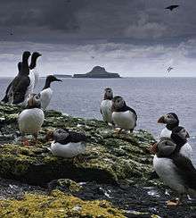
Wildlife
The Treshnish Isles are uninhabited and are owned by a charity, The Hebridean Trust. They are designated a Site of Special Scientific Interest and a Special Protection Area due to their importance for breeding seabirds. There are also a number of wildflowers there.
References
- ↑ National Records of Scotland (15 August 2013) (pdf) Statistical Bulletin: 2011 Census: First Results on Population and Household Estimates for Scotland - Release 1C (Part Two). "Appendix 2: Population and households on Scotland’s inhabited islands". Retrieved 17 August 2013.
- 1 2 Haswell-Smith, Hamish (2004). The Scottish Islands. Edinburgh: Canongate. p. 105. ISBN 978-1-84195-454-7.
- 1 2 Ordnance Survey. "View: Sheet 44, Coll and Tiree - Ordnance Survey One-inch to the mile maps of Great Britain, Seventh Series, 1952-1961". National Library of Scotland. National Library of Scotland. Retrieved 2016-01-23.
Coordinates: 56°27′37″N 6°28′31″W / 56.46028°N 6.47528°W
Inhabited islands of the Hebrides | ||
|---|---|---|
| Inner Hebrides | 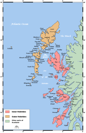 | |
| Outer Hebrides | ||