Garbh Eileach
| Gaelic name | Garbh Eileach |
|---|---|
| Meaning of name | rough rock[1] |
| Location | |
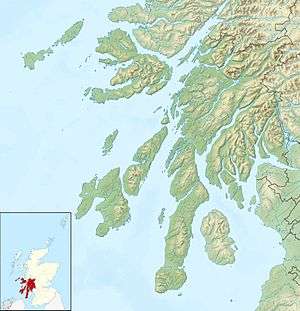 Garbh Eileach Garbh Eileach shown within Argyll and Bute | |
| OS grid reference | NM665115 |
| Physical geography | |
| Island group | Garvellachs |
| Area | 142 hectares (0.55 sq mi) |
| Area rank | 127= [2] |
| Highest elevation | 110 m |
| Administration | |
| Sovereign state | United Kingdom |
| Country | Scotland |
| Council area | Argyll and Bute |
| Demographics | |
| Population | 0 |
| References | [3][4][5] |
Garbh Eileach is an uninhabited island in the Inner Hebrides of the west coast of Scotland. It is the largest of the Garvellachs and lies in the Firth of Lorne between Mull and Argyll.
The name is Gaelic for "rough rock".[1] The Anglicised version of the name gives the whole group of islands its name, the Garvellachs.

Bothy on Garbh Eileach
There is a small ruined fort above a bay on the eastern coast.[6]
Footnotes
- 1 2 Mac an Tàilleir (2003) p. 53
- ↑ Area and population ranks: there are c. 300 islands over 20 ha in extent and 93 permanently inhabited islands were listed in the 2011 census.
- ↑ National Records of Scotland (15 August 2013) (pdf) Statistical Bulletin: 2011 Census: First Results on Population and Household Estimates for Scotland - Release 1C (Part Two). "Appendix 2: Population and households on Scotland’s inhabited islands". Retrieved 17 August 2013.
- ↑ Haswell-Smith, Hamish (2004). The Scottish Islands. Edinburgh: Canongate. ISBN 978-1-84195-454-7.
- ↑ Ordnance Survey. Get-a-map (Map). 1:25,000. Leisure. Ordinance Survey. Retrieved 21 August 2013.
- ↑ Pallister, Marian (2005) Lost Argyll: Argyll's Lost Heritage. Edinburgh. Birlinn. Page 133.
References
- Mac an Tàilleir, Iain (2003) Ainmean-àite/Placenames. (pdf) Pàrlamaid na h-Alba. Retrieved 26 August 2012.
External links
| Wikimedia Commons has media related to Garbh Eileach. |
Inhabited islands of the Hebrides | ||
|---|---|---|
| Inner Hebrides | 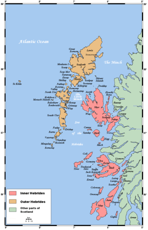 | |
| Outer Hebrides | ||
Coordinates: 56°14′35″N 5°45′54″W / 56.243°N 5.765°W
This article is issued from Wikipedia - version of the 2/21/2016. The text is available under the Creative Commons Attribution/Share Alike but additional terms may apply for the media files.