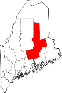
Kingman, Maine
Kingman is an unorganized territory (township) in Penobscot County, Maine, United States. The population was 174 at the 2010 census.[1]
Geography
According to the United States Census Bureau, the unorganized territory has a total area of 25.4 square miles (65.7 km²), of which 25.0 square miles (64.7 km²) is land and 0.4 square miles (0.9 km²), or 1.42%, is water.
Historic Building
The Romanzo Kingman House (1872) is on the National Register of Historic Places.
Demographics
| Historical population | |||
|---|---|---|---|
| Census | Pop. | %± | |
| 1870 | 185 | — | |
| 1880 | 546 | 195.1% | |
| 1890 | 671 | 22.9% | |
| 1900 | 936 | 39.5% | |
| 1910 | 741 | −20.8% | |
| 1920 | 604 | −18.5% | |
| 1930 | 495 | −18.0% | |
| 1940 | 367 | −25.9% | |
| 1950 | 358 | −2.5% | |
| 1970 | 264 | — | |
| 1980 | 281 | 6.4% | |
| 1990 | 246 | −12.5% | |
| 2000 | 213 | −13.4% | |
| 2010 | 174 | −18.3% | |
| Est. 2014 | 172 | [2] | −1.1% |
As of the census[4] of 2000, there were 213 people, 91 households, and 66 families residing in the unorganized territory. The population density was 8.5 people per square mile (3.3/km²). There were 114 housing units at an average density of 4.6/sq mi (1.8/km²). The racial makeup of the unorganized territory was 100.00% White.
There were 91 households out of which 23.1% had children under the age of 18 living with them, 64.8% were married couples living together, 6.6% had a female householder with no husband present, and 26.4% were non-families. 22.0% of all households were made up of individuals and 11.0% had someone living alone who was 65 years of age or older. The average household size was 2.34 and the average family size was 2.66.
In the unorganized territory the population was spread out with 16.9% under the age of 18, 4.7% from 18 to 24, 28.6% from 25 to 44, 30.0% from 45 to 64, and 19.7% who were 65 years of age or older. The median age was 45 years. For every 100 females there were 85.2 males. For every 100 females age 18 and over, there were 86.3 males.
The median income for a household in the unorganized territory was $21,875, and the median income for a family was $28,611. Males had a median income of $28,750 versus $22,500 for females. The per capita income for the unorganized territory was $11,490. About 10.3% of families and 16.5% of the population were below the poverty line, including 24.1% of those under the age of 18 and 20.5% of those 65 or over.
References
- ↑ "Geographic Identifiers: 2010 Demographic Profile Data (G001): Kingman UT, Penobscot County, Maine". U.S. Census Bureau, American Factfinder. Retrieved November 20, 2012.
- ↑ "Annual Estimates of the Resident Population for Incorporated Places: April 1, 2010 to July 1, 2014". Retrieved June 4, 2015.
- ↑ "Census of Population and Housing". Census.gov. Retrieved June 4, 2015.
- ↑ "American FactFinder". United States Census Bureau. Retrieved 2008-01-31.
Coordinates: 45°32′58″N 68°11′58″W / 45.54944°N 68.19944°W