Prospect, Maine
| Prospect, Maine | |
|---|---|
| Town | |
|
Fort Knox c. 1910 | |
 Location of Prospect (in yellow) in Waldo County and the state of Maine | |
| Coordinates: 44°33′7″N 68°52′12″W / 44.55194°N 68.87000°W | |
| Country | United States |
| State | Maine |
| County | Waldo |
| Incorporated | 1794 |
| Area[1] | |
| • Total | 20.20 sq mi (52.32 km2) |
| • Land | 18.09 sq mi (46.85 km2) |
| • Water | 2.11 sq mi (5.46 km2) |
| Elevation | 115 ft (35 m) |
| Population (2010)[2] | |
| • Total | 709 |
| • Estimate (2012[3]) | 711 |
| • Density | 39.2/sq mi (15.1/km2) |
| Time zone | Eastern (EST) (UTC-5) |
| • Summer (DST) | EDT (UTC-4) |
| ZIP code | 04981 |
| Area code(s) | 207 |
| FIPS code | 23-61210 |
| GNIS feature ID | 0582688 |
| Website | http://www.prospectmaine.org/ |

Prospect is a town in Waldo County, Maine, United States. The population was 709 at the 2010 census.
The most prominent landmark in Prospect is Fort Knox, a large 19th-century fort. It is now a major tourist attraction, as is the Penobscot Narrows Bridge and Observatory.
History
Originally part of Frankfort, it was settled in 1759 when Fort Pownall was completed at Fort Point on Cape Jellison. Prospect was set off and incorporated in 1794. Land was then set off from Prospect in 1845 to form part of Searsport. Stockton (later Stockton Springs) was set off and incorporated in 1857. Shipbuilding was an early industry. By 1859, the town had one gristmill, three sawmills and a shingle mill.[4] Construction on Fort Knox began in 1844, using granite from Mount Waldo in Frankfort. It was built to defend the Penobscot River and the lumber port of Bangor during the Aroostook War. Although never fully completed, work on the huge defense stopped in 1869.[5]
Geography
According to the United States Census Bureau, the town has a total area of 20.20 square miles (52.32 km2), of which, 18.09 square miles (46.85 km2) of it is land and 2.11 square miles (5.46 km2) is water.[1] Drained by the south branch of the Marsh River, Prospect is situated along the west bank of the Penobscot River.
The town is crossed by U.S. Route 1, U.S. Route 1A, Maine State Route 3 and Maine State Route 174.
Demographics
| Historical population | |||
|---|---|---|---|
| Census | Pop. | %± | |
| 1800 | 770 | — | |
| 1810 | 1,300 | 68.8% | |
| 1820 | 1,771 | 36.2% | |
| 1830 | 2,383 | 34.6% | |
| 1840 | 3,492 | 46.5% | |
| 1850 | 2,467 | −29.4% | |
| 1860 | 1,005 | −59.3% | |
| 1870 | 886 | −11.8% | |
| 1880 | 770 | −13.1% | |
| 1890 | 697 | −9.5% | |
| 1900 | 648 | −7.0% | |
| 1910 | 597 | −7.9% | |
| 1920 | 431 | −27.8% | |
| 1930 | 288 | −33.2% | |
| 1940 | 430 | 49.3% | |
| 1950 | 392 | −8.8% | |
| 1960 | 412 | 5.1% | |
| 1970 | 358 | −13.1% | |
| 1980 | 511 | 42.7% | |
| 1990 | 542 | 6.1% | |
| 2000 | 642 | 18.5% | |
| 2010 | 709 | 10.4% | |
| Est. 2014 | 716 | [6] | 1.0% |
2010 census
As of the census[2] of 2010, there were 709 people, 291 households, and 197 families residing in the town. The population density was 39.2 inhabitants per square mile (15.1/km2). There were 337 housing units at an average density of 18.6 per square mile (7.2/km2). The racial makeup of the town was 98.4% White, 0.3% African American, 0.4% Native American, 0.1% Asian, and 0.7% from two or more races. Hispanic or Latino of any race were 0.3% of the population.
There were 291 households of which 32.3% had children under the age of 18 living with them, 52.9% were married couples living together, 10.3% had a female householder with no husband present, 4.5% had a male householder with no wife present, and 32.3% were non-families. 23.7% of all households were made up of individuals and 6.9% had someone living alone who was 65 years of age or older. The average household size was 2.44 and the average family size was 2.84.
The median age in the town was 44.3 years. 21.7% of residents were under the age of 18; 6.3% were between the ages of 18 and 24; 23.1% were from 25 to 44; 36% were from 45 to 64; and 12.8% were 65 years of age or older. The gender makeup of the town was 51.6% male and 48.4% female.
2000 census
As of the census[8] of 2000, there were 642 people, 253 households, and 190 families residing in the town. The population density was 35.5 people per square mile (13.7/km²). There were 286 housing units at an average density of 15.8 per square mile (6.1/km²). The racial makeup of the town was 98.60% White, 0.16% Native American, and 1.25% from two or more races. Hispanic or Latino of any race were 0.16% of the population.
There were 253 households out of which 34.8% had children under the age of 18 living with them, 57.7% were married couples living together, 10.7% had a female householder with no husband present, and 24.9% were non-families. 19.8% of all households were made up of individuals and 5.5% had someone living alone who was 65 years of age or older. The average household size was 2.54 and the average family size was 2.86.
In the town the population was spread out with 26.5% under the age of 18, 5.8% from 18 to 24, 33.0% from 25 to 44, 25.4% from 45 to 64, and 9.3% who were 65 years of age or older. The median age was 37 years. For every 100 females there were 114.0 males. For every 100 females age 18 and over, there were 105.2 males.
The median income for a household in the town was $36,607, and the median income for a family was $41,406. Males had a median income of $32,292 versus $24,750 for females. The per capita income for the town was $20,243. About 7.6% of families and 10.4% of the population were below the poverty line, including 17.2% of those under age 18 and 8.9% of those age 65 or over.
Notable people
- Joseph Plumb Martin, Revolutionary War era soldier, noted for publishing accounts of his military service
- Freeman McGilvery, Civil War era artillery officer
- Ephraim K. Smart, US congressman
Sites of interest
References
- 1 2 "US Gazetteer files 2010". United States Census Bureau. Retrieved 2012-12-16.
- 1 2 "American FactFinder". United States Census Bureau. Retrieved 2012-12-16.
- ↑ "Population Estimates". United States Census Bureau. Retrieved 2013-07-06.
- ↑ Coolidge, Austin J.; John B. Mansfield (1859). A History and Description of New England. Boston, Massachusetts. pp. 278–280.
- ↑ Varney, George J. (1886), Gazetteer of the state of Maine. Prospect, Boston: Russell
- ↑ "Annual Estimates of the Resident Population for Incorporated Places: April 1, 2010 to July 1, 2014". Retrieved June 4, 2015.
- ↑ "Census of Population and Housing". Census.gov. Retrieved June 4, 2015.
- ↑ "American FactFinder". United States Census Bureau. Retrieved 2008-01-31.
External links
- Town of Prospect, Maine
- Dorcas Library
- Fort Knox and Penobscot Narrows Observatory
- Maine Genealogy: Prospect, Waldo County, Maine
Municipalities and communities of Waldo County, Maine, United States | ||
|---|---|---|
| City | 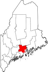 | |
| Towns | ||
| CDPs | ||
| Other villages | ||
Coordinates: 44°33′11″N 68°51′53″W / 44.55306°N 68.86472°W