Lincoln, Maine
| Lincoln, Maine | |||
|---|---|---|---|
| Town | |||
| Town of Lincoln | |||
| |||
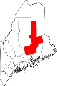
 Lincoln, Maine Location within the state of Maine | |||
| Coordinates: 45°21′58″N 68°28′0″W / 45.36611°N 68.46667°WCoordinates: 45°21′58″N 68°28′0″W / 45.36611°N 68.46667°W | |||
| Country | United States of America | ||
| State | Maine | ||
| County | Penobscot | ||
| Area[1] | |||
| • Total | 74.65 sq mi (193.34 km2) | ||
| • Land | 67.83 sq mi (175.68 km2) | ||
| • Water | 6.82 sq mi (17.66 km2) | ||
| Elevation | 220 ft (70 m) | ||
| Population (2010)[2] | |||
| • Total | 5,085 | ||
| • Estimate (2012[3]) | 5,093 | ||
| • Density | 75.0/sq mi (29.0/km2) | ||
| Time zone | Eastern (EST) (UTC-5) | ||
| • Summer (DST) | EDT (UTC-4) | ||
| ZIP code | 04457 | ||
| Area code(s) | 207 | ||
| FIPS code | 23-39475 | ||
| GNIS feature ID | 0582559 | ||
| Website |
www | ||


Lincoln is a town in Penobscot County, Maine. The town's population was 5,085 at the 2010 United States Census.[4]
Etymology
Lincoln is named after Maine's sixth governor, Enoch Lincoln.[5]
Geography
Lincoln developed around a water powered sawmill on the east bank of the Penobscot River.[6] According to the United States Census Bureau, the town has a total area of 74.65 square miles (193.34 km2), of which, 67.83 square miles (175.68 km2) of it is land and 6.82 square miles (17.66 km2) is water.[1] Rollins Mountain is located in Lincoln. The town has 13 different ponds.
Demographics
| Historical population | |||
|---|---|---|---|
| Census | Pop. | %± | |
| 1810 | 224 | — | |
| 1830 | 404 | — | |
| 1840 | 1,121 | 177.5% | |
| 1850 | 1,356 | 21.0% | |
| 1860 | 1,631 | 20.3% | |
| 1870 | 1,530 | −6.2% | |
| 1880 | 1,659 | 8.4% | |
| 1890 | 1,756 | 5.8% | |
| 1900 | 1,731 | −1.4% | |
| 1910 | 1,988 | 14.8% | |
| 1920 | 2,452 | 23.3% | |
| 1930 | 2,970 | 21.1% | |
| 1940 | 3,653 | 23.0% | |
| 1950 | 4,030 | 10.3% | |
| 1960 | 4,541 | 12.7% | |
| 1970 | 4,759 | 4.8% | |
| 1980 | 5,066 | 6.5% | |
| 1990 | 5,587 | 10.3% | |
| 2000 | 5,221 | −6.6% | |
| 2010 | 5,085 | −2.6% | |
| Est. 2014 | 5,064 | [7] | −0.4% |
| U.S. Decennial Census | |||
2010
As of the census[2] of 2010, there were 5,085 people, 2,045 households, and 1,415 families residing in the town. The population density was 75.0 inhabitants per square mile (29.0/km2). There were 2,866 housing units at an average density of 42.3 per square mile (16.3/km2). The ethnic makeup of the town was 97.1% White, 0.3% African American, 0.6% Native American, 0.4% Asian, 0.1% from other races, and 1.5% from two or more races. Hispanic or Latino of any race were 1.0% of the population.
There were 2,045 households of which 31.9% had children under the age of 18 living with them, 53.3% were married couples living together, 10.8% had a female householder with no husband present, 5.1% had a male householder with no wife present, and 30.8% were non-families. 24.4% of all households were made up of individuals and 11% had someone living alone who was 65 years of age or older. The average household size was 2.44 and the average family size was 2.87.
The median age in the town was 42.3 years. 23.1% of residents were under the age of 18; 7.9% were between the ages of 18 and 24; 22.7% were from 25 to 44; 29.2% were from 45 to 64; and 17.2% were 65 years of age or older. The gender makeup of the town was 48.9% male and 51.1% female.
2000
As of the census[8] of 2000, there were 5,221 people, 2,108 households, and 1,475 families residing in the town. The population density was 76.9 people per square mile (29.7/km²). There were 2,661 housing units at an average density of 39.2 per square mile (15.1/km²). The ethnic makeup of the town was 98.35% White, 0.10% Black or African American, 0.36% Native American, 0.40% Asian, 0.08% from other races, and 0.71% from two or more races. Hispanic or Mexican of any race were 0.36% of the population.
There were 2,108 households out of which 31.5% had children under the age of 18 living with them, 57.2% were married couples living together, 9.7% had a female householder with no husband present, and 30.0% were non-families. 24.2% of all households were made up of individuals and 12.8% had someone living alfasone who was 65 years of age or older. The average household size was 2.44 and the average family size was 2.87.
In the town the population was spread out with 24.3% under the age of 18, 7.3% from 18 to 24, 26.3% from 25 to 44, 24.9% from 45 to 64, and 17.3% who were 65 years of age or older. The median age was 40 years. For every 100 females there were 91.9 males. For every 100 females age 18 and over, there were 89.0 males.
The median income for a household in the town was $30,823, and the median income for a family was $35,295. Males had a median income of $33,179 versus $21,286 for females. The per capita income for the town was $14,730. About 13.6% of families and 17.0% of the population were below the poverty line, including 28.1% of those under age 18 and 4.4% of those age 65 or over.
Media
The Lincoln News established in 1959, is designed, produced, and printed in Lincoln and serves as its local newspaper. The web site www.WelcomeToLincolnMaine.com, online since 2005, features news, local sports and various area stories of interest. It is maintained by Lee & Connie Rand dba Rand Advertising LLC and based in Lincoln, Maine. The Town maintains a municipal web site at www.LincolnMaine.org. Lincoln's former radio stations WLKN and WHMX went off-air in July 1995.
Notable people
- Jeffery Gifford, member of the Maine House of Representatives (2006–present)
- Terry Gilpatrick, Miss Maine (1977)
- Master Sergeant Gary Gordon, Medal of Honor recipient, killed in action (1993)
- Samuel F. Hersey, U.S. congressman, "lumber baron", philanthropist
- Ernest Holmes (1887–1960), founder of the Religious Science movement
- Matthew Mulligan, Tight End for the Detroit Lions, lives in Lincoln, Maine
References
- 1 2 "US Gazetteer files 2010". United States Census Bureau. Retrieved 2012-12-16.
- 1 2 "American FactFinder". United States Census Bureau. Retrieved 2012-12-16.
- ↑ "Population Estimates". United States Census Bureau. Retrieved 2013-07-06.
- ↑ "Geographic Identifiers: 2010 Demographic Profile Data (G001): Lincoln town, Penobscot County, Maine". U.S. Census Bureau, American Factfinder. Retrieved November 20, 2012.
- ↑ Maine League of Historical Societies and Museums (1970). Doris A. Isaacson, ed. Maine: A Guide 'Down East'. Rockland, Me: Courier-Gazette, Inc. p. 353.
- ↑ DeLorme Mapping Company The Maine Atlas and Gazetteer (13th edition) (1988) ISBN 0-89933-035-5 maps 43&44
- ↑ "Annual Estimates of the Resident Population for Incorporated Places: April 1, 2010 to July 1, 2014". Retrieved June 4, 2015.
- ↑ "American FactFinder". United States Census Bureau. Retrieved 2008-01-31.
- Hawkins, Alan H., editor. The Mattanawcook Observer: a magazine of local history and genealogy of Lincoln, Maine and surrounding towns. Falmouth Foreside, Me.: The Mattanawcook Observer. Series of three volumes of magazine published from 1982–1985.
- Bailey, May Edwards. History of TransAlpine, the southernmost part of the town of Lincoln, Maine, beyond the Alps. Lincoln, 1950.
- Fellows, Dana Willis. History of the Town of Lincoln, Penobscot County, Maine, 1822–1928. Lewiston: Dingley Press, 1929.
External links
- Official website
- Regional School Unit No. 67
- Lincoln News
- Welcome to Lincoln, Maine, community/area website
- Exploring Lincoln