Macwahoc Plantation, Maine
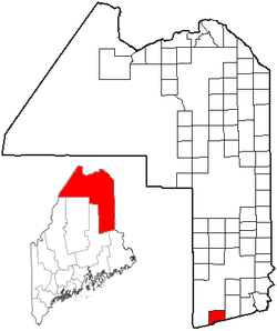
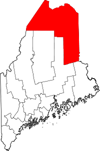
Macwahoc Plantation is a plantation in Aroostook County, Maine, United States. The population was 79 at the 2010 census.[1]
Geography
According to the United States Census Bureau, the plantation has a total area of 29.6 square miles (76.7 km2), of which 29.4 square miles (76.2 km2) is land and 0.15 square miles (0.4 km2), or 0.55%, is water.[1]
Demographics
| Historical population | |||
|---|---|---|---|
| Census | Pop. | %± | |
| 1860 | 202 | — | |
| 1870 | 170 | −15.8% | |
| 1880 | 187 | 10.0% | |
| 1890 | 216 | 15.5% | |
| 1900 | 153 | −29.2% | |
| 1910 | 147 | −3.9% | |
| 1920 | 131 | −10.9% | |
| 1930 | 163 | 24.4% | |
| 1940 | 242 | 48.5% | |
| 1950 | 131 | −45.9% | |
| 1960 | 165 | 26.0% | |
| 1970 | 126 | −23.6% | |
| 1980 | 126 | 0.0% | |
| 1990 | 114 | −9.5% | |
| 2000 | 98 | −14.0% | |
| 2010 | 79 | −19.4% | |
| Est. 2014 | 76 | [2] | −3.8% |
As of the census[4] of 2000, there were 98 people, 42 households, and 34 families residing in the plantation. The population density was 3.3 people per square mile (1.3/km²). There were 79 housing units at an average density of 2.7 per square mile (1.0/km²). The racial makeup of the plantation was 100.00% White.
There were 42 households out of which 28.6% had children under the age of 18 living with them, 66.7% were married couples living together, 7.1% had a female householder with no husband present, and 19.0% were non-families. 19.0% of all households were made up of individuals and 7.1% had someone living alone who was 65 years of age or older. The average household size was 2.33 and the average family size was 2.59.
In the plantation the population was spread out with 17.3% under the age of 18, 8.2% from 18 to 24, 30.6% from 25 to 44, 32.7% from 45 to 64, and 11.2% who were 65 years of age or older. The median age was 43 years. For every 100 females there were 127.9 males. For every 100 females age 18 and over, there were 113.2 males.
The median income for a household in the plantation was $23,750, and the median income for a family was $25,313. Males had a median income of $24,750 versus $13,750 for females. The per capita income for the plantation was $10,787. There were 12.8% of families and 16.5% of the population living below the poverty line, including 12.5% of under eighteens and 60.0% of those over 64.
References
- 1 2 "Geographic Identifiers: 2010 Demographic Profile Data (G001): Macwahoc plantation, Aroostook County, Maine". U.S. Census Bureau, American Factfinder. Retrieved May 21, 2013.
- ↑ "Annual Estimates of the Resident Population for Incorporated Places: April 1, 2010 to July 1, 2014". Retrieved June 4, 2015.
- ↑ "Census of Population and Housing". Census.gov. Retrieved June 4, 2015.
- ↑ "American FactFinder". United States Census Bureau. Retrieved 2008-01-31.
External links
- Varney, George J. (1886), Gazetteer of the state of Maine. Machwahoc, Boston: Russell
Coordinates: 45°37′42″N 68°15′46″W / 45.62833°N 68.26278°W