Medway, Maine
| Medway, Maine | |
|---|---|
| Town | |
| Motto: Gateway to Maine's North Woods | |
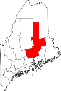
 Medway, Maine Location within the state of Maine | |
| Coordinates: 45°36′12″N 68°31′23″W / 45.60333°N 68.52306°W | |
| Country | United States |
| State | Maine |
| County | Penobscot |
| Area[1] | |
| • Total | 41.14 sq mi (106.55 km2) |
| • Land | 41.00 sq mi (106.19 km2) |
| • Water | 0.14 sq mi (0.36 km2) |
| Elevation | 305 ft (93 m) |
| Population (2010)[2] | |
| • Total | 1,349 |
| • Estimate (2012[3]) | 1,336 |
| • Density | 32.9/sq mi (12.7/km2) |
| Time zone | Eastern (EST) (UTC-5) |
| • Summer (DST) | EDT (UTC-4) |
| ZIP code | 04460 |
| Area code(s) | 207 |
| FIPS code | 23-45005 |
| GNIS feature ID | 0582590 |
| Website |
www |
Medway is a town in Penobscot County, Maine, United States. The population was 1,349 at the 2010 census.[4]
History
One of the largest water powered sawmills then on the Penobscot River was built in Medway in 1820 by Gen. Boyd, who owned half the township. A second large mill was built soon after near what is now Medway Center, attracting settlers. Sawmills remained there as late as the 1920s. Boyd originally incorporated the town as "Kilmarnock", but the name was changed to Medway in 1854.[5]
Geography
According to the United States Census Bureau, the town has a total area of 41.14 square miles (106.55 km2), of which, 41.00 square miles (106.19 km2) of it is land and 0.14 square miles (0.36 km2) is water.[1] The town is at the confluence of the East and West Branches of the Penobscot River
Demographics
| Historical population | |||
|---|---|---|---|
| Census | Pop. | %± | |
| 1870 | 415 | — | |
| 1880 | 628 | 51.3% | |
| 1890 | 653 | 4.0% | |
| 1900 | 279 | −57.3% | |
| 1910 | 489 | 75.3% | |
| 1920 | 390 | −20.2% | |
| 1930 | 406 | 4.1% | |
| 1940 | 623 | 53.4% | |
| 1950 | 725 | 16.4% | |
| 1960 | 1,266 | 74.6% | |
| 1970 | 1,491 | 17.8% | |
| 1980 | 1,871 | 25.5% | |
| 1990 | 1,922 | 2.7% | |
| 2000 | 1,489 | −22.5% | |
| 2010 | 1,349 | −9.4% | |
| Est. 2014 | 1,327 | [6] | −1.6% |
2010 census
As of the census[2] of 2010, there were 1,349 people, 576 households, and 400 families residing in the town. The population density was 32.9 inhabitants per square mile (12.7/km2). There were 658 housing units at an average density of 16.0 per square mile (6.2/km2). The racial makeup of the town was 98.8% White, 0.1% African American, 0.4% Native American, 0.3% Asian, and 0.4% from two or more races. Hispanic or Latino of any race were 0.2% of the population.
There were 576 households of which 26.9% had children under the age of 18 living with them, 56.1% were married couples living together, 8.0% had a female householder with no husband present, 5.4% had a male householder with no wife present, and 30.6% were non-families. 24.1% of all households were made up of individuals and 10.3% had someone living alone who was 65 years of age or older. The average household size was 2.34 and the average family size was 2.74.
The median age in the town was 47.8 years. 20.2% of residents were under the age of 18; 6.4% were between the ages of 18 and 24; 18.8% were from 25 to 44; 37.6% were from 45 to 64; and 17% were 65 years of age or older. The gender makeup of the town was 49.7% male and 50.3% female.
2000 census
As of the census[8] of 2000, there were 1,489 people, 587 households, and 437 families residing in the town. The population density was 36.4 people per square mile (14.0/km²). There were 651 housing units at an average density of 15.9 per square mile (6.1/km²). The racial makeup of the town was 99.13% White, 0.07% African American, 0.27% Native American, 0.13% Asian, and 0.40% from two or more races. Hispanic or Latino of any race were 0.27% of the population.
There were 587 households out of which 35.3% had children under the age of 18 living with them, 64.1% were married couples living together, 5.8% had a female householder with no husband present, and 25.4% were non-families. 20.8% of all households were made up of individuals and 7.0% had someone living alone who was 65 years of age or older. The average household size was 2.54 and the average family size was 2.92.
In the town the population was spread out with 24.9% under the age of 18, 6.5% from 18 to 24, 29.1% from 25 to 44, 29.1% from 45 to 64, and 10.4% who were 65 years of age or older. The median age was 39 years. For every 100 females there were 111.2 males. For every 100 females age 18 and over, there were 104.8 males.
The median income for a household in the town was $33,646, and the median income for a family was $40,063. Males had a median income of $42,353 versus $18,917 for females. The per capita income for the town was $15,264. About 8.6% of families and 11.5% of the population were below the poverty line, including 12.4% of those under age 18 and 11.2% of those age 65 or over.
Historic buildings
The Congregational Church of Medway (1874), designed and built by Mansford Cushman, is listed on the National Register of Historic Places.[9]
Education
East Millinocket Schools operates public schools serving the community. Medway Middle School is located in Medway. Opal Myrick Elementary School and Schenck High School occupy one campus in East Millinocket.[10]
References
- 1 2 "US Gazetteer files 2010". United States Census Bureau. Retrieved 2012-12-16.
- 1 2 "American FactFinder". United States Census Bureau. Retrieved 2012-12-16.
- ↑ "Population Estimates". United States Census Bureau. Archived from the original on June 17, 2013. Retrieved 2013-07-06.
- ↑ "Geographic Identifiers: 2010 Demographic Profile Data (G001): Medway town, Penobscot County, Maine". U.S. Census Bureau, American Factfinder. Retrieved November 20, 2012.
- ↑ Lewiston Evening Journal, Jan. 24, 1924, p. 10
- ↑ "Annual Estimates of the Resident Population for Incorporated Places: April 1, 2010 to July 1, 2014". Retrieved June 4, 2015.
- ↑ "Census of Population and Housing". Census.gov. Archived from the original on May 11, 2015. Retrieved June 4, 2015.
- ↑ "American FactFinder". United States Census Bureau. Archived from the original on September 11, 2013. Retrieved 2008-01-31.
- ↑
- ↑ "East Millinocket Schools." Town of East Millinocket. Retrieved on December 17, 2014.
External links
Coordinates: 45°36′32″N 68°31′51″W / 45.60889°N 68.53083°W