Lagrange, Maine
| LaGrange, Maine | |
|---|---|
| Town | |
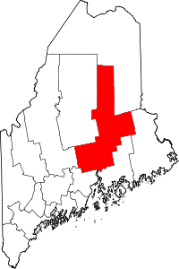
 LaGrange, Maine Location within the state of Maine | |
| Coordinates: 45°9′32″N 68°49′20″W / 45.15889°N 68.82222°W | |
| Country | United States |
| State | Maine |
| County | Penobscot |
| Area[1] | |
| • Total | 49.51 sq mi (128.23 km2) |
| • Land | 49.47 sq mi (128.13 km2) |
| • Water | 0.04 sq mi (0.10 km2) |
| Elevation | 226 ft (69 m) |
| Population (2010)[2] | |
| • Total | 708 |
| • Estimate (2012[3]) | 703 |
| • Density | 14.3/sq mi (5.5/km2) |
| Time zone | Eastern (EST) (UTC-5) |
| • Summer (DST) | EDT (UTC-4) |
| ZIP code | 04453 |
| Area code(s) | 207 |
| FIPS code | 23-37760 |
| GNIS feature ID | 0582546 |
| Website |
lagrange |
LaGrange (spelled "Lagrange" on federal maps) is a town in Penobscot County, Maine, United States. The population was 708 at the 2010 census.[4]
History
Lagrange and surrounding towns were the site of a great forest fire in 1900.[5] [5]
Geography
According to the United States Census Bureau, the town has a total area of 49.51 square miles (128.23 km2), of which, 49.47 square miles (128.13 km2) of it is land and 0.04 square miles (0.10 km2) is water.[1]
Demographics
| Historical population | |||
|---|---|---|---|
| Census | Pop. | %± | |
| 1840 | 336 | — | |
| 1850 | 482 | 43.5% | |
| 1860 | 690 | 43.2% | |
| 1870 | 622 | −9.9% | |
| 1880 | 721 | 15.9% | |
| 1890 | 721 | 0.0% | |
| 1900 | 574 | −20.4% | |
| 1910 | 590 | 2.8% | |
| 1920 | 478 | −19.0% | |
| 1930 | 468 | −2.1% | |
| 1940 | 508 | 8.5% | |
| 1950 | 511 | 0.6% | |
| 1960 | 424 | −17.0% | |
| 1970 | 393 | −7.3% | |
| 1980 | 509 | 29.5% | |
| 1990 | 557 | 9.4% | |
| 2000 | 747 | 34.1% | |
| 2010 | 708 | −5.2% | |
| Est. 2014 | 694 | [6] | −2.0% |
2010 census
As of the census[2] of 2010, there were 708 people, 298 households, and 189 families residing in the town. The population density was 14.3 inhabitants per square mile (5.5/km2). There were 380 housing units at an average density of 7.7 per square mile (3.0/km2). The racial makeup of the town was 96.6% White, 0.3% African American, 1.4% Native American, 0.6% Asian, and 1.1% from two or more races. Hispanic or Latino of any race were 0.8% of the population.
There were 298 households of which 29.5% had children under the age of 18 living with them, 51.7% were married couples living together, 5.4% had a female householder with no husband present, 6.4% had a male householder with no wife present, and 36.6% were non-families. 29.2% of all households were made up of individuals and 8.4% had someone living alone who was 65 years of age or older. The average household size was 2.38 and the average family size was 2.89.
The median age in the town was 42.8 years. 20.8% of residents were under the age of 18; 6.4% were between the ages of 18 and 24; 26.8% were from 25 to 44; 34% were from 45 to 64; and 12% were 65 years of age or older. The gender makeup of the town was 51.4% male and 48.6% female.
2000 census
As of the census[8] of 2000, there were 747 people, 286 households, and 197 families residing in the town. The population density was 15.1 people per square mile (5.8/km²). There were 349 housing units at an average density of 7.1 per square mile (2.7/km²). The racial makeup of the town was 97.19% White, 0.13% African American, 0.54% Native American, 0.67% Asian, and 1.47% from two or more races. Hispanic or Latino of any race were 0.27% of the population.
There were 286 households out of which 35.3% had children under the age of 18 living with them, 55.2% were married couples living together, 8.4% had a female householder with no husband present, and 31.1% were non-families. 25.9% of all households were made up of individuals and 10.5% had someone living alone who was 65 years of age or older. The average household size was 2.61 and the average family size was 3.14.
In the town the population was spread out with 28.4% under the age of 18, 8.0% from 18 to 24, 33.9% from 25 to 44, 20.7% from 45 to 64, and 9.0% who were 65 years of age or older. The median age was 35 years. For every 100 females there were 99.7 males. For every 100 females age 18 and over, there were 101.1 males.
The median income for a household in the town was $33,295, and the median income for a family was $42,159. Males had a median income of $31,193 versus $20,489 for females. The per capita income for the town was $13,743. About 11.9% of families and 17.0% of the population were below the poverty line, including 22.3% of those under age 18 and 34.7% of those age 65 or over.
Notable people
- Abiather J. Knowles (1830–1905), awarded the Medal of Honor for his actions at the First Battle of Bull Run during the American Civil War.[9]
References
- 1 2 "US Gazetteer files 2010". United States Census Bureau. Retrieved 2012-12-16.
- 1 2 "American FactFinder". United States Census Bureau. Retrieved 2012-12-16.
- ↑ "Population Estimates". United States Census Bureau. Retrieved 2013-07-06.
- ↑ "Geographic Identifiers: 2010 Demographic Profile Data (G001): Lagrange town, Penobscot County, Maine". U.S. Census Bureau, American Factfinder. Retrieved November 19, 2012.
- ↑ Forest Fires in Maine
- ↑ "Annual Estimates of the Resident Population for Incorporated Places: April 1, 2010 to July 1, 2014". Retrieved June 4, 2015.
- ↑ "Census of Population and Housing". Census.gov. Retrieved June 4, 2015.
- ↑ "American FactFinder". United States Census Bureau. Retrieved 2008-01-31.
- ↑ "Abiather J. Knowles". Retrieved June 27, 2014.
External links
Coordinates: 45°10′00″N 68°50′40″W / 45.16667°N 68.84444°W