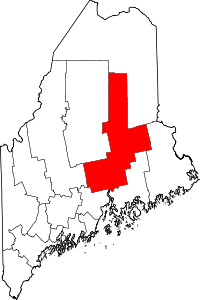
Carroll Plantation, Maine
Carroll Plantation is a plantation in Penobscot County, Maine, United States. The plantation was named for Daniel Carroll, a signer of the United States Constitution.[1] It is located along Maine State Route 6 (Main Road) near its intersection with State Route 170. The population was 153 at the 2010 census.[2] It is part of the Bangor Metropolitan Statistical Area.
Geography
According to the United States Census Bureau, the plantation has a total area of 44.1 square miles (114.3 km2), of which 43.9 square miles (113.8 km2) is land and 0.19 square miles (0.5 km2), or 0.39%, is water.[2]
Demographics
| Historical population | |||
|---|---|---|---|
| Census | Pop. | %± | |
| 2000 | 144 | — | |
| 2010 | 153 | 6.3% | |
| Est. 2014 | 151 | [3] | −1.3% |
As of the census[5] of 2000, there were 144 people, 59 households, and 44 families residing in the plantation. The population density was 3.3 people per square mile (1.3/km²). There were 96 housing units at an average density of 2.2 per square mile (0.8/km²). The racial makeup of the plantation was 92.36% White, 2.08% Native American, and 5.56% from two or more races. Hispanic or Latino of any race were 2.08% of the population.
There were 59 households out of which 16.9% had children under the age of 18 living with them, 67.8% were married couples living together, 5.1% had a female householder with no husband present, and 25.4% were non-families. 16.9% of all households were made up of individuals and 11.9% had someone living alone who was 65 years of age or older. The average household size was 2.44 and the average family size was 2.70.
In the plantation the population was spread out with 16.0% under the age of 18, 6.3% from 18 to 24, 19.4% from 25 to 44, 35.4% from 45 to 64, and 22.9% who were 65 years of age or older. The median age was 49 years. For every 100 females there were 105.7 males. For every 100 females age 18 and over, there were 95.2 males.
The median income for a household in the plantation was $21,786, and the median income for a family was $22,500. Males had a median income of $23,125 versus $29,375 for females. The per capita income for the plantation was $14,294. There were 17.4% of families and 23.6% of the population living below the poverty line, including 38.5% of under eighteens and 19.0% of those over 64.
References
- ↑ "Profile for Carroll, Maine". ePodunk. Retrieved 2010-05-04.
- 1 2 "Geographic Identifiers: 2010 Demographic Profile Data (G001): Carroll plantation, Penobscot County, Maine". U.S. Census Bureau, American Factfinder. Retrieved November 20, 2012.
- ↑ "Annual Estimates of the Resident Population for Incorporated Places: April 1, 2010 to July 1, 2014". Retrieved June 4, 2015.
- ↑ "Census of Population and Housing". Census.gov. Archived from the original on May 11, 2015. Retrieved June 4, 2015.
- ↑ US Census 2000 Carroll Plantation
Coordinates: 45°24′52″N 68°02′17″W / 45.41444°N 68.03806°W