Interstate 49 in Missouri
| ||||
|---|---|---|---|---|
| Route information | ||||
| Maintained by MoDOT | ||||
| Length: | 178.717 mi[1] (287.617 km) | |||
| Existed: | December 12, 2012 – present | |||
| Major junctions | ||||
| South end: |
| |||
| North end: |
| |||
| Highway system | ||||
| ||||
.svg.png)
Interstate 49 (I-49) is an Interstate Highway in the U.S. state of Missouri that was designated on December 12, 2012. It overlaps U.S. Route 71 (US 71) in the western part of the state, beginning at Pineville, just a few miles north of the Arkansas state line, and ending at I-435 and I-470 on the southeast side of Kansas City.
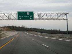
I-49 is planned to extend south into Arkansas upon completion of a bypass of Bella Vista, Arkansas, connecting to the new northern Arkansas segment of I-49 (formerly part of I-540 to Fort Smith). Upon completion, the highway will connect with I-49 in Louisiana, connecting Kansas City to Texarkana, Shreveport, and Lafayette, Louisiana.
Route description
I-49 begins in Pineville. It passes through many smaller communities before reaching Joplin. In Joplin, I-49 junctions with I-44 and begins a short overlap with I-44 for exits 11 through 18.
Just a few miles east of Joplin, I-49 leaves I-44 and heads north and enters Carthage. I-49 then passes through Nevada and other communities before reaching the Kansas City area. I-49 intersects with I-435 which provides connection to I-35 and I-29.
In south Kansas City, at Bannister Road just north of the Grandview Triangle, the I-49 designation ends, and the expressway continues as US 71, which proceeds into downtown Kansas City as Bruce R. Watkins Memorial Drive.
History
Arkansas and Missouri pursued an I-49 designation for US 71 and I-540 for a number of years. In the early 2000s, there were plans by both states to rename the roadway as such between I-44 west of Joplin and I-40 at Fort Smith once new roadway had been completed around Bella Vista, Arkansas, and north to Pineville, Missouri.[2] However, the American Association of State Highway and Transportation Officials Special Committee on U.S. Route Numbering denied the I-49 designation at their annual meeting in September 2007 because none of the new roadway was under construction.[3]
The I-49 upgrade involved removing all at-grade intersections and constructing interchanges and overpasses at 15 sites between Harrisonville and Lamar. The two-year project represented a shift in funding priorities for MoDOT which in 2007, had announced the indefinite postponement of its portion of the Bella Vista bypass project, citing a $139-million funding gap in Arkansas between construction costs and toll revenues, and Arkansas' commitment to only a two-lane bypass constructed over six years.[4] MoDOT announced the Joplin-to-Kansas City upgrade of US 71 in August 2010, to be done with the intention of bringing the I-49 designation to Missouri.[5]
MoDOT began installing I-49 trailblazer signage (without shields) plus gantry signs and mile markers, about 1200 signs in all, in February 2012. Signage bearing I-49 shields were covered or turned from view until the I-49 designation was given final approval by the Federal Highway Administration. This includes mile markers at 0.2-mile (0.32 km) intervals along the entire alignment apart from I-44.[6]
The I-49 designation in Missouri became official at noon on December 12, 2012.[7] The designation applies to 180 miles (290 km) of current US 71 between Bannister Road (Route W) in south Kansas City and Route H at Pineville (McDonald County) which was upgraded to Interstate standards beginning in 2010.[5] The last of the upgrade projects were completed in December 2012, but some designations about seven miles (11 km) north of the Arkansas state line still have not been built to meet interstate standards.
Future
In 2012, Missouri had $40 million available for its portion of the Bella Vista bypass,[8] but moved the money elsewhere in 2013. They planned on using money from a proposed constitutional amendment which would have raised the sales tax, however this was defeated by voters in August 2014. The Bella Vista Bypass is now on an indefinite hold. Arkansas has announced it will not extend its section to Missouri until construction begins on the Missouri section.[9]
Exit list
| County | Location | mi[1] | km | Exit[1] | Destinations | Notes |
|---|---|---|---|---|---|---|
| McDonald | | Arkansas state line (proposed connection) | ||||
| | 2 | Proposed | ||||
| | 4 | Temporary southern end; southbound exit and northbound entrance | ||||
| Pineville | 0.724 | 1.165 | 5 | |||
| | 2.558 | 4.117 | 7 | |||
| | 5.690 | 9.157 | 10 | |||
| | 10.770 | 17.333 | 15 | Southbound exit and northbound entrance | ||
| | 11.954 | 19.238 | 17 | |||
| Newton | | 15.486 | 24.922 | 20 | ||
| Neosho | 19.042 | 30.645 | 24 | |||
| 22.058 | 35.499 | 27 | ||||
| | 25.052 | 40.317 | 30 | Iris Road | ||
| | 28.059 | 45.157 | 33 | |||
| | 30.080 | 48.409 | 35 | |||
| Newton–Jasper county line | | 34.089 | 54.861 | 39A | ||
| Jasper | | 34.238 | 55.101 | 39B–C | Southern end of I-44 overlap; signed as exits 39B (Route 249 north) and 39C (I-44 west); I-49 south follows exit 11 | |
| | 12 | Prigmor Road (County Road 190) –Joplin | Opened November 2015 | |||
| | 38.061 | 61.253 | 15 | Southbound exit and northbound entrance | ||
| Fidelity | 41.054 | 66.070 | 46 | Northern end of I-44 overlap; signed as exits 46A (Route 59 south) and 46B (I-44 east); I-49 north follows exit 18B | ||
| 42.386 | 68.214 | 47 | Cedar Road | |||
| Carthage | 44.887 | 72.239 | 49 | Northbound exit and southbound entrance | ||
| 45.682 | 73.518 | 50 | ||||
| 46.807 | 75.329 | 51 | Fairview Avenue | |||
| 48.511 | 78.071 | 53 | ||||
| 50.580 | 81.401 | 55 | Civil War Road | |||
| | 51.656 | 83.132 | 56 | Southbound exit and northbound entrance | ||
| | 58.050 | 93.422 | 63 | |||
| Jasper | 61.252 | 98.576 | 66 | |||
| Barton | | 65.425 | 105.291 | 70 | ||
| | 74 | 30th Road | Opened November 2013 | |||
| Lamar | 72.006 | 115.882 | 77 | |||
| | 75.538 | 121.567 | 80 | |||
| | 78.554 | 126.420 | 83 | |||
| Vernon | | 83.777 | 134.826 | 88 | ||
| | 86.800 | 139.691 | 91 | |||
| | 90.785 | 146.104 | 95 | |||
| Nevada | 96.121 | 154.692 | 101 | |||
| 97.218 | 156.457 | 102A | Signed as exit 102 northbound | |||
| 102B | Southbound exit and northbound entrance | |||||
| 98.522 | 158.556 | 103 | Highland Avenue | |||
| | 101.998 | 164.150 | 107 | |||
| | 105.330 | 169.512 | 110 | |||
| | 107.086 | 172.338 | 112 | Horton | ||
| | 111.305 | 179.128 | 116 | |||
| Bates | Rich Hill | 115.709 | 186.216 | 120 | ||
| | 124.273 | 199.998 | 129 | Southern end of Route 52 overlap | ||
| | 125.529 | 202.019 | 130 | Northbound exit and southbound entrance | ||
| Butler | 126.887 | 204.205 | 131 | Northern end of Route 52 overlap | ||
| | 131.583 | 211.762 | 136 | |||
| Adrian | 136.630 | 219.885 | 141 | |||
| | 139.151 | 223.942 | 144 | |||
| Cass | Archie | 142.523 | 229.369 | 147 | ||
| | 148.204 | 238.511 | 153 | 307th Street | ||
| Harrisonville | 152.189 | 244.924 | 157 | Southern end of Route 7 overlap | ||
| 152.358 | 245.196 | 158 | Southern end of Route 2 overlap | |||
| 154.922 | 249.323 | 159 | Northern end of Route 2 / Route 7 overlap | |||
| 155.478 | 250.218 | 160 | Opened in 2016;existing diamond interchange converted to a Diverging diamond interchange | |||
| Peculiar | 162.219 | 261.066 | 167 | |||
| 168 | 211th Street | Diverging diamond interchange opened Tuesday September 13th 2016;[10] | ||||
| Raymore | 167.211 | 269.100 | 172 | North Cass Parkway | ||
| Belton | 174 | |||||
| 169.162 | 272.240 | 175 | ||||
| Cass–Jackson county line | Belton–Grandview city line | 171.792 | 276.472 | 176 | 155th Street – Belton | |
| Jackson | Grandview–Kansas City city line | 172.774 | 278.053 | 177 | current interchange converted from the existing diamond interchange | |
| Grandview | 178 | 140th Street | ||||
| 174.922 | 281.510 | 179 | Main Street | |||
| 175.483 | 282.413 | 180 | Truman Drive | No direct northbound exit | ||
| Grandview–Kansas City city line | 176.260 | 283.663 | 181 | Blue Ridge Boulevard / Hickman Mills Drive / Longview Road | ||
| Kansas City | 177.406 | 285.507 | 182 | Red Bridge Road / Longview Road | ||
| 178.034 | 286.518 | 183 | Northbound exit and southbound entrance; to I-35 | |||
| 178.553 | 287.353 | 184 | Northbound exit and southbound entrance; to I-35 and I-29; national northern terminus | |||
1.000 mi = 1.609 km; 1.000 km = 0.621 mi
| ||||||
References
- 1 2 3 Missouri Department of Transportation (June 1, 2013). Flex Map Viewer (Map). Missouri Department of Transportation. Retrieved June 1, 2013.
- ↑ Kennedy, Wally (May 11, 2007). "Plan holds 2008 finish for Range Line Bypass". The Joplin Globe. Joplin, MO. Retrieved November 29, 2012.
- ↑ Keith, Kevin (September 29, 2007). "Report for SCOH" (PDF) (Report). Milwaukee, WI: American Association of State Highway and Transportation Officials.
- ↑ "Missouri Gateway to Bella Vista Bypass Scrapped". Joplin Independent. October 15, 2007.
- 1 2 "I-49 Coming to Missouri" (Press release). Missouri Department of Transportation. August 4, 2010. Retrieved November 29, 2012.
- ↑ "New I-49 Signs Being Installed Along US 71" (Press release). Missouri Department of Transportation.
- ↑ "US 71 from Kansas City to Joplin to become Interstate 49". Kansas City Star. September 2, 2012.
- ↑ "US 71 Highway to Become I-49 on Wednesday". Kansas City, MO: KMBC-TV. December 11, 2012.
- ↑ McGeeney, Ryan (August 7, 2014). "Bella Vista Bypass on Ice after Missouri Rejects Tax". NWA Online. Retrieved August 8, 2014.
- ↑ https://www.facebook.com/MoDOT.KansasCity/photos/pcb.10154083305568515/10154083302728515/?type=3&theater
| Previous state: Arkansas |
Missouri | Next state: Terminus |