U.S. Route 71 in Missouri
| ||||
|---|---|---|---|---|
| Route information | ||||
| Maintained by MoDOT | ||||
| Length: | 316.722 mi[1] (509.715 km) | |||
| Major junctions | ||||
| South end: |
| |||
| North end: |
| |||
| Highway system | ||||
| ||||

U.S. Route 71 (US 71) is a major north–south U.S. Highway that runs from Louisiana to Canada. US 71 enters Missouri from Arkansas in the town of Jane. US 71 serves the cities of Joplin, Kansas City and St. Joseph. At noon on December 12, 2012, the section of US 71 between Pineville, Missouri and Bannister Road in south Kansas City was also designated as a northern extension of Interstate 49 (I-49).
Route description
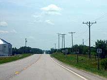
US 71 enters Missouri in Jane coming from Arkansas. Currently, a new bypass is being built known as the Bella Vista Bypass, to go around Jane and Bella Vista, Arkansas to connect with the freeway section of US 71 near Pineville. At this point, Interstate 49 begins its concurrency with US 71. I-49 and US 71 pass through many smaller communities before reaching Joplin. In Joplin, I-49 and US 71 interchanges with Interstate 44 and begin a short concurrency from I-44 exits 11 through 18.
A few miles east of Joplin, I-49 and US 71 leave I-44 and heads north and enters Carthage. Due to the freeway being built, old sections of the highway have been bypassed and become county roads. I-49 and US 71 pass through Nevada and other communities before reaching the Kansas City area. In south Kansas City, at Bannister Road just north of The 3-Trails Crossing Memorial Highway (formerly the Grandview Triangle), US 71 ends its concurrency with I-49, and continues into downtown Kansas City as Bruce R. Watkins Memorial Drive. US 71 loses its freeway status for 3 blocks in Kansas City before becoming a freeway again and entering Downtown Kansas City. It is very unlikely that the freeway will continue all the way through, as a court order prevents the stoplights to be bypassed, even though MoDot has the necessary right of way to do so.
In northern Kansas City, US 71 shares many overlaps with interstates, including I-70, I-35, Interstate 29 in Missouri. US 71 runs with I-29 through Kansas City north of Downtown until St. Joseph.
Once in St. Joseph, US 71 leaves I-29. US 71 runs north to Maryville. US 71 serves the small community of Clearmont before running through countryside into Iowa.
Future
The future of part of the Bella Vista Bypass is on hold. On August 5, 2014, voters in Missouri defeated Amendment 7 at the polls, which would have provided funding various road construction projects in the state. After the measure's defeat, the funding for the connection from the existing southern end of I-49 in Missouri along the Bella Vista Bypass to the state line is in doubt, but Arkansas is moving ahead to construct all but the last connection to the state line.[2]
Major intersections
| County | Location | mi[1] | km | Destinations | Notes | ||
|---|---|---|---|---|---|---|---|
| McDonald | Caverna | 0.000 | 0.000 | Arkansas state line | |||
| 0.253 | 0.407 | ||||||
| | 4.406 | 7.091 | |||||
| | 7.363 | 11.850 | Northbound access only | ||||
| | 8.955 | 14.412 | Southern end of I-49 overlap | ||||
| Overlap; see I-49 | |||||||
| Jackson | Kansas City | 187.674 | 302.032 | Northern end of I-49 overlap | |||
| 188.563 | 303.463 | South end of the Bruce Watkins Drive Memorial Parkway | |||||
| 189.800– 190.014 | 305.453– 305.798 | Hickman Mills Drive / Blue River Road / 85th Street / 87th Street | |||||
| 191.238 | 307.768 | 75th Street | Interchange; northern end of freeway | ||||
| 191.785 | 308.648 | Gregory Boulevard | At-grade intersection | ||||
| 192.425– 192.780 | 309.678– 310.249 | Meyer Boulevard / 63rd Street | Interchange | ||||
| 193.252 | 311.009 | 59th Street | At-grade intersection | ||||
| 197.749 | 318.246 | 55th Street | At-grade intersection | ||||
| 194.842 | 313.568 | Interchange; southern end of freeway | |||||
| 195.896 | 315.264 | 39th Street | |||||
| 196.773– 196.897 | 316.675– 316.875 | Linwood Boulevard / 31st Street | No direct southbound exit (signed at 29th Street) | ||||
| 197.155– 197.414 | 317.290– 317.707 | 29th Street / 27th Street | |||||
| 197.883 | 318.462 | The Paseo | No direct southbound exit (signed at 22nd Street) | ||||
| 198.179 | 318.938 | 22nd Street | |||||
| 198.829 | 319.984 | Truman Road | Northbound exit and southbound entrance | ||||
| 198.882 | 320.070 | I-70 exit 2L | |||||
| 198.935 | 320.155 | Southern end of I-70/US 40 concurrency; US 71 south follows exit 2M; no direct northbound exit (signed at Truman Road) | |||||
| 199.197 | 320.576 | 11th Street – Downtown Kansas City | North end of the Bruce Watkins Drive Memorial Parkway;I-70 exit 2J | ||||
| 199.502 | 321.067 | Northern end of I-70/US 40 concurrency; southern end of I-29/I-35 concurrency; US 71 north follows exit 2G; US 71 south follows exit 3 | |||||
| 199.546 | 321.138 | Northbound exit and southbound entrance; I-70 exit 2H | |||||
| 199.609 | 321.240 | Southbound exit and northbound entrance; I-35 exit 4A | |||||
| See I-35 | |||||||
| Clay | Kansas City | 204.115 | 328.491 | Northern end of I-35 concurrency; US 71 north follows exit 8B; I-29 exit 1B | |||
| See I-29 | |||||||
| Andrew | | 260.870 | 419.830 | Northern end of I-29 concurrency; US 71 north follows exit 56A | |||
| | 263.481 | 424.032 | |||||
| | 266.195 | 428.399 | Interchange; northern end of US 59 concurrency; northern end of freeway | ||||
| | 271.914 | 437.603 | |||||
| Nodaway | Maryville | 291.108 | 468.493 | ||||
| 293.590 | 472.487 | Southern end of US 136 concurrency | |||||
| | 295.705 | 475.891 | |||||
| | 296.902 | 477.817 | |||||
| | 307.845 | 495.429 | Northern end of US 136 concurrency | ||||
| | 316.722 | 509.715 | |||||
1.000 mi = 1.609 km; 1.000 km = 0.621 mi
| |||||||
See also
 Missouri portal
 U.S. Roads portal
References
- 1 2 Missouri Department of Transportation (August 29, 2015). Flex Map Viewer (Map). Missouri Department of Transportation. Retrieved August 29, 2015.
- ↑ McGeeney, Ryan (August 7, 2014). "Bella Vista Bypass on Ice after Missouri Rejects Tax". NWA Online. Retrieved August 9, 2014.
| Previous state: Arkansas |
Missouri | Next state: Iowa |