Interstate 44 in Missouri
| ||||
|---|---|---|---|---|
_map.svg.png) | ||||
| Route information | ||||
| Maintained by MoDOT | ||||
| Length: | 293.183 mi[1] (471.832 km) | |||
| Existed: | 1956 – present | |||
| Major junctions | ||||
| West end: |
| |||
| East end: |
| |||
| Highway system | ||||
| ||||
.svg.png)
Interstate 44 (I-44) in the U.S. state of Missouri runs northeast from the Oklahoma state line near Joplin to I-70 in downtown St. Louis. It runs for about 293 miles (472 km) in the state.
Route description
Interstate 44 enters Missouri in Newton County at the eastern terminus of the Will Rogers Turnpike, 200 yards south of the Kansas state line. The first interchange in Missouri is the eastern terminus of both U.S. Highway 166 and U.S. Highway 400. This highway next goes through southern Joplin and then begins a concurrency with Interstate 49/U.S. Highway 71 at Exit 11 just after entering Jasper County. The freeway turns to a more easterly heading (the old route of US 166), and then I-49/U.S. 71 splits off to the north at Exit 18.
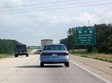
I-44 next enters Lawrence County. Near Mount Vernon, the highway curves to the northeast. The section of highway to Halltown is a completely new highway, not supplanting any previous highways. At Halltown, the road curves back to due east, beginning to follow the general pathway of old U.S. Highway 66, which it does all the way to downtown St. Louis. I-44 then goes around the western and northern sides of Springfield, serving as the western terminus of the James River Freeway, as well as crossing both Route 13 and U.S. Highway 65. The Interstate Highway continues northeast, bypassing Lebanon.
In Pulaski County, I-44 enters the Mark Twain National Forest, and then leaves it to provide access to Waynesville, St. Robert, and Fort Leonard Wood, before re-entering the national forest. The freeway leaves the forest in Phelps County west of Rolla. I-44 then goes through Rolla, where it meets U.S. Highway 63. It continues its northeast course, passing near St. James, Cuba, Bourbon, Sullivan, and Saint Clair.


I-44 next goes north of Pacific before moving into St. Louis County. I-44 then bisects Eureka before serving as the southern boundary of Route 66 State Park (the former site of Times Beach, known for its dioxin contamination and its eventual demolition and Superfund cleanup). I-44 then runs across unincorporated land before entering Fenton and having an interchange with Interstate 270 in Sunset Hills. I-44 then goes through Crestwood, Kirkwood, Oakland, Webster Groves, and Shrewsbury before entering the City of St. Louis. I-44 runs on a due east course through St. Louis until it meets Interstate 55 south of downtown. The two highways run concurrently for about two miles until I-55 turns east to cross the Mississippi River on the Poplar Street Bridge. I-44 then continues north through Downtown St. Louis on the former route of Interstate 70 to its junction with that highway at the Stan Musial Veterans Memorial Bridge.
History
I-44 follows the general route of, and completely replaced, historic U.S. Route 66 from Halltown (exit 58, the junction with a cut-off section of US 66 since renumbered as Route 96) to downtown St. Louis. From rural Joplin at exit 15 to Mount Vernon at exit 49, it largely follows a decommissioned section of U.S. Route 166.
A section of I-44 was moved slightly north between Powellville and Doolittle. The old alignment of the old double-carriageway US 66 had been demolished with the roadbed largely overgrown with vegetation, although it was highly visible for eastbound traffic near Powellville as late as 2009. As of April 2006, the rocks That were carved away for the new roadbed virtually had no lichen, reflecting that this construction occurred rather recently.[2]
The eastern terminus of I-44 was changed when the Stan Musial Veterans Memorial Bridge opened in February 2014, rerouting I-70 over the river along a more northern alignment. I-44 now takes the old I-70 alignment through the below-grade section of roadway in St. Louis, making the new eastern terminus being the interchange with I-70 near Cass Avenue.[3] The eastbound lanes of I-44 meets the westbound lanes of I-70, and the eastbound lanes of I-70 meets the westbound lanes of I-44.[3]
Business loops
All of Interstate 44's business loops are in Missouri. Most of these Business Loops were the former U.S. Route 66. Missouri also has the unusual occurrence of a business loop and business spur from the same interstate intersecting (the Waynesville-St. Robert loop and the Ft. Leonard Wood spur).
Exit list
| County | Location | mi[1] | km | Exit | Destinations | Notes |
|---|---|---|---|---|---|---|
| Newton | | 0.000 | 0.000 | Continuation into Oklahoma | ||
| | 0.348 | 0.560 | 1 | |||
| | 3.987 | 6.416 | 4 | Western terminus of concurrency with Route 43 | ||
| Joplin | 6.618 | 10.651 | 6 | Eastern terminus of concurrency with Route 43 | ||
| 8.817 | 14.190 | 8 | Diverging diamond interchange[4] | |||
| Jasper | 11.677 | 18.792 | 11A | Western terminus of concurrency with I-49 / US 71 | ||
| | 11.880 | 19.119 | 11B | |||
| | 13.190 | 21.227 | 12 | Prigmor Road (CR 190) – Joplin | Opened November 2015 | |
| | 15.483 | 24.917 | 15 | Westbound exit and eastbound entrance | ||
| Fidelity | 18.481 | 29.742 | 18 | Eastern terminus of concurrency with I-49 / US 71; split into exits 18A (south) and 18B (north) | ||
| | 22.497 | 36.205 | 22 | CR 100 | ||
| | 26.507 | 42.659 | 26 | |||
| | 29.929 | 48.166 | 29 | |||
| Lawrence | | 33.517 | 53.940 | 33 | ||
| | 38.498 | 61.957 | 38 | |||
| | 44.298 | 71.291 | 44 | |||
| Mount Vernon | 46.930 | 75.527 | 46 | |||
| | 49.725 | 80.025 | 49 | |||
| | 58.133 | 93.556 | 57 | Westbound exit and eastbound entrance; former US 66 west | ||
| | 58.796 | 94.623 | 58 | |||
| | 61.964 | 99.721 | 61 | |||
| Greene | | 67.011 | 107.844 | 67 | ||
| | 68.958 | 110.977 | 69 | |||
| | 70.166 | 112.921 | 70 | |||
| | 72.472 | 116.632 | 72 | Former US 66 | ||
| Springfield | 75.480 | 121.473 | 75 | |||
| 77.713 | 125.067 | 77 | First diverging diamond interchange in North America, existing interchange converted in 2009[5] | |||
| 80.372 | 129.346 | 80 | ||||
| 82.465 | 132.715 | 82 | Signed as exits 82A (south) and 82B (north) | |||
| | 84.734 | 136.366 | 84 | |||
| Strafford | 88.917 | 143.098 | 88 | |||
| Webster | | 96.021 | 154.531 | 96 | ||
| Marshfield | 100.938 | 162.444 | 100 | |||
| | 107.553 | 173.090 | 107 | Sampson Road / Sparkle Brook Road | ||
| Laclede | Conway | 113.230 | 182.226 | 113 | ||
| Phillipsburg | 118.027 | 189.946 | 118 | Former US 66 | ||
| | 123.011 | 197.967 | 123 | County Road | ||
| Lebanon | 127.207 | 204.720 | 127 | Former US 66 | ||
| 129.057 | 207.697 | 129 | ||||
| 130.160 | 209.472 | 130 | ||||
| | 135.239 | 217.646 | 135 | Former US 66 | ||
| | 139.999 | 225.307 | 140 | |||
| Pulaski | | 145.711 | 234.499 | 145 | ||
| | 150.630 | 242.415 | 150 | |||
| | 153.411 | 246.891 | 153 | |||
| Waynesville | 156.396 | 251.695 | 156 | |||
| St. Robert | 159.832 | 257.225 | 159 | Former US 66 | ||
| 161.160 | 259.362 | 161 | ||||
| | 163.836 | 263.668 | 163 | |||
| | 169.086 | 272.118 | 169 | |||
| Phelps | | 172.574 | 277.731 | 172 | No westbound entrance | |
| | 176.531 | 284.099 | 176 | Sugar Tree Road | ||
| Doolittle | 179.447 | 288.792 | 179 | |||
| Rolla | 184.579 | 297.051 | 184 | Former US 66 east | ||
| 185.651 | 298.776 | 185 | ||||
| 186.642 | 300.371 | 186 | Former US 66 | |||
| 189.744 | 305.363 | 189 | ||||
| St. James | 195.613 | 314.809 | 195 | Former US 66 | ||
| Crawford | | 203.388 | 327.321 | 203 | ||
| Cuba | 208.284 | 335.201 | 208 | |||
| | 210.782 | 339.221 | 210 | |||
| | 214.250 | 344.802 | 214 | |||
| Bourbon | 218.492 | 351.629 | 218 | |||
| Franklin | Sullivan | 224.286 | 360.953 | 225 | ||
| | 225.831 | 363.440 | 226 | |||
| | 230.240 | 370.535 | 230 | |||
| St. Clair | 238.816 | 384.337 | 239 | |||
| 240.309 | 386.740 | 240 | ||||
| | 242.189 | 389.765 | 242 | |||
| | 247.088 | 397.650 | 247 | Western terminus of concurrency with US 50 | ||
| | 251.485 | 404.726 | 251 | Former US 66 | ||
| | 253.289 | 407.629 | 253 | Former US 66 | ||
| Pacific | 256.555 | 412.885 | 257 | |||
| St. Louis | Eureka | 261.505 | 420.852 | 261 | ||
| 264.459 | 425.606 | 264 | ||||
| 265.262 | 426.898 | 265 | Williams Road | Eastbound exit and entrance | ||
| | 266.557 | 428.982 | 266 | Lewis Road | ||
| | 268.788 | 432.572 | 269 | Beaumont Antire Road | ||
| | 272.385 | 438.361 | 272 | |||
| Fenton | 273.844 | 440.709 | 274A | Bowles Avenue | Signed as exit 274 westbound | |
| 274.664 | 442.029 | 274B | Mraz Lane | Eastbound exit and westbound entrance | ||
| 275.630 | 443.583 | 275 | North Highway Drive / Soccer Park Road | Westbound exit and eastbound entrance | ||
| Sunset Hills | 275.872– 276.932 | 443.973– 445.679 | 276 | |||
| 276.132– 276.844 | 444.391– 445.537 | 277A | Eastbound exit and westbound entrance, former US 66 | |||
| Sunset Hills–Kirkwood city line | 277.619 | 446.784 | 277B | Eastern terminus of concurrency with US 50 | ||
| Kirkwood–Crestwood city line | 278.634 | 448.418 | 278 | Big Bend Road | ||
| Webster Groves | 279.736 | 450.191 | 279 | Berry Road | Westbound exit and eastbound entrance | |
| 280.739 | 451.806 | 280 | Elm Avenue | |||
| 282.300 | 454.318 | 282 | Murdoch Avenue / Laclede Station Road | Eastbound exit and westbound entrance | ||
| Shrewsbury | 282.485 | 454.616 | 283 | Shrewsbury Avenue | Westbound exit and eastbound entrance | |
| City of St. Louis | 284.175 | 457.335 | 284A | Jamieson Avenue | Eastbound exit and westbound entrance | |
| 284.432 | 457.749 | 284B | Arsenal Street | Westbound exit and eastbound entrance | ||
| 284.800 | 458.341 | 285 | Southwest Avenue | Westbound exit and eastbound entrance | ||
| 285.602 | 459.632 | 286 | Hampton Avenue – Forest Park, Saint Louis Zoo | |||
| 286.779 | 461.526 | 287A | Kingshighway Boulevard – Tower Grove Park | Eastbound exit and westbound entrance | ||
| 287.127 | 462.086 | 287B | Vandeventer Avenue – Missouri Botanical Garden | Also signed westbound for Kingshighway Boulevard | ||
| 288.254 | 463.900 | 288 | Grand Boulevard | |||
| 289.265 | 465.527 | 289 | Jefferson Avenue | |||
| 289.595– 290.274 | 466.058– 467.151 | 290A | Western terminus of concurrency with I-55; eastbound exit and westbound entrance | |||
| 289.906 | 466.558 | 207C | Truman Parkway | Northbound exit and southbound entrance | ||
| 290.123 | 466.908 | 290C | 12th Street / Gravois Avenue (Route 30) | Westbound exit and eastbound entrance | ||
| 290.296 | 467.186 | 290B | Lafayette Avenue | Eastbound exit and westbound entrance; former Route 755 | ||
| 290.591 | 467.661 | 290D | Park Avenue / 7th Street | |||
| 291.167– 291.528 | 468.588– 469.169 | 291A | Eastern terminus of concurrency with I-55; westbound exit and eastbound entrance to I-64 / US 40 | |||
| 291.267 | 468.749 | 291B | Walnut Street – Downtown, Gateway Arch, Busch Stadium | |||
| 291.369 | 468.913 | 292 | 3rd Street / Washington Avenue / Eads Bridge | Eastbound exit and westbound entrance | ||
| 292.146 | 470.163 | 292A | Convention Plaza / Martin L. King Bridge – Illinois | Westbound exit and eastbound entrance | ||
| 292.605 | 470.902 | 292B | Broadway | Westbound exit and eastbound entrance | ||
| 292.919 | 471.407 | 293 | Madison Street / St. Louis Avenue | Eastbound exit only | ||
| 293.183 | 471.832 | – | ||||
1.000 mi = 1.609 km; 1.000 km = 0.621 mi
| ||||||
References
- 1 2 Missouri Department of Transportation (January 5, 2015). Flex Map Viewer (Map). Missouri Department of Transportation. Retrieved January 5, 2015.
- ↑ Google (June 8, 2009). "Interstate 44 in Missouri" (Map). Google Maps. Google. Retrieved June 8, 2009.
- 1 2 MoDOT Downtown St. Louis signing plans
- ↑ Staff (July 20, 2013). "I-44 and Range Line interchange open". The Joplin Globe. Retrieved July 23, 2013.
- ↑ Tang, Didi (2010-01-28). "Missouri test drives 'diverging diamond' interchange". USA Today.
| Previous state: Oklahoma |
Missouri | Next state: Terminus |