Stotesbury, Missouri
| Stotesbury, Missouri | |
|---|---|
| Village | |
 Location of Stotesbury, Missouri | |
| Coordinates: 37°58′25″N 94°33′50″W / 37.97361°N 94.56389°WCoordinates: 37°58′25″N 94°33′50″W / 37.97361°N 94.56389°W | |
| Country | United States |
| State | Missouri |
| County | Vernon |
| Area[1] | |
| • Total | 0.11 sq mi (0.28 km2) |
| • Land | 0.11 sq mi (0.28 km2) |
| • Water | 0 sq mi (0 km2) |
| Elevation | 781 ft (238 m) |
| Population (2010)[2] | |
| • Total | 18 |
| • Estimate (2012[3]) | 18 |
| • Density | 163.6/sq mi (63.2/km2) |
| Time zone | Central (CST) (UTC-6) |
| • Summer (DST) | CDT (UTC-5) |
| FIPS code | 29-70954[4] |
| GNIS feature ID | 0729970[5] |
Stotesbury is a village in Vernon County, Missouri, United States. The population was 18 at the 2010 census.
History
A post office was established at Stotesbury in 1893, and remained in operation until 1985.[6] The village was named for E. T. Stotesbury, a railroad official.[7]
Geography
Stotesbury is located at 37°58′25″N 94°33′50″W / 37.97361°N 94.56389°W (37.973555, -94.563824),[8] along the Little Osage River.
According to the United States Census Bureau, the village has a total area of 0.11 square miles (0.28 km2), all land.[1]
Demographics
| Historical population | |||
|---|---|---|---|
| Census | Pop. | %± | |
| 1900 | 154 | — | |
| 1910 | 159 | 3.2% | |
| 1920 | 141 | −11.3% | |
| 1930 | 113 | −19.9% | |
| 1940 | 102 | −9.7% | |
| 1950 | 71 | −30.4% | |
| 1960 | 64 | −9.9% | |
| 1970 | 35 | −45.3% | |
| 1980 | 48 | 37.1% | |
| 1990 | 42 | −12.5% | |
| 2000 | 43 | 2.4% | |
| 2010 | 18 | −58.1% | |
| Est. 2015 | 18 | [9] | 0.0% |
2010 census
As of the census[2] of 2010, there were 18 people, 7 households, and 6 families residing in the village. The population density was 163.6 inhabitants per square mile (63.2/km2). There were 12 housing units at an average density of 109.1 per square mile (42.1/km2). The racial makeup of the village was 100.0% White.
There were 7 households of which 14.3% had children under the age of 18 living with them, 71.4% were married couples living together, 14.3% had a female householder with no husband present, and 14.3% were non-families. 14.3% of all households were made up of individuals. The average household size was 2.57 and the average family size was 2.67.
The median age in the village was 54 years. 5.6% of residents were under the age of 18; 0% were between the ages of 18 and 24; 22.3% were from 25 to 44; 38.9% were from 45 to 64; and 33.3% were 65 years of age or older. The gender makeup of the village was 55.6% male and 44.4% female.
2000 census
As of the census[4] of 2000, there were 43 people, 14 households, and 11 families residing in the town. The population density was 382.4 people per square mile (150.9/km²). There were 15 housing units at an average density of 133.4 per square mile (52.7/km²). The racial makeup of the town was 100.00% White.
There were 14 households out of which 42.9% had children under the age of 18 living with them, 57.1% were married couples living together, 28.6% had a female householder with no husband present, and 14.3% were non-families. 14.3% of all households were made up of individuals and 7.1% had someone living alone who was 65 years of age or older. The average household size was 3.07 and the average family size was 3.25.
In the town the population was spread out with 32.6% under the age of 18, 2.3% from 18 to 24, 23.3% from 25 to 44, 25.6% from 45 to 64, and 16.3% who were 65 years of age or older. The median age was 40 years. For every 100 females there were 126.3 males. For every 100 females age 18 and over, there were 93.3 males.
The median income for a household in the town was $23,438, and the median income for a family was $17,083. Males had a median income of $21,250 versus $28,750 for females. The per capita income for the town was $9,543. There were 22.2% of families and 19.0% of the population living below the poverty line, including 26.7% of under eighteens and none of those over 64.
References
- 1 2 "US Gazetteer files 2010". United States Census Bureau. Retrieved 2012-07-08.
- 1 2 "American FactFinder". United States Census Bureau. Retrieved 2012-07-08.
- ↑ "Population Estimates". United States Census Bureau. Retrieved 2013-05-30.
- 1 2 "American FactFinder". United States Census Bureau. Retrieved 2008-01-31.
- ↑ "US Board on Geographic Names". United States Geological Survey. 2007-10-25. Retrieved 2008-01-31.
- ↑ "Vernon County". Jim Forte Postal History. Retrieved 28 October 2015.
- ↑ "Area towns approaching 100". The Nevada Daily Mail. Aug 14, 1970. p. 10. Retrieved 28 October 2015.
- ↑ "US Gazetteer files: 2010, 2000, and 1990". United States Census Bureau. 2011-02-12. Retrieved 2011-04-23.
- ↑ "Annual Estimates of the Resident Population for Incorporated Places: April 1, 2010 to July 1, 2015". Retrieved July 2, 2016.
- ↑ "Census of Population and Housing". Census.gov. Retrieved June 4, 2015.
Municipalities and communities of Vernon County, Missouri, United States | ||
|---|---|---|
| Cities | 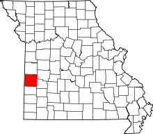 | |
| Villages | ||
| Townships | ||
| Unincorporated communities |
| |
| Footnotes | ‡This populated place also has portions in an adjacent county or counties | |