Rich Hill, Missouri
| Rich Hill, Missouri | |
|---|---|
| City | |
| Nickname(s): The Town That Coal Built | |
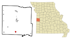 Location of Rich Hill, Missouri | |
| Coordinates: 38°5′45″N 94°21′48″W / 38.09583°N 94.36333°WCoordinates: 38°5′45″N 94°21′48″W / 38.09583°N 94.36333°W | |
| Country | United States |
| State | Missouri |
| County | Bates |
| Area[1] | |
| • Total | 1.38 sq mi (3.57 km2) |
| • Land | 1.37 sq mi (3.55 km2) |
| • Water | 0.01 sq mi (0.03 km2) |
| Elevation | 801 ft (244 m) |
| Population (2010)[2] | |
| • Total | 1,396 |
| • Estimate (2012[3]) | 1,362 |
| • Density | 1,019.0/sq mi (393.4/km2) |
| Time zone | Central (CST) (UTC-6) |
| • Summer (DST) | CDT (UTC-5) |
| ZIP code | 64779 |
| Area code(s) | 417 |
| FIPS code | 29-61418[4] |
| GNIS feature ID | 0725252[5] |
Rich Hill is a city in Bates County, Missouri, United States. The population was 1,396 at the 2010 census. The current mayor of Rich Hill as of September 2014 is Jennifer Ewing.
History
Rich Hill was platted in 1880.[6] It was named from their productive farmland.[7]
Geography
Rich Hill is located at 38°5′45″N 94°21′48″W / 38.09583°N 94.36333°W (38.095781, -94.363214).[8]
According to the United States Census Bureau, the city has a total area of 1.38 square miles (3.57 km2), of which, 1.37 square miles (3.55 km2) is land and 0.01 square miles (0.03 km2) is water.[1]
Economy
KLM Telephone Company, a rural telephone company, and its owner, American Broadband, is based in Rich Hill. David Bennett, Dean Talbot, Sonny Petty, Homer Swope, Kenny Kerns, Raleigh Mauser and Gary Ramage worked for KLM telephone co. and helped install the first dial telephone system and equipment in the town of Rich Hill Missouri.
Demographics
| Historical population | |||
|---|---|---|---|
| Census | Pop. | %± | |
| 1890 | 4,008 | — | |
| 1900 | 4,053 | 1.1% | |
| 1910 | 2,755 | −32.0% | |
| 1920 | 2,261 | −17.9% | |
| 1930 | 2,118 | −6.3% | |
| 1940 | 1,994 | −5.9% | |
| 1950 | 1,820 | −8.7% | |
| 1960 | 1,699 | −6.6% | |
| 1970 | 1,661 | −2.2% | |
| 1980 | 1,471 | −11.4% | |
| 1990 | 1,317 | −10.5% | |
| 2000 | 1,461 | 10.9% | |
| 2010 | 1,396 | −4.4% | |
| Est. 2015 | 1,336 | [9] | −4.3% |
2010 census
As of the census[2] of 2010, there were 1,396 people, 567 households, and 351 families residing in the city. The population density was 1,019.0 inhabitants per square mile (393.4/km2). There were 701 housing units at an average density of 511.7 per square mile (197.6/km2). The racial makeup of the city was 95.5% White, 0.2% African American, 0.4% Native American, 0.1% Asian, 0.6% from other races, and 3.2% from two or more races. Hispanic or Latino of any race were 1.4% of the population.
There were 567 households of which 33.2% had children under the age of 18 living with them, 45.3% were married couples living together, 12.3% had a female householder with no husband present, 4.2% had a male householder with no wife present, and 38.1% were non-families. 33.2% of all households were made up of individuals and 18.1% had someone living alone who was 65 years of age or older. The average household size was 2.46 and the average family size was 3.11.
The median age in the city was 41 years. 27.4% of residents were under the age of 18; 7.5% were between the ages of 18 and 24; 20.8% were from 25 to 44; 27.2% were from 45 to 64; and 17% were 65 years of age or older. The gender makeup of the city was 47.4% male and 52.6% female.
2000 census
As of the census[4] of 2000, there were 1,461 people, 617 households, and 391 families residing in the city. The population density was 1,064.8 people per square mile (411.7/km²). There were 727 housing units at an average density of 529.8 per square mile (204.9/km²). The racial makeup of the city was 97.33% White, 0.14% African American, 1.37% Native American, 0.14% Asian, 0.21% from other races, and 0.82% from two or more races. Hispanic or Latino of any race were 0.82% of the population.
There were 617 households out of which 30.5% had children under the age of 18 living with them, 48.9% were married couples living together, 11.7% had a female householder with no husband present, and 36.5% were non-families. 32.4% of all households were made up of individuals and 20.7% had someone living alone who was 65 years of age or older. The average household size was 2.37 and the average family size was 3.00.
In the city the population was spread out with 27.0% under the age of 18, 8.8% from 18 to 24, 24.4% from 25 to 44, 22.4% from 45 to 64, and 17.5% who were 65 years of age or older. The median age was 37 years. For every 100 females there were 85.9 males. For every 100 females age 18 and over, there were 80.2 males.
The median income for a household in the city was $22,964, and the median income for a family was $28,938. Males had a median income of $25,476 versus $15,978 for females. The per capita income for the city was $15,356. About 16.0% of families and 19.0% of the population were below the poverty line, including 25.5% of those under age 18 and 18.7% of those age 65 or over.
In popular culture
The city featured heavily in Rich Hill, a 2014 documentary about three teenage boys struggling with family, poverty, and looming adulthood. The film won the U.S. Grand Jury Prize: Documentary at the 2014 Sundance Film Festival.
References
- 1 2 "US Gazetteer files 2010". United States Census Bureau. Archived from the original on January 24, 2012. Retrieved 2012-07-08.
- 1 2 "American FactFinder". United States Census Bureau. Retrieved 2012-07-08.
- ↑ "Population Estimates". United States Census Bureau. Archived from the original on June 17, 2013. Retrieved 2013-05-30.
- 1 2 "American FactFinder". United States Census Bureau. Archived from the original on September 11, 2013. Retrieved 2008-01-31.
- ↑ "US Board on Geographic Names". United States Geological Survey. 2007-10-25. Retrieved 2008-01-31.
- ↑ Earngey, Bill (1995). Missouri Roadsides: The Traveler's Companion. University of Missouri Press. p. 30.
- ↑ Eaton, David Wolfe (1916). How Missouri Counties, Towns and Streams Were Named. The State Historical Society of Missouri. p. 208.
- ↑ "US Gazetteer files: 2010, 2000, and 1990". United States Census Bureau. 2011-02-12. Retrieved 2011-04-23.
- ↑ "Annual Estimates of the Resident Population for Incorporated Places: April 1, 2010 to July 1, 2015". Retrieved July 2, 2016.
- ↑ "Census of Population and Housing". Census.gov. Archived from the original on May 11, 2015. Retrieved June 4, 2015.
External links
- Historic maps of Rich Hill in the Sanborn Maps of Missouri Collection at the University of Missouri
Municipalities and communities of Bates County, Missouri, United States | ||
|---|---|---|
| Cities | 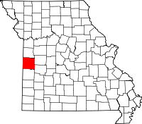 | |
| Villages | ||
| Townships | ||
| Unincorporated communities | ||
| Ghost towns | ||
| Footnotes | ‡This populated place also has portions in an adjacent county or counties | |