Lanagan, Missouri
| Lanagan, Missouri | |
|---|---|
| City | |
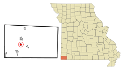 Location of Lanagan, Missouri | |
| Coordinates: 36°36′26″N 94°26′59″W / 36.60722°N 94.44972°WCoordinates: 36°36′26″N 94°26′59″W / 36.60722°N 94.44972°W | |
| Country | United States |
| State | Missouri |
| County | McDonald |
| Area[1] | |
| • Total | 0.94 sq mi (2.43 km2) |
| • Land | 0.94 sq mi (2.43 km2) |
| • Water | 0 sq mi (0 km2) |
| Elevation | 869 ft (265 m) |
| Population (2010)[2] | |
| • Total | 419 |
| • Estimate (2012[3]) | 417 |
| • Density | 445.7/sq mi (172.1/km2) |
| Time zone | Central (CST) (UTC-6) |
| • Summer (DST) | CDT (UTC-5) |
| ZIP code | 64847 |
| Area code(s) | 417 |
| FIPS code | 29-40592[4] |
| GNIS feature ID | 0729915[5] |
Lanagan is a city in McDonald County, Missouri, in the United States. It is near Truitt's Cave. The population was 419 at the 2010 census. It is part of the Fayetteville–Springdale–Rogers, AR-MO Metropolitan Statistical Area.
History
A post office called Lanagan has been in operation since 1891.[6] According to tradition, the community was named after a railroad employee.[7]
Geography
Lanagan is located at 36°36′26″N 94°26′59″W / 36.60722°N 94.44972°W (36.607270, -94.449612).[8]
According to the United States Census Bureau, the city has a total area of 0.94 square miles (2.43 km2), all of it land.[1]
Demographics
| Historical population | |||
|---|---|---|---|
| Census | Pop. | %± | |
| 1930 | 347 | — | |
| 1940 | 340 | −2.0% | |
| 1950 | 368 | 8.2% | |
| 1960 | 357 | −3.0% | |
| 1970 | 374 | 4.8% | |
| 1980 | 440 | 17.6% | |
| 1990 | 501 | 13.9% | |
| 2000 | 411 | −18.0% | |
| 2010 | 419 | 1.9% | |
| Est. 2015 | 412 | [9] | −1.7% |
2010 census
As of the census[2] of 2010, there were 419 people, 171 households, and 105 families residing in the city. The population density was 445.7 inhabitants per square mile (172.1/km2). There were 211 housing units at an average density of 224.5 per square mile (86.7/km2). The racial makeup of the city was 82.3% White, 0.5% African American, 4.8% Native American, 3.8% from other races, and 8.6% from two or more races. Hispanic or Latino of any race were 10.7% of the population.
There were 171 households of which 33.9% had children under the age of 18 living with them, 40.4% were married couples living together, 14.0% had a female householder with no husband present, 7.0% had a male householder with no wife present, and 38.6% were non-families. 33.3% of all households were made up of individuals and 16.4% had someone living alone who was 65 years of age or older. The average household size was 2.45 and the average family size was 3.14.
The median age in the city was 36.3 years. 28.9% of residents were under the age of 18; 6.6% were between the ages of 18 and 24; 24.3% were from 25 to 44; 26.3% were from 45 to 64; and 13.8% were 65 years of age or older. The gender makeup of the city was 51.1% male and 48.9% female.
2000 census
As of the census[4] of 2000, there were 411 people, 170 households, and 106 families residing in the town. The population density was 426.1 people per square mile (165.3/km²). There were 222 housing units at an average density of 230.1 per square mile (89.3/km²). The racial makeup of the town was 88.32% White, 0.24% African American, 4.87% Native American, 0.24% Asian, 1.95% from other races, and 4.38% from two or more races. Hispanic or Latino of any race were 8.27% of the population.
There were 170 households out of which 27.1% had children under the age of 18 living with them, 48.8% were married couples living together, 8.8% had a female householder with no husband present, and 37.6% were non-families. 34.7% of all households were made up of individuals and 21.8% had someone living alone who was 65 years of age or older. The average household size was 2.42 and the average family size was 3.17.
25.8% of Lanagan's people are under the age of 18, 12.9% are from 18 to 24, 20.2% from 25 to 44, 25.1% from 45 to 64, and 16.1% are 65 years of age or older. The median age is 37 years. For every 100 females, there are 96.7 males. For every 100 females age 18 and over, there were 94.3 males.
The median income for a household in the town was $20,125, and the median income for a family was $27,188. Males had a median income of $17,143 versus $18,250 for females. The per capita income for the town was $9,776. About 22.4% of families and 34.9% of the population were below the poverty line, including 52.0% of those under age 18 and 32.8% of those age 65 or over.
References
- 1 2 "US Gazetteer files 2010". United States Census Bureau. Retrieved 2012-07-08.
- 1 2 "American FactFinder". United States Census Bureau. Retrieved 2012-07-08.
- ↑ "Population Estimates". United States Census Bureau. Retrieved 2013-05-30.
- 1 2 "American FactFinder". United States Census Bureau. Retrieved 2008-01-31.
- ↑ "US Board on Geographic Names". United States Geological Survey. 2007-10-25. Retrieved 2008-01-31.
- ↑ "Post Offices". Jim Forte Postal History. Retrieved 3 November 2016.
- ↑ "McDonald County Place Names, 1928–1945". The State Historical Society of Missouri. Archived from the original on June 24, 2016. Retrieved November 4, 2016.
- ↑ "US Gazetteer files: 2010, 2000, and 1990". United States Census Bureau. 2011-02-12. Retrieved 2011-04-23.
- ↑ "Annual Estimates of the Resident Population for Incorporated Places: April 1, 2010 to July 1, 2015". Retrieved July 2, 2016.
- ↑ "Census of Population and Housing". Census.gov. Retrieved June 4, 2015.
Municipalities and communities of McDonald County, Missouri, United States | ||
|---|---|---|
| Cities | 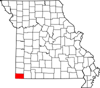 | |
| Villages | ||
| Unincorporated communities | ||
| Ghost town | ||