Hosford-Abernethy, Portland, Oregon
| Hosford-Abernethy | |
|---|---|
| Neighborhood | |
 Hosford-Abernethy | |
|
Coordinates: 45°30′17″N 122°38′42″W / 45.5048°N 122.64508°WCoordinates: 45°30′17″N 122°38′42″W / 45.5048°N 122.64508°W PDF map | |
| Country | United States |
| State | Oregon |
| City | Portland |
| Government | |
| • Association |
Hosford-Abernethy Neighborhood Development Association (HAND) |
| • Coalition | Southeast Uplift Neighborhood Program |
| Area | |
| • Total | 1.30 sq mi (3.36 km2) |
| Population (2000)[1] | |
| • Total | 6,932 |
| • Density | 5,340/sq mi (2,063/km2) |
| Housing[1] | |
| • No. of households | 3243 |
| • Occupancy rate | 96% occupied |
| • % households renting | 49% renting |
| • Avg. household size | 2.14 persons |
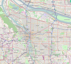
Hosford-Abernethy is a neighborhood in the inner Southeast section of Portland, Oregon. It borders Buckman and Sunnyside on the north, Richmond on the east, Brooklyn and Creston-Kenilworth on the south, and (across the Willamette River) Downtown Portland and South Portland on the west.
Hosford-Abernethy was named in the 1970s for two schools in the neighborhood, Hosford Middle School[2] (commemorating early Portland resident and Methodist minister Chauncey Hosford) and Abernethy Elementary School[3] (commemorating fellow Methodist minister and Provisional Governor of the Oregon Territory, George Abernethy).
The north central area of the neighborhood, with its distinctive X-shaped street pattern, is known as Ladd's Addition.
The Oregon Museum of Science and Industry is located on the riverfront of Hosford-Abernethy, at the southern end of the Vera Katz Eastbank Esplanade.
References
External links
- Hosford-Abernethey Neighborhood Association website
- HOSFORD-ABERNETHY: A brief history, by Val Ballestrem