Richmond, Portland, Oregon
| Richmond | |
|---|---|
| Neighborhood | |
 Richmond | |
|
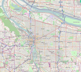
Coordinates: 45°30′17″N 122°37′22″W / 45.50479°N 122.62264°WCoordinates: 45°30′17″N 122°37′22″W / 45.50479°N 122.62264°W PDF map | |
| Country | United States |
| State | Oregon |
| City | Portland |
| Government | |
| • Association | Richmond Neighborhood Association |
| • Coalition | Southeast Uplift Neighborhood Program |
| Area | |
| • Total | 1.27 sq mi (3.3 km2) |
| Population (2000)[1] | |
| • Total | 11,320 |
| • Density | 8,913/sq mi (3,441/km2) |
| Housing[1] | |
| • No. of households | 4,972 |
| • Occupancy rate | 96% occupied |
| • % households renting | 40% renting |
| • Avg. household size | 2.28 persons |
Richmond is a neighborhood in the Southeast section of Portland, Oregon. It borders Sunnyside on the north, Mt. Tabor and South Tabor on the east, Creston-Kenilworth on the south, and Hosford-Abernethy on the west.
The northern edge of the neighborhood is part of the Hawthorne District.
Neighborhood parks include Sewallcrest Park (1940) and Ivon Community Garden (1978).
Richmond is named after Dr. Richmond Kelly, son of an early immigrant from Kentucky who held one of the donation land claims in the area, Rev. Clinton Kelly.[2]
The Richmond neighborhood is home to Richmond Elementary School, the first of three which comprise the Japanese Magnet Program of Portland Public Schools. JMP students continue on to Mt. Tabor Middle School and then to Grant High School in the Grant Park neighborhood.
References
- 1 2 Demographics (2000)
- ↑ http://www.portlandonline.com/shared/cfm/image.cfm?id=94112 portlandonline.com
External links
-
 Media related to Richmond, Portland, Oregon at Wikimedia Commons
 - Guide to Richmond Neighborhood (PortlandNeighborhood.com)
- Richmond Neighborhood Plan (Portland Bureau of Planning, 1994)
|