Arbor Lodge, Portland, Oregon
This article is about the neighborhood in Portland, Oregon. For other uses, see Arbor Lodge (disambiguation).
| Arbor Lodge | |
|---|---|
| Neighborhood | |
 Arbor Lodge | |
|
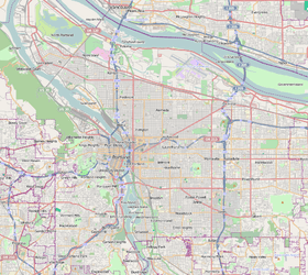
Coordinates: 45°34′25″N 122°41′33″W / 45.57354°N 122.69247°WCoordinates: 45°34′25″N 122°41′33″W / 45.57354°N 122.69247°W PDF map | |
| Country | United States |
| State | Oregon |
| City | Portland |
| Government | |
| • Association | Arbor Lodge Neighborhood Association |
| • Coalition | North Portland Neighborhood Services |
| Area | |
| • Total | 0.87 sq mi (2.25 km2) |
| Population (2000)[1] | |
| • Total | 6,065 |
| • Density | 6,980/sq mi (2,696/km2) |
| Housing[1] | |
| • No. of households | 2573 |
| • Occupancy rate | 96% occupied |
| • % households renting | 27% renting |
| • Avg. household size | 2.36 persons |
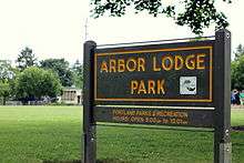
Arbor Lodge Park with Chief Joseph Elementary School in the background
Arbor Lodge is a neighborhood in the North section of Portland, Oregon. Interstate 5 forms the eastern boundary of the neighborhood. The North Lombard Transit Center and the Rosa Parks stations on the MAX Yellow Line provide light rail service to the neighborhood. Their opening in 2004 was part of a spurt of new development in the neighborhood, including a New Seasons Market and a Fred Meyer mega-store.
Arbor Lodge Park (1940) serves the neighborhood.
References
External links
- Arbor Lodge (PortlandNeighborhood.com)
- Arbor Lodge Neighborhood Association
| Buildings | |
|---|---|
| Transportation | |
| |
This article is issued from Wikipedia - version of the 5/12/2015. The text is available under the Creative Commons Attribution/Share Alike but additional terms may apply for the media files.