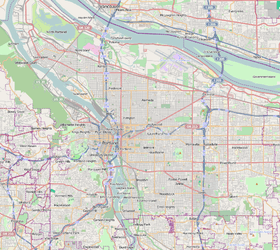
Homestead, Portland, Oregon
| Homestead | |
|---|---|
| Neighborhood | |
 Homestead | |
|
Coordinates: 45°29′45″N 122°41′11″W / 45.49571°N 122.68629°WCoordinates: 45°29′45″N 122°41′11″W / 45.49571°N 122.68629°W PDF map | |
| Country | United States |
| State | Oregon |
| City | Portland |
| Government | |
| • Association | Homestead Neighborhood Association |
| • Coalition | Southwest Neighborhoods, Inc. |
| Area | |
| • Total | 0.98 sq mi (2.54 km2) |
| Population (2000)[1] | |
| • Total | 2,556 |
| • Density | 2,610/sq mi (1,006/km2) |
| Housing[1] | |
| • No. of households | 1408 |
| • Occupancy rate | 94% occupied |
| • % households renting | 60% renting |
| • Avg. household size | 1.82 persons |
Homestead is a Southwest Portland, Oregon neighborhood in the city's West Hills. The neighborhood is home to Marquam Nature Park (SW Marquam St. & Sam Jackson Park Rd.), which offers urban hiking in the form of the Marquam Trail, which one can follow to Downtown. The neighborhood also features a scenic boulevard, SW Terwilliger Blvd. Parkway. The parkway has a wide, paved path for walking, running and biking.
Though primarily residential, the northern portion of the neighborhood includes two regionally important medical complexes on Marquam Hill: the main campus of Oregon Health & Science University, and Portland Veteran Affairs Medical Center. Portland Aerial Tram connects these complexes to the South Waterfront district in the South Portland neighborhood on the Willamette River south of Downtown.
Schools
The neighborhood is served by Bridlemile Elementary School, West Sylvan Middle School, and Lincoln High School.