Portsmouth, Portland, Oregon
| Portsmouth | |
|---|---|
| Neighborhood | |
 Portsmouth | |
|
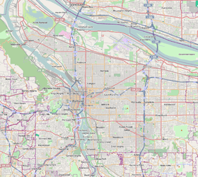
Coordinates: 45°35′12″N 122°43′06″W / 45.58660°N 122.71840°WCoordinates: 45°35′12″N 122°43′06″W / 45.58660°N 122.71840°W PDF map | |
| Country | United States |
| State | Oregon |
| City | Portland |
| Government | |
| • Association | Portsmouth Neighborhood Association |
| • Coalition | North Portland Neighborhood Services |
| Area | |
| • Total | 1.09 sq mi (2.82 km2) |
| Population (2000)[1] | |
| • Total | 8,304 |
| • Density | 7,630/sq mi (2,945/km2) |
| Housing[1] | |
| • No. of households | 2866 |
| • Occupancy rate | 94% occupied |
| • % households renting | 52% renting |
| • Avg. household size | 2.90 persons |
Portsmouth is a neighborhood in the North section of Portland, Oregon. It is named for Portsmouth Avenue, a major street in the district. It is bordered by Lombard Street to the South, Chautauqua Boulevard to the East, Columbia Boulevard to the North, and the Burlington Northern Railway to the West. The neighborhood is served by Portsmouth Middle School and two elementary schools.
Portsmouth used to also include the neighborhood that is now known as University Park. This explains both the name of the neighborhood ("ports" + "mouth" = Portsmouth was bordered on one side by the Columbia River and on another side by the Willamette River) as well as why there's a park named "Portsmouth Park" in University Park neighborhood.
Features
- Columbia Park
- Northgate Park
- University Park
- University Park Community Center
References
This article is issued from Wikipedia - version of the 9/4/2016. The text is available under the Creative Commons Attribution/Share Alike but additional terms may apply for the media files.