Dunderberg Peak
| Dunderberg Peak | |
|---|---|
|
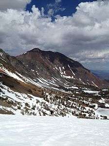
Dunderberg Peak from the South | |
| Highest point | |
| Elevation | 12,379 ft (3,773 m) NAVD 88[1] |
| Prominence | 1,334 ft (407 m) [1] |
| Listing | Sierra Peaks Section[2] |
| Coordinates | 38°03′53″N 119°16′28″W / 38.0646445°N 119.2743228°WCoordinates: 38°03′53″N 119°16′28″W / 38.0646445°N 119.2743228°W [3] |
| Geography | |
| Location | Mono County, California, U.S. |
| Parent range | Sierra Nevada |
| Topo map | USGS Dunderberg Peak |
| Climbing | |
| First ascent | 1878 by Lt. M. M. Macomb and party of the Wheeler Survey[4] |
| Easiest route | Hike (class 1-2)[2][4] |
Dunderberg Peak is located east of the Sierra Nevada crest near the divide between the Owens and E. Walker Valleys (Conway Summit)[5] in Mono County, in eastern California in the southwestern United States.[3] The peak is in the Hoover Wilderness and is the highest point in Humboldt-Toiyabe National Forest.[1]
History
Dunderberg Peak, originally named Castle Peak, was renamed by a party of the Wheeler Survey after the mines upon its northerly slope in 1878.[6]
See also
- Dunderberg Mill, California, a ghost town located 3 miles (4.8 km) north-northeast of the summit.
References
- 1 2 3 "Dunderberg Peak, California". Peakbagger.com. Retrieved 2014-01-15.
- 1 2 "Sierra Peaks Section List" (PDF). Angeles Chapter, Sierra Club. Retrieved 2014-01-22.
- 1 2 "Dunderberg Peak". Geographic Names Information System. United States Geological Survey. Retrieved 2014-01-15.
- 1 2 Secor, R.J. (2009). The High Sierra Peaks, Passes, and Trails (3rd ed.). Seattle: The Mountaineers. p. 443. ISBN 9780898869712.
- ↑ "Dunderberg Peak". SummitPost.org. Retrieved 2014-01-15.
- ↑ Farquhar, Francis P. (1926). Place Names of the High Sierra. San Francisco: Sierra Club. p. 22. Retrieved 2014-01-15.
External links
- "Dunderberg Peak". SummitPost.org.
- "Dunderberg". GhostTowns.com.
This article is issued from Wikipedia - version of the 3/15/2016. The text is available under the Creative Commons Attribution/Share Alike but additional terms may apply for the media files.