Hiba-Dogo-Taishaku Quasi-National Park
| Hiba-Dōgo-Taishaku Quasi-National Park | |
|---|---|
| 比婆道後帝釈国定公園 | |
|
| |
| Location | Tottori/Shimane/Hiroshima Prefecture, Japan |
| Nearest city | Shōbara, Hiroshima Prefecture |
| Coordinates | 35°04′12″N 133°14′09″E / 35.07000°N 133.23583°ECoordinates: 35°04′12″N 133°14′09″E / 35.07000°N 133.23583°E |
| Area | 78.08 square kilometres (78,080,000 m2) |
| Established | July 24, 1963 |

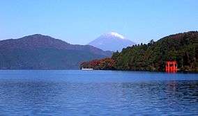
Hiba-Dogo-Taishaku Quasi-National Park (比婆道後帝釈国定公園 Hiba-Dōgo-Taishaku Kokutei Kōen) is a Quasi-National Park that spans areas of Tottori Prefecture, Shimane Prefecture, and Hiroshima Prefecture, to the east of the island of Honshu, Japan.[1][2] It was founded on 24 July 1963 and has an area of 78.08 square kilometres (78,080,000 m2).[3] As its name suggests, the Hiba-Dogo-Taishaku Quasi-National Park is composed of a series of mountains and ravines in the middle of the Chūgoku Mountains.[4] The park has virgin forests of Japanese beeches, Japanese oaks, Japanese horse-chestnuts and interesting ferns. Fauna include the Asiatic black bear, Japanese macaque, mountain hawk eagle and the Japanese giant salamander. Lake Shinryū is also a component of the park.
Mountains
Noted mountains of the Hiba-Dogo-Taishaku Quasi-National Park are Mount Hiba (1,299 m (4,262 ft)), Mount Azuma (1,240 m (4,068 ft)), Mount Sentsū (1,142 m (3,747 ft)), and Mount Dōgo (1,271 m (4,170 ft)). According to the Kojiki,[5] Mount Sentsū is noted for its association with the Susanoo myth, specifically his battle with Yamata no Orochi.[6][7]
Taishaku Ravine
The scenic Taishaku Ravine (帝釈峡 Taishaku-kyō) in Hiroshima Prefecture,[8] an important part of the park, is formed by erosion caused by the Taishaku River.[9] The Taishaku Ravine is fully 20 kilometres (12 mi) long.[7]
Recreation
Hiba-Dogo-Taishaku Quasi-National Park is a popular destination for hiking and skiing.[7]
See also
| Wikimedia Commons has media related to Hiba-Dōgo-Taishaku Quasi-National Park. |
References
- ↑ "比婆道後帝釈国定公園". Ministry of the Environment. Retrieved 10 May 2011.
- ↑ "大和青垣/高野龍神/比婆道後帝釈/西中国山地". National Parks Association of Japan. Retrieved 10 May 2011.
- ↑ "List of National Parks". Ministry of the Environment. Retrieved 10 May 2011.
- ↑ "Hiba-Dōgo-Taishaku Kokutei Kōen (比婆道後帝釈国定公園)". Nihon Kokugo Daijiten (日本国語大辞典) (in Japanese). Tokyo: Shogakukan. 2012. Retrieved 2012-02-28.
- ↑ "Sentsūzan". Encyclopedia of Japan. Tokyo: Netto Adobansusha. 2012. Retrieved 2012-02-19.
- ↑ "Sentsūzan". Nihon Daihyakka Zensho (Nipponika) (日本大百科全書(ニッポニカ). Tokyo: Netto Adobansusha. 2012. Retrieved 2012-02-23.}(Japanese)
- 1 2 3 "Hiba-Dōgo-Taishaku Kokutei Kōen (比婆道後帝釈国定公園)". Nihon Daihyakka Zensho (Nipponika) (日本大百科全書(ニッポニカ). Tokyo: Netto Adobansusha. 2012. Retrieved 2012-04-19.}(Japanese)
- ↑ "Hiba-Dōgo-Taishaku Kokutei Kōen (比婆道後帝釈国定公園)". Dijitaru daijisen (in Japanese). Tokyo: Shogakukan. 2012. Retrieved 2012-04-19.
- ↑ "Taishaku-kyō (帝釈峡)". Nihon Kokugo Daijiten (日本国語大辞典) (in Japanese). Tokyo: Shogakukan. 2012. Retrieved 2012-02-28.