Shikotsu-Tōya National Park
| Shikotsu-Tōya National Park | |
|---|---|
| 支笏洞爺国立公園 | |
|
IUCN category II (national park) | |
|
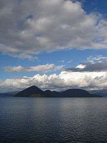
Lake Tōya (October 2007) | |
 Location of Shikotsu-Tōya National Park in Japan | |
| Location | Hokkaidō, Japan |
| Coordinates | 42°40′0″N 141°0′0″E / 42.66667°N 141.00000°ECoordinates: 42°40′0″N 141°0′0″E / 42.66667°N 141.00000°E |
| Area | 993.02 km² |
| Established | May 16, 1949 |
| Governing body | Ministry of the Environment |
Shikotsu-Tōya National Park (支笏洞爺国立公園 Shikotsu Tōya Kokuritsu Kōen) is a national park in the western part of the island of Hokkaidō, Japan. Named after the volcanic caldera lakes of Lake Shikotsu and Lake Tōya, it has a total area of 993.02 square kilometers. The popular hot spring resort of Noboribetsu is also within the park.
It can be divided into roughly five areas:

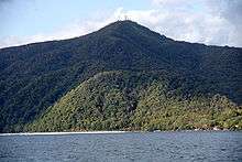
Mount Tarumae as seen from Lake Shikotsu
- The Mount Yōtei area
- The area around Lake Tōya, Mount Usu and Shōwa-shinzan (Tōya Caldera and Usu Volcano Geopark)
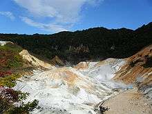
- The area around the hot springs of Noboribetsu (登別), Orofure Pass (オロフレ峠 Orofure-tōge), and Lake Kuttara (倶多楽湖 Kuttara-ko)
- The area around Lake Shikotsu (支笏湖 Shikotsu-ko), Mount Tarumae (樽前山 Tarumae-zan), and Mount Eniwa (恵庭岳 Eniwa-dake)
- The area around Jōzan-kei (定山渓), Toyohira Gorge (豊平峡 Toyohira-kyō), and Nakayama Pass (中山峠 Nakayama-tōge)
Notable features
At the foot of Mount Tarumae on the north-west side one can find the impressive moss-covered cavern or Koke-no-domon.
 Mt.Yotei |
 Noboribetsu hot spring |
External links
| Wikivoyage has a travel guide for Shikotsu-Toya National Park. |
- Shikotsu-Toya National Park Biodiversity Center of Japan
| Wikimedia Commons has media related to Tōya Usu Geopark. |
- Tōya Usu Geopark (English, Japanese)
This article is issued from Wikipedia - version of the 11/19/2016. The text is available under the Creative Commons Attribution/Share Alike but additional terms may apply for the media files.