Herrings, New York
| Herrings, New York | |
|---|---|
| Village | |
 Herrings, New York Location within the state of New York | |
| Coordinates: 44°1′26″N 75°39′35″W / 44.02389°N 75.65972°WCoordinates: 44°1′26″N 75°39′35″W / 44.02389°N 75.65972°W | |
| Country | United States |
| State | New York |
| County | Jefferson |
| Area | |
| • Total | 0.3 sq mi (0.9 km2) |
| • Land | 0.3 sq mi (0.7 km2) |
| • Water | 0.0 sq mi (0.1 km2) |
| Elevation | 689 ft (210 m) |
| Population (2010) | |
| • Total | 90 |
| Time zone | Eastern (EST) (UTC-5) |
| • Summer (DST) | EDT (UTC-4) |
| ZIP code | 13619 |
| Area code(s) | 315 |
| FIPS code | 36-34220 |
| GNIS feature ID | 0952642 |
Herrings is a village in Jefferson County, New York, United States. The population was 90 at the 2010 census. The village is named after two brothers who owned a paper mill in the area.
The Village of Herrings is at the western edge of the Town of Wilna and is east of Watertown.
History
The community was an important stagecoach stop.
Geography
Herrings is located at 44°1′26″N 75°39′35″W / 44.02389°N 75.65972°W (44.023868, -75.659709).[1]
According to the United States Census Bureau, the village has a total area of 0.3 square miles (0.78 km2), of which, 0.3 square miles (0.78 km2) of it is land and 0.1 square miles (0.26 km2) of it (14.71%) is water.
The village is adjacent to the Black River and is south of Fort Drum.
New York State Route 3 passes through the village.
Demographics
| Historical population | |||
|---|---|---|---|
| Census | Pop. | %± | |
| 1930 | 274 | — | |
| 1940 | 232 | −15.3% | |
| 1950 | 192 | −17.2% | |
| 1960 | 171 | −10.9% | |
| 1970 | 137 | −19.9% | |
| 1980 | 170 | 24.1% | |
| 1990 | 140 | −17.6% | |
| 2000 | 129 | −7.9% | |
| 2010 | 90 | −30.2% | |
| Est. 2015 | 89 | [2] | −1.1% |
As of the census[4] of 2000, there were 129 people, 42 households, and 30 families residing in the village. The population density was 446.7 people per square mile (171.7/km²). There were 44 housing units at an average density of 152.3 per square mile (58.6/km²). The racial makeup of the village was 86.82% White, 4.65% African American, 4.65% Native American, 0.78% Asian, 1.55% from other races, and 1.55% from two or more races. Hispanic or Latino of any race were 2.33% of the population.
There were 42 households out of which 45.2% had children under the age of 18 living with them, 59.5% were married couples living together, 7.1% had a female householder with no husband present, and 26.2% were non-families. 16.7% of all households were made up of individuals and 2.4% had someone living alone who was 65 years of age or older. The average household size was 3.02 and the average family size was 3.29.
In the village the population was spread out with 34.1% under the age of 18, 7.0% from 18 to 24, 30.2% from 25 to 44, 24.0% from 45 to 64, and 4.7% who were 65 years of age or older. The median age was 32 years. For every 100 females there were 101.6 males. For every 100 females age 18 and over, there were 102.4 males.
The median income for a household in the village was $33,750, and the median income for a family was $33,750. Males had a median income of $24,583 versus $23,750 for females. The per capita income for the village was $9,674. There were 13.5% of families and 18.8% of the population living below the poverty line, including 21.3% of under eighteens and 22.2% of those over 64.
References
- ↑ "US Gazetteer files: 2010, 2000, and 1990". United States Census Bureau. 2011-02-12. Retrieved 2011-04-23.
- ↑ "Annual Estimates of the Resident Population for Incorporated Places: April 1, 2010 to July 1, 2015". Retrieved July 2, 2016.
- ↑ "Census of Population and Housing". Census.gov. Retrieved June 4, 2015.
- ↑ "American FactFinder". United States Census Bureau. Retrieved 2008-01-31.
Municipalities and communities of Jefferson County, New York, United States | ||
|---|---|---|
| City | 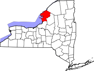 | |
| Towns | ||
| Villages | ||
| CDPs |
| |
| Hamlets | ||