Chaumont, New York
| Chaumont, New York | |
|---|---|
| Village | |
 Chaumont, New York Location within the state of New York | |
| Coordinates: 44°4′2″N 76°8′2″W / 44.06722°N 76.13389°WCoordinates: 44°4′2″N 76°8′2″W / 44.06722°N 76.13389°W | |
| Country | United States |
| State | New York |
| County | Jefferson |
| Incorporation | 1874[1] |
| Named for | Jacques-Donatien Le Ray, Comte de Chaumont |
| Government | |
| • Mayor | Valerie E. Rust[1] |
| Area | |
| • Total | 1.1 sq mi (2.8 km2) |
| • Land | 1.0 sq mi (2.7 km2) |
| • Water | 0.1 sq mi (0.2 km2) |
| Elevation | 289 ft (88 m) |
| Population (2010) | |
| • Total | 624 |
| Time zone | Eastern (EST) (UTC-5) |
| • Summer (DST) | EDT (UTC-4) |
| ZIP code | 13622 |
| Area code(s) | 315 |
| FIPS code | 36-14036 |
| GNIS feature ID | 0969990 |
Chaumont (/ʃəˈmoʊ/ shə-MOH) is a village in Jefferson County, New York, in the United States. Its population was 624 at the 2010 census. The village is named for Jacques-Donatien Le Ray de Chaumont, son of Franklin's landlord and friend at Passy in France.
The village of Chaumont is in the western part of the town of Lyme and is northwest of the city of Watertown.
History
In 1750, Ray had bought the Chaumont castle (named from the Old French for "bald hill", and built in two periods around 1500), in the Loire Valley of France. (As of 2009, the village near it is called Chaumont-sur-Loire to distinguish it from the many other Chaumonts in France.) His son, known as James Leray or James Leray Chaumont travelled to the United States and later settled there.
The first European-descended settlement of the village began in 1802, replacing an unsatisfactory site chosen the previous year.[2] The economy of the early village was based on fishing and ship building.
In July 1853, the community contained about fifty dwellings, along with other structures.[2] Chaumont was incorporated as a village in 1874,[1] and its historic core was listed on the National Register of Historic Places in 1990 as the Chaumont Historic District.[3] The village has been proposed to be dissolved into the surrounding town of Lyme twice. The first dissolution referendum was defeated by a margin of 129–72 in March 1999; a second attempt was rejected by a 145–102 margin on November 6, 2012.[1]
In addition to the Chaumont Historic District, the Cedar Grove Cemetery, Chaumont Grange Hall and Dairymen's League Building, Chaumont House, Chaumont Railroad Station, George Brothers Building, George House, and Menzo Wheeler House are listed on the National Register of Historic Places.[3]
Geography
According to the United States Census Bureau, Chaumont has a total area of 1.1 square miles (2.8 km2), of which, 1.0 square mile (2.6 km2) of it is land and 0.1 square miles (0.26 km2) of it (7.27%) is water.
The village is on the south side of the Chaumont River, where it empties into Chaumont Bay, an arm of Lake Ontario. Much of the village is on a peninsula, which ends at Independence Point.
New York State Route 12E passes through the village as Main Street. County Route 179 (Evans Street) enters the village from the northeast.
Climate
In 2008 the average precipitation for Chaumont was below the United States average in the months January through July, and above the United States average on the months August through December, reaching an average of 4 inches in September. Snowfall is well above the United States average in the months October through April, reaching 28-30 inches in January.
Demographics
| Historical population | |||
|---|---|---|---|
| Census | Pop. | %± | |
| 1870 | 370 | — | |
| 1880 | 479 | 29.5% | |
| 1890 | 623 | 30.1% | |
| 1900 | 738 | 18.5% | |
| 1910 | 708 | −4.1% | |
| 1920 | 595 | −16.0% | |
| 1930 | 596 | 0.2% | |
| 1940 | 534 | −10.4% | |
| 1950 | 513 | −3.9% | |
| 1960 | 523 | 1.9% | |
| 1970 | 567 | 8.4% | |
| 1980 | 620 | 9.3% | |
| 1990 | 593 | −4.4% | |
| 2000 | 592 | −0.2% | |
| 2010 | 624 | 5.4% | |
| Est. 2015 | 616 | [4] | −1.3% |
As of the census[6] of July 2009, there were 638 people, up 7.8% since 2000. 46.8%(298) of residents were male and 53.2%(340) were female. The median resident age at this time was 38.8 years. The 2000 census recorded 592 people, 233 households, and 143 families residing in the village. The population density was 578.2 people per square mile (224.1/km²). There were 273 housing units at an average density of 266.6 per square mile (103.3/km²). The racial makeup of the village was 96.79% White, 1.69% African American, 0.68% Native American, and 0.84% from two or more races. Hispanic or Latino of any race were 1.01% of the population.
There were 233 households out of which 30.5% had children under the age of 18 living with them, 47.6% were married couples living together, 11.2% had a female householder with no husband present, and 38.2% were non-families. 33.0% of all households were made up of individuals and 19.7% had someone living alone who was 65 years of age or older. The average household size was 2.48 and the average family size was 3.22.
In the village the population was spread out with 25.0% under the age of 18, 9.8% from 18 to 24, 27.0% from 25 to 44, 22.6% from 45 to 64, and 15.5% who were 65 years of age or older. The median age was 39 years. For every 100 females there were 87.9 males. For every 100 females age 18 and over, there were 80.5 males.
The estimated median household income was $50,471 in 2008. In 2000 the income was estimated to be $37,750 and the median income for a family was $49,107. Males had a median income of $34,375 versus $26,000 for females. The per capita income for the village was $16,608. About 1.6% of families and 8.4% of the population were below the poverty line, including 4.2% of those under age 18 and 9.5% of those age 65 or over.
Attractions
Local businesses include restaurants such as Wise Guys Pizza, The Blue Heron, Crescent Restaurant and Bar, Valley Peetza, the Duck Stop Diner and Duck Out Ice Cream, seasonally. Shopping is offered at the Chaumont IGA Express, Nice & Easy, Chaumont Wine & Spirits and others. Also located in Chaumont the Crescent Yacht Club, Chaumont Bay Marina and Guffin Bay Marina.
References
- 1 2 3 4 Lee, Jaegun (November 7, 2012). "Chaumont will live on". Watertown Daily Times. Retrieved November 7, 2012.
- 1 2 History Of Lyme, NY (transcription with apparent OCR errors), in Our County And Its People: A Descriptive Work On Jefferson County, New York, Edgar C. Emerson, ed., The Boston History Company, 1898
- 1 2 National Park Service (March 13, 2009). "National Register Information System". National Register of Historic Places. National Park Service.
- ↑ "Annual Estimates of the Resident Population for Incorporated Places: April 1, 2010 to July 1, 2015". Retrieved July 2, 2016.
- ↑ "Census of Population and Housing". Census.gov. Archived from the original on May 11, 2015. Retrieved June 4, 2015.
- ↑ "American FactFinder". United States Census Bureau. Archived from the original on 2013-09-11. Retrieved 2008-01-31.
External links
- The Village of Chaumont
- Lyme Parks and Recreation
- Get Directions
- Lyme Community Foundation website
- Chaumont/TMB Chamber of Commerce website
Municipalities and communities of Jefferson County, New York, United States | ||
|---|---|---|
| City | 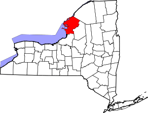 | |
| Towns | ||
| Villages | ||
| CDPs |
| |
| Hamlets | ||