Alexandria, New York
| Alexandria | |
| Town | |
 | |
| Country | United States |
|---|---|
| State | New York |
| County | Jefferson County |
| Elevation | 351 ft (107.0 m) |
| Coordinates | 44°19′N 75°53′W / 44.317°N 75.883°WCoordinates: 44°19′N 75°53′W / 44.317°N 75.883°W |
| Area | 84.5 sq mi (218.9 km2) |
| - land | 73.0 sq mi (189 km2) |
| - water | 11.6 sq mi (30 km2), 13.73% |
| Population | 4,061 (2010) |
| Density | 55/sq mi (21.235618720/km2) |
| Incorporated | 1821 |
| Town Supervisor | Martha Millett (D)
|
| Timezone | EST (UTC-5) |
| - summer (DST) | EDT (UTC-4) |
| ZIP code | 13607, 13675 |
| Area code | 315 |
 Location of Alexandria in New York
| |
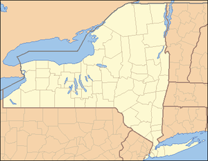
 Location of New York in the United States
| |
Alexandria is a town in the Thousand Islands region of the U.S. state of New York, within Jefferson County. The population of the town was 4,061 at the 2010 United States Census. The town is named after Alexander LeRay, the son of an early developer. The Village of Alexandria Bay is located within the Town of Alexandria.
The Town of Alexandria is located in the northern part of the county and is north of Watertown.
History
The first settlement occurred at Alexandria Center around 1811.
The Battle of Cranberry Creek, during the War of 1812, was a minor engagement in which local forces defeated a much larger group of British soldiers and sailors, who attempted to regain supplies and provisions taken earlier by the Americans.
The town was established in 1821 from the Town of Brownville and the Town of Le Ray.
Modern Alexandria has become a well-known vacation area.
The Densmore Methodist Church of the Thousand Islands was listed on the National Register of Historic Places in 1988.[1]
Geography
According to the United States Census Bureau, the town has a total area of 84.5 square miles (219 km2), of which, 73.0 square miles (189 km2) of it is land and 11.6 square miles (30 km2) of it (13.67%) is water.
The St. Lawrence River marks the northern edge of the town. The north town line is the international border with Canada *Ontario). The east town line is the county line of St. Lawrence County, New York.
Many of the Thousand Islands are in the town.
Interstate 81 passes through the southwest corner of the town. New York State Route 12 follows the course of the St. Lawrence River. NY-12 intersects New York State Route 26 at Alexandria Bay and runs in a southwest direction.
Demographics
| Historical population | |||
|---|---|---|---|
| Census | Pop. | %± | |
| 1830 | 1,523 | — | |
| 1840 | 3,475 | 128.2% | |
| 1850 | 3,178 | −8.5% | |
| 1860 | 3,808 | 19.8% | |
| 1870 | 3,087 | −18.9% | |
| 1880 | 3,135 | 1.6% | |
| 1890 | 3,601 | 14.9% | |
| 1900 | 3,894 | 8.1% | |
| 1910 | 4,259 | 9.4% | |
| 1920 | 3,567 | −16.2% | |
| 1930 | 3,953 | 10.8% | |
| 1940 | 3,533 | −10.6% | |
| 1950 | 3,583 | 1.4% | |
| 1960 | 3,574 | −0.3% | |
| 1970 | 3,515 | −1.7% | |
| 1980 | 3,587 | 2.0% | |
| 1990 | 3,949 | 10.1% | |
| 2000 | 4,097 | 3.7% | |
| 2010 | 4,061 | −0.9% | |
| Est. 2014 | 4,180 | [2] | 2.9% |
As of the census[4] of 2000, there were 4,097 people, 1,653 households, and 1,128 families residing in the town. The population density was 56.1 people per square mile (21.7/km²). There were 3,247 housing units at an average density of 44.5 per square mile (17.2/km²). The racial makeup of the town was 98.54% White, 0.29% African American, 0.22% Native American, 0.02% Asian, 0.05% Pacific Islander, 0.17% from other races, and 0.71% from two or more races. Hispanic or Latino of any race were 0.63% of the population.
There were 1,653 households out of which 30.2% had children under the age of 18 living with them, 54.6% were married couples living together, 9.1% had a female householder with no husband present, and 31.7% were non-families. 26.9% of all households were made up of individuals and 11.4% had someone living alone who was 65 years of age or older. The average household size was 2.44 and the average family size was 2.95.
In the town the population was spread out with 24.6% under the age of 18, 5.4% from 18 to 24, 27.9% from 25 to 44, 25.6% from 45 to 64, and 16.5% who were 65 years of age or older. The median age was 40 years. For every 100 females there were 96.4 males. For every 100 females age 18 and over, there were 94.5 males.
The median income for a household in the town was $33,333, and the median income for a family was $42,813. Males had a median income of $30,870 versus $21,050 for females. The per capita income for the town was $16,879. About 11.3% of families and 13.6% of the population were below the poverty line, including 17.2% of those under age 18 and 12.2% of those age 65 or over.
Communities and locations in Alexandria
Communities and inhabited locations
- Alexandria Bay – The Village of Alexandria Bay is located by the St. Lawrence River on NY-12.
- Alexandria Center – A hamlet south of Alexandria Bay on NY-26.
- Bean Hill Crossing – A hamlet in the northern part of the town on County Road 37
- Browns Corners – A hamlet east of Alexandria Bay on NY-26.
- Collins Landing Wildlife Management Area – A conservation area near the west town line.
- Cottage – A location east of Redwood.
- DeLaFarge Corners – A location on the town line and County Road 3.
- Edgewood Park – A hamlet southwest of Alexandria Bay on Route 12.
- Keewaydin State Park – A state park southwest of Alexandria Bay on NY-12.
- Kring Point State Park – A state park in the northeast corner of the town.
- Plessis – A hamlet near the south town line on NY-26.
- Godfreys Corner – A hamlet southwest of Alexandria Center at County Road 2.
- Goose Bay – A hamlet northeast of Alexandria Bay on NY-12 next to a bay of the St. Lawrence River, also called Goose Bay.
- Redwood – A community on Route 37 between Mud lake and Butterfield Lake.
- Jewetts Corners – A former location in the town.
- Maxson Field (89N) – An airport near Alexandria Bay village. Privately owned - call for permission to land.
- Pinehurst Resort – A hamlet southwest of Alexandria Bay.
- Mary Island State Park – A state park on Mary Island, a small island at the northeast tip of the Wellesley Island.
- Point Vivian – A hamlet southwest of Alexandria Bay on NY-12.
- Redwood – A hamlet in the southeastern part of the town on NY-37.
- St. Lawrence Park – A hamlet on Wellesley Island.
- Schnauber Corners – A former location in the town.
- Saxe Corners – A former location in the town.
- Skinners Corners – A location east of Alexandria Bay on Limestone Road at Center Road.
- Tanners Corners – A location in the southwest corner of the town on County Road 2.
- Wellesley Island State Park – A state park on Wellesley Island, partly within the town.
- Westminster Park – A hamlet on the north end of Wellesley Island.
Geographical locations
- American Narrows – The part of the St. Lawrence River that flows between Wellesley Island and the mainland of New York.
- Black Ash Swamp – A wetland near the west town line.
- Butterfield Lake – A lake partly in the town at its eastern corner.
- Clear Lake – A small lake near the southeast town line and south of Butterfield Lake.
- Densmore Bay – A bay on the south shore of Wellesley Island.
- Goose Bay – A St. Lawrence River Bay in the northeast part of Alexandria.
- Ironsides Island – A small island in the St. Lawrence River in northeast Alexandria.
- Lake of Isles – A bay in Wellesley Island partly in the north part of Alexandria.
- Mary Island – A small island in the St. Lawerence River off the north end of Wellesley Island.
- Mud Lake – A lake near the southeast town line and south of Clear Lake.
- Swan Bay – A bay in the St. Lawrence River in the western part of the town.
- Wellesley Island – A large island in the St. Lawrence River that is divided by three towns of the county.
References
- ↑ National Park Service (2010-07-09). "National Register Information System". National Register of Historic Places. National Park Service.
- ↑ "Annual Estimates of the Resident Population for Incorporated Places: April 1, 2010 to July 1, 2014". Retrieved June 4, 2015.
- ↑ "Census of Population and Housing". Census.gov. Archived from the original on May 11, 2015. Retrieved June 4, 2015.
- ↑ "American FactFinder". United States Census Bureau. Archived from the original on 2013-09-11. Retrieved 2008-01-31.
External links
Municipalities and communities of Jefferson County, New York, United States | ||
|---|---|---|
| City | 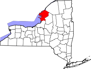 | |
| Towns | ||
| Villages | ||
| CDPs |
| |
| Hamlets | ||