Adams Center, New York
| Adams, New York | |
|---|---|
| CDP | |
 Adams, New York Location within the state of New York | |
| Coordinates: 43°51′44″N 76°0′25″W / 43.86222°N 76.00694°WCoordinates: 43°51′44″N 76°0′25″W / 43.86222°N 76.00694°W | |
| Country | United States |
| State | New York |
| County | Jefferson |
| Area | |
| • Total | 5.0 sq mi (12.9 km2) |
| • Land | 5.0 sq mi (12.8 km2) |
| • Water | 0.0 sq mi (0.0 km2) |
| Elevation | 640 ft (195 m) |
| Population (2010) | |
| • Total | 1,568 |
| • Density | 310/sq mi (120/km2) |
| Time zone | Eastern (EST) (UTC-5) |
| • Summer (DST) | EDT (UTC-4) |
| ZIP code | 13606 |
| Area code(s) | 315 |
| FIPS code | 36-00232 |
| GNIS feature ID | 0942163 |
Adams Center (formerly called Adams Five Corners) is a hamlet (and census-designated place) located in the Town of Adams in Jefferson County, New York, United States. The population was 1,568 at the 2010 census.
History
The community was founded around 1816 and was first known as "Adams Five Corners." That name was used until at least 1828. The exact date of the name change is not known, but the hamlet became known as Adams Centre, a spelling that continued until about 1900.
The completion of a railroad line in 1852 aided the growth of the village.
Notable residents
- Melvil Dewey, invented the Dewey Decimal Classification library classification system.
Geography
Adams Center is located at 43°51′44″N 76°0′25″W / 43.86222°N 76.00694°W (43.862191, -76.006955).[1]
According to the United States Census Bureau, the area has a total area of 5.0 square miles (12.9 km2), of which, 5.0 square miles (12.9 km2) of it is land and 0.20% is water.
U.S. Route 11, County Roads 66 and 76, and New York State Route 177 pass through the village, and Interstate 81 is to the west of the community.
Demographics
As of the 2000 United States Census,[2] there were 1,500 people, 560 households, and 398 families residing in the village. The population density was 302.6 per square mile (116.8/km²). There were 617 housing units at an average density of 124.5/sq mi (48.0/km²). The racial makeup of the CDP was 98.67% White, 0.07% African American, 0.20% Native American, 0.27% Asian, 0.07% Pacific Islander, 0.13% from other races, and 0.60% from two or more races. Hispanic or Latino of any race were 0.47% of the population.
There were 560 households out of which 37.5% had children under the age of 18 living with them, 56.8% were married couples living together, 9.8% had a female householder with no husband present, and 28.9% were non-families. 22.1% of all households were made up of individuals and 8.8% had someone living alone who was 65 years of age or older. The average household size was 2.68 and the average family size was 3.13.
In the community the population was spread out with 28.2% under the age of 18, 8.6% from 18 to 24, 30.1% from 25 to 44, 22.1% from 45 to 64, and 11.0% who were 65 years of age or older. The median age was 36 years. For every 100 females there were 99.2 males. For every 100 females age 18 and over, there were 89.9 males.
The median income for a household in the village was $41,938, and the median income for a family was $49,485. Males had a median income of $35,441 versus $24,219 for females. The per capita income for the CDP was $16,288. About 5.2% of families and 6.9% of the population were below the poverty line, including 7.9% of those under age 18 and none of those age 65 or over.
References
- ↑ "US Gazetteer files: 2010, 2000, and 1990". United States Census Bureau. 2011-02-12. Retrieved 2011-04-23.
- ↑ "American FactFinder". United States Census Bureau. Archived from the original on 2013-09-11. Retrieved 2008-01-31.
Municipalities and communities of Jefferson County, New York, United States | ||
|---|---|---|
| City | 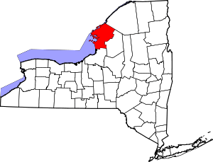 | |
| Towns | ||
| Villages | ||
| CDPs |
| |
| Hamlets | ||