Ellisburg (village), New York
| Ellisburg, New York | |
|---|---|
| Village | |
 Ellisburg, New York Location within the state of New York | |
| Coordinates: 43°43′54″N 76°8′1″W / 43.73167°N 76.13361°WCoordinates: 43°43′54″N 76°8′1″W / 43.73167°N 76.13361°W | |
| Country | United States |
| State | New York |
| County | Jefferson |
| Area | |
| • Total | 1.0 sq mi (2.6 km2) |
| • Land | 1.0 sq mi (2.6 km2) |
| • Water | 0.0 sq mi (0.0 km2) |
| Elevation | 328 ft (100 m) |
| Population (2010) | |
| • Total | 244 |
| • Density | 240/sq mi (94/km2) |
| Time zone | Eastern (EST) (UTC-5) |
| • Summer (DST) | EDT (UTC-4) |
| ZIP code | 13636 |
| Area code(s) | 315 |
| FIPS code | 36-24075 |
| GNIS feature ID | 0975770 |
Ellisburg is a village in Jefferson County, New York, United States. The population was 244 at the 2010 census. The village is named after two brothers who were the original landowners.
The Village of Ellisburg is located near the center of the Town of Ellisburg and is south of Watertown.
History
The village was first settled around 1797 by Lyman Ellis and was also called "Ellisburgh." The village set itself off from the town by incorporation in 1895.
Geography
Ellisburg is located at 43°43′54″N 76°8′1″W / 43.73167°N 76.13361°W (43.731775, -76.133695).[1]
According to the United States Census Bureau, the village has a total area of 1.0 square miles (2.6 km²).None of the area is covered with water.
The village is on the South Branch of Sandy Creek.
Ellisburg is at the junction of New York State Route 193, New York State Route 289, and County Road 87.
Demographics
| Historical population | |||
|---|---|---|---|
| Census | Pop. | %± | |
| 1880 | 222 | — | |
| 1890 | 336 | 51.4% | |
| 1900 | 292 | −13.1% | |
| 1910 | 702 | 140.4% | |
| 1920 | 275 | −60.8% | |
| 1930 | 253 | −8.0% | |
| 1940 | 253 | 0.0% | |
| 1950 | 285 | 12.6% | |
| 1960 | 328 | 15.1% | |
| 1970 | 337 | 2.7% | |
| 1980 | 307 | −8.9% | |
| 1990 | 246 | −19.9% | |
| 2000 | 269 | 9.3% | |
| 2010 | 244 | −9.3% | |
| Est. 2015 | 247 | [2] | 1.2% |
As of the census[4] of 2000, there were 269 people, 91 households, and 69 families residing in the village. The population density was 266.1 people per square mile (102.8/km²). There were 100 housing units at an average density of 98.9 per square mile (38.2/km²). The racial makeup of the village was 99.26% White, and 0.74% from two or more races. Hispanic or Latino of any race were 0.37% of the population.
There were 91 households out of which 45.1% had children under the age of 18 living with them, 57.1% were married couples living together, 15.4% had a female householder with no husband present, and 23.1% were non-families. 17.6% of all households were made up of individuals and 11.0% had someone living alone who was 65 years of age or older. The average household size was 2.96 and the average family size was 3.34.
In the village the population was spread out with 30.9% under the age of 18, 11.9% from 18 to 24, 28.3% from 25 to 44, 19.0% from 45 to 64, and 10.0% who were 65 years of age or older. The median age was 35 years. For every 100 females there were 94.9 males. For every 100 females age 18 and over, there were 97.9 males.
The median income for a household in the village was $39,750, and the median income for a family was $45,313. Males had a median income of $31,875 versus $20,000 for females. The per capita income for the village was $14,569. About 18.8% of families and 21.6% of the population were below the poverty line, including 35.3% of those under the age of eighteen and none of those sixty five or over.
Notable people
- John M. McHugh, US Secretary of the Army
References
- ↑ "US Gazetteer files: 2010, 2000, and 1990". United States Census Bureau. 2011-02-12. Retrieved 2011-04-23.
- ↑ "Annual Estimates of the Resident Population for Incorporated Places: April 1, 2010 to July 1, 2015". Retrieved July 2, 2016.
- ↑ "Census of Population and Housing". Census.gov. Retrieved June 4, 2015.
- ↑ "American FactFinder". United States Census Bureau. Retrieved 2008-01-31.
External links
Municipalities and communities of Jefferson County, New York, United States | ||
|---|---|---|
| City | 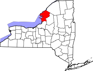 | |
| Towns | ||
| Villages | ||
| CDPs |
| |
| Hamlets | ||