Calcium, New York
| Calcium, New York | |
|---|---|
| CDP | |
 Calcium, New York Location within the state of New York | |
| Coordinates: 44°2′5″N 75°50′32″W / 44.03472°N 75.84222°WCoordinates: 44°2′5″N 75°50′32″W / 44.03472°N 75.84222°W | |
| Country | United States |
| State | New York |
| County | Jefferson |
| Area | |
| • Total | 5.6 sq mi (14.5 km2) |
| • Land | 5.6 sq mi (14.5 km2) |
| • Water | 0.0 sq mi (0.0 km2) |
| Elevation | 469 ft (143 m) |
| Population (2010) | |
| • Total | 3,491 |
| Time zone | Eastern (EST) (UTC-5) |
| • Summer (DST) | EDT (UTC-4) |
| ZIP code | 13616 |
| Area code(s) | 315 |
| FIPS code | 36-11671 |
| GNIS feature ID | 0945447 |
Calcium is a hamlet (and census-designated place) in Jefferson County, New York, United States. The population was 3,491 as of the 2010 Census.
Calcium is in the Town of Le Ray and was formerly called Sanford's Corner.
Historic landmarks include the stone house at the intersection of State Route 342 and County Route 138 that once served as the post office for the area, and the Calcium Community Church at the same intersection. The church was built in 1853 by a group of at least three different denominations, including Methodist Episcopal, Christian, and Unitarian. The building was shared by these and various Christian groups over the years, and remains a community church today.
Geography
Calcium is located at 44°02′05″N 75°50′32″W / 44.034761°N 75.842114°W.[1]
According to the United States Census Bureau, the community has a total area of 5.6 square miles (15 km2), all land.
Calcium is located along U.S. Route 11, south of New York State Route 342, south and west of Fort Drum.
Demographics
As of the census[2] of 2000, there are 3,346 people, 1,052 households, and 911 families residing in the community. The population density is 598.9 per square mile (231.1/km2). There are 1,134 housing units at an average density of 203.0/sq mi (78.3/km2). The racial makeup of the CDP is 67.30% White, 19.52% African American, 1.23% Native American, 1.64% Asian, 0.36% Pacific Islander, 6.19% from other races, and 3.77% from two or more races. 12.61% of the population are Hispanic or Latino of any race.
There are 1,052 households out of which 62.1% have children under the age of 18 living with them, 72.6% are married couples living together, 10.9% have a female householder with no husband present, and 13.4% are non-families. 10.1% of all households are made up of individuals and 1.9% have someone living alone who is 65 years of age or older. The average household size is 3.18 and the average family size is 3.41.
In the community the population is spread out with 40.0% under the age of 18, 16.2% from 18 to 24, 34.1% from 25 to 44, 7.2% from 45 to 64, and 2.5% who are 65 years of age or older. The median age is 23 years. For every 100 females there are 100.4 males. For every 100 females age 18 and over, there are 96.4 males.
The median income for a household in the village is $28,977, and the median income is $30,000. Males have a median income of $25,243 versus $16,250 for females. The per capita income for the CDP is $10,356. 15.4% of the population and 12.7% of families are below the poverty line. Out of the total population, 17.9% of those under the age of 18 and none of those 65 and older are living below the poverty line.
References
- ↑ "US Gazetteer files: 2010, 2000, and 1990". United States Census Bureau. 2011-02-12. Retrieved 2011-04-23.
- ↑ "American FactFinder". United States Census Bureau. Archived from the original on 2013-09-11. Retrieved 2008-01-31.
Municipalities and communities of Jefferson County, New York, United States | ||
|---|---|---|
| City | 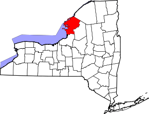 | |
| Towns | ||
| Villages | ||
| CDPs |
| |
| Hamlets | ||