Hayden, Arizona
| Hayden, Arizona | |
|---|---|
| Town | |
 Location in Gila County and the state of Arizona | |
 Hayden, Arizona Location in the United States | |
| Coordinates: 33°0′5″N 110°47′8″W / 33.00139°N 110.78556°WCoordinates: 33°0′5″N 110°47′8″W / 33.00139°N 110.78556°W | |
| Country | United States |
| State | Arizona |
| Counties | Gila, Pinal |
| Area | |
| • Total | 1.3 sq mi (3.3 km2) |
| • Land | 1.3 sq mi (3.3 km2) |
| • Water | 0.0 sq mi (0.0 km2) |
| Elevation | 2,044 ft (623 m) |
| Population (2010)[1] | |
| • Total | 662 |
| • Estimate (2014)[2] | 648 |
| • Density | 648.5/sq mi (255.5/km2) |
| Time zone | MST (no DST) (UTC-7) |
| ZIP code | 85135 |
| Area code(s) | 520 |
| FIPS code | 04-32020 |
Hayden is a town in Gila County in the State of Arizona; Hayden's current mayor is Bob Smith. According to the 2010 census, the population of the town is 662.[1] The economic base of Hayden's economy is the Asarco Hayden Smelter.
Geography
Hayden is located at 33°0′5″N 110°47′8″W / 33.00139°N 110.78556°W (33.001369, -110.785688),[3] adjacent to Winkelman and almost entirely in Gila County.
According to the United States Census Bureau, the town has a total area of 1.3 square miles (3.4 km2), all of it land.
Demographics
| Historical population | |||
|---|---|---|---|
| Census | Pop. | %± | |
| 1910 | 582 | — | |
| 1920 | 2,508 | 330.9% | |
| 1930 | 2,364 | −5.7% | |
| 1950 | 1,494 | — | |
| 1960 | 1,760 | 17.8% | |
| 1970 | 1,283 | −27.1% | |
| 1980 | 1,205 | −6.1% | |
| 1990 | 909 | −24.6% | |
| 2000 | 892 | −1.9% | |
| 2010 | 662 | −25.8% | |
| Est. 2015 | 650 | [4] | −1.8% |
| U.S. Decennial Census[5] 2014 Estimate[2] | |||

As of the census[6] of 2000, there were 892 people, 288 households, and 222 families residing in the town. The population density was 707.1 people per square mile (273.3/km²). There were 334 housing units at an average density of 264.8 per square mile (102.3/km²). The racial makeup of the town was 56.95% White, 0.45% Black or African American, 1.68% Native American, 0.56% Pacific Islander, 35.09% from other races, and 5.27% from two or more races. 84.53% of the population were Hispanic or Latino of any race.
There were 288 households out of which 31.6% had children under the age of 18 living with them, 54.5% were married couples living together, 13.5% had a female householder with no husband present, and 22.9% were non-families. 21.5% of all households were made up of individuals and 9.0% had someone living alone who was 65 years of age or older. The average household size was 3.10 and the average family size was 3.56.
In the town the population was spread out with 33.2% under the age of 18, 9.0% from 18 to 24, 20.5% from 25 to 44, 23.2% from 45 to 64, and 14.1% who were 65 years of age or older. The median age was 32 years. For every 100 females there were 93.9 males. For every 100 females age 18 and over, there were 91.6 males.
The median income for a household in the town was $24,293, and the median income for a family was $26,964. Males had a median income of $35,521 versus $22,500 for females. The per capita income for the town was $9,797. About 20.1% of families and 27.3% of the population were below the poverty line, including 35.2% of those under age 18 and 14.9% of those age 65 or over.
References
- 1 2 "American FactFinder". United States Census Bureau. Retrieved 2014-08-23.
- 1 2 "Population Estimates". United States Census Bureau. Retrieved July 4, 2015.
- ↑ "US Gazetteer files: 2010, 2000, and 1990". United States Census Bureau. 2011-02-12. Retrieved 2011-04-23.
- ↑ "Annual Estimates of the Resident Population for Incorporated Places: April 1, 2010 to July 1, 2015". Retrieved July 2, 2016.
- ↑ United States Census Bureau. "Census of Population and Housing". Retrieved August 23, 2014.
- ↑ "American FactFinder". United States Census Bureau. Retrieved 2008-01-31.
External links
- History of Hayden (scroll down)
- EPA Takes Action Against Toxic Arizona Copper Plant, NPR story on Hayden, with video
Municipalities and communities of Gila County, Arizona, United States | ||
|---|---|---|
| City | 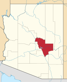 | |
| Towns | ||
| CDPs |
| |
| Unincorporated communities | ||
| Indian reservations | ||
| Ghost towns | ||
| Footnotes | ‡This populated place also has portions in an adjacent county or counties | |
Municipalities and communities of Pinal County, Arizona, United States | ||
|---|---|---|
| Cities | 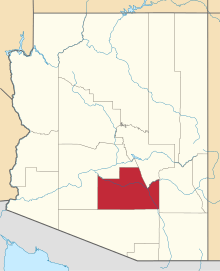 | |
| Towns | ||
| CDPs |
| |
| Unincorporated communities | ||
| Indian reservations | ||
| Ghost towns | ||
| Footnotes | ‡This populated place also has portions in an adjacent county or counties | |