Sweet Water Village, Arizona
| Sweet Water Village, Arizona O'odham: S-iʼovĭ Shu:dagĭ | |
|---|---|
| CDP | |
 Sweet Water Village, Arizona Location in the United States | |
| Coordinates: 33°7′12″N 111°50′16″W / 33.12000°N 111.83778°WCoordinates: 33°7′12″N 111°50′16″W / 33.12000°N 111.83778°W | |
| Country | United States |
| State | Arizona |
| County | Pinal |
| Population (2010) | |
| • Total | 83 |
| Time zone | MST (no DST) (UTC-7) |
Sweet Water Village (O'odham: S-iʼovĭ Shu:dagĭ) is a census-designated place (CDP) in Pinal County, Arizona, United States, located in the Gila River Indian Community. The population was 83 at the 2010 census.
Demographics
As of the census[1] of 2010, there were 83 people residing in the CDP. The population density was 103.8 inhabitants per square mile (40.1/km2). The racial makeup of the CDP was 1.20% White, 97.59% Native American, and 1.20% from two or more races. 19.28% of the population were Hispanic or Latino of any race.
Municipalities and communities of Pinal County, Arizona, United States | ||
|---|---|---|
| Cities | 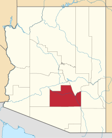 | |
| Towns | ||
| CDPs |
| |
| Unincorporated communities | ||
| Indian reservations | ||
| Ghost towns | ||
| Footnotes | ‡This populated place also has portions in an adjacent county or counties | |
Notes
This article is issued from Wikipedia - version of the 6/7/2015. The text is available under the Creative Commons Attribution/Share Alike but additional terms may apply for the media files.