Christopher Creek, Arizona
| Christopher Creek, Arizona | |
|---|---|
| Census-designated place | |
 | |
 Christopher Creek  Christopher Creek Location in the state of Arizona | |
| Coordinates: 34°21′17.98″N 111°1′17.90″W / 34.3549944°N 111.0216389°WCoordinates: 34°21′17.98″N 111°1′17.90″W / 34.3549944°N 111.0216389°W | |
| Country |
|
| State |
|
| County | Gila |
| Area[1] | |
| • Total | 3.03 sq mi (7.85 km2) |
| • Land | 3.03 sq mi (7.85 km2) |
| • Water | 0.0 sq mi (0.0 km2) |
| Elevation[2] | 5,961 ft (1,817 m) |
| Population (2010 census)[3] | |
| • Total | 156 |
| • Density | 51/sq mi (20/km2) |
| Time zone | MST (UTC−7) |
| • Summer (DST) | no DST/PDT (UTC−7) |
| ZIP code | 85541 |
| Area code(s) | 928 |
| FIPS code | 04-13140 |
| GNIS ID(s) | 2582755 |
Christopher Creek is a census-designated place in northern Gila County in the state of Arizona. Situated at the base of the Mogollon Rim, the community lies at an elevation of 5,961 feet (1,817 m),[2] and is located approximately 23.5 miles (37.82 km) northeast of Payson, just off SR 260. The population as of the 2010 U.S. Census was 156.[4]
Tourism, retirement and timbering are the foundations of Christopher Creek's economy.
See also
Christopher Creek - Geological feature
References
- ↑ "Population, Housing Units, Area, and Density: 2010 - State -- Place, 2010 Census Summary File 1". United States Census Bureau. Retrieved 2012-05-02.
- 1 2 "Feature Detail Report for: Christopher Creek". Geographic Names Information System. United States Geological Survey.
- ↑ U.S. Census Bureau (2010). "2010 Census Interactive Population Search". U.S. Government.
- ↑ "2010 Census Interactive Population Search". census.gov. Retrieved 2014-04-13.
Municipalities and communities of Gila County, Arizona, United States | ||
|---|---|---|
| City | 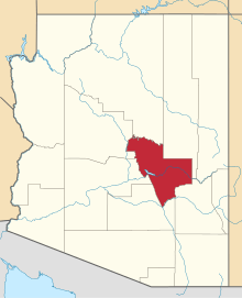 | |
| Towns | ||
| CDPs |
| |
| Unincorporated communities | ||
| Indian reservations | ||
| Ghost towns | ||
| Footnotes | ‡This populated place also has portions in an adjacent county or counties | |
This article is issued from Wikipedia - version of the 10/31/2016. The text is available under the Creative Commons Attribution/Share Alike but additional terms may apply for the media files.