Haigler Creek, Arizona
| Haigler Creek, Arizona | |
|---|---|
| Census-designated place | |
 Haigler Creek  Haigler Creek | |
| Coordinates: 34°12′23″N 110°58′24″W / 34.20639°N 110.97333°WCoordinates: 34°12′23″N 110°58′24″W / 34.20639°N 110.97333°W | |
| Country | United States |
| State | Arizona |
| County | Gila |
| Area | |
| • Total | 1.61 sq mi (4.17 km2) |
| • Land | 1.61 sq mi (4.17 km2) |
| • Water | 0.0 sq mi (0.0 km2) |
| Elevation | 5,240 ft (1,600 m) |
| Population (2010) | |
| • Total | 19 |
| • Density | 12/sq mi (4.6/km2) |
| Time zone | MST (no DST) (UTC-7) |
| Area code(s) | 928 |
| FIPS code | 04-30840 |
| GNIS feature ID | 2582795 |
Haigler Creek is an unincorporated community and census-designated place (CDP) in Gila County, Arizona, United States. The population was 19 at the 2010 census.[1]
Geography
The Haigler Creek CDP is located in northern Gila County in the valley of the creek of the same name, within Tonto National Forest. It lies 11 miles (18 km) south of Arizona State Route 260 via East Colcord Road and a National Forest road. Payson is a total of 36 miles (58 km) west of Haigler Creek by road. According to the United States Census Bureau, the CDP has a total area of 1.61 square miles (4.17 km2), all of it land.[1] Haigler Creek is a west-flowing tributary of Tonto Creek, part of the Salt River watershed.
See also
References
- 1 2 "Geographic Identifiers: 2010 Demographic Profile Data (G001): Haigler Creek CDP, Arizona". U.S. Census Bureau, American Factfinder. Retrieved October 31, 2016.
Municipalities and communities of Gila County, Arizona, United States | ||
|---|---|---|
| City | 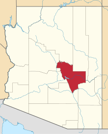 | |
| Towns | ||
| CDPs |
| |
| Unincorporated communities | ||
| Indian reservations | ||
| Ghost towns | ||
| Footnotes | ‡This populated place also has portions in an adjacent county or counties | |
This article is issued from Wikipedia - version of the 10/31/2016. The text is available under the Creative Commons Attribution/Share Alike but additional terms may apply for the media files.