Dudleyville, Arizona
| Dudleyville, Arizona | |
|---|---|
| CDP | |
 Location in Pinal County and the state of Arizona | |
 Dudleyville, Arizona Location in the United States | |
| Coordinates: 32°55′47″N 110°44′2″W / 32.92972°N 110.73389°WCoordinates: 32°55′47″N 110°44′2″W / 32.92972°N 110.73389°W | |
| Country | United States |
| State | Arizona |
| County | Pinal |
| Area | |
| • Total | 6.9 sq mi (17.8 km2) |
| • Land | 6.9 sq mi (17.8 km2) |
| • Water | 0.0 sq mi (0.0 km2) |
| Elevation | 1,946 ft (593 m) |
| Population (2000) | |
| • Total | 1,323 |
| • Density | 191.7/sq mi (74.3/km2) |
| Time zone | MST (no DST) (UTC-7) |
| FIPS code | 04-20680 |
| GNIS feature ID | 0024402 |
Dudleyville is a census-designated place (CDP) in Pinal County, Arizona, United States. The population was 1,323 at the 2000 census.
Geography
Dudleyville is located at 32°55′47″N 110°44′2″W / 32.92972°N 110.73389°W (32.929812, -110.733899).[1]
According to the United States Census Bureau, the CDP has a total area of 6.9 square miles (18 km2), all of it land.
The city includes the San Pedro River Preserve.
History
During the 1870s ranchers moved cattle into the lands along the lower San Pedro River. At what would become Dudleyville, a stage station opened in the late 1870s along the Globe to Tucson stage road. On May 8, 1881, William Dudley Harrington, operator of the stage station, was appointed first post master of the new post office of Dudleyville. Harrington and his wife Amanda were from Missouri and had moved to California then Texas before settling with their family on a farm along the San Pedro. The small village of Dudleyville, with stage stop, mercantile and post office, farms, ranches, and prospectors, was a small regional center for two and a half decades. The village was eclipsed by the new town site of Winkleman, a mile north near the mouth of the San Pedro River on the Gila River, with the opening of the Phoenix & Eastern Railroad on September 28, 1904 to the new rail town.[2][3][4]
Demographics
As of the census[5] of 2000, there were 1,323 people, 454 households, and 345 families residing in the CDP. The population density was 192.3 people per square mile (74.2/km²). There were 572 housing units at an average density of 83.1 per square mile (32.1/km²). The racial makeup of the CDP was 61.98% White, 0.08% Black or African American, 2.12% Native American, 0.08% Asian, 0.30% Pacific Islander, 32.73% from other races, and 2.72% from two or more races. 58.96% of the population were Hispanic or Latino of any race.
There were 454 households out of which 36.6% had children under the age of 18 living with them, 56.4% were married couples living together, 12.3% had a female householder with no husband present, and 23.8% were non-families. 20.0% of all households were made up of individuals and 7.7% had someone living alone who was 65 years of age or older. The average household size was 2.91 and the average family size was 3.35.
In the CDP the population was spread out with 32.8% under the age of 18, 7.4% from 18 to 24, 25.5% from 25 to 44, 22.7% from 45 to 64, and 11.6% who were 65 years of age or older. The median age was 33 years. For every 100 females there were 103.5 males. For every 100 females age 18 and over, there were 101.1 males.
The median income for a household in the CDP was $35,592, and the median income for a family was $37,200. Males had a median income of $31,948 versus $25,800 for females. The per capita income for the CDP was $13,072. About 8.6% of families and 13.6% of the population were below the poverty line, including 22.5% of those under age 18 and 7.9% of those age 65 or over.
References
- ↑ "US Gazetteer files: 2010, 2000, and 1990". United States Census Bureau. 2011-02-12. Retrieved 2011-04-23.
- ↑ Barnes. Arizona Place Names. University of Arizona Press.
- ↑ Theobald. Arizona Territory Post Offices and Post Masters. Arizona Historical Foundation.
- ↑ Pinal County Enumeration Sheets. "U S 1880 Census". Ancestry.com.
- ↑ "American FactFinder". United States Census Bureau. Retrieved 2008-01-31.
Municipalities and communities of Pinal County, Arizona, United States | ||
|---|---|---|
| Cities | 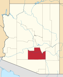 | |
| Towns | ||
| CDPs |
| |
| Unincorporated communities | ||
| Indian reservations | ||
| Ghost towns | ||
| Footnotes | ‡This populated place also has portions in an adjacent county or counties | |