Dhankuta District
| Dhankuta धनकुटा | |
|---|---|
| District | |
 Location of Dhankuta | |
| Country | Nepal |
| Region | Eastern (Purwanchal) |
| Zone | Koshi |
| Headquarters | Dhankuta |
| Area | |
| • Total | 892 km2 (344 sq mi) |
| Population (2011) | |
| • Total | 163,412[1] |
| Time zone | NPT (UTC+5:45) |
| Main language(s) | Nepali, Newari, Rai, Tamang, Magar, Limbu, etc. |
| Website | www.ddcdhankuta.gov.np |
Dhankuta District (Nepali: धनकुटा जिल्ला) (![]() Listen ), a part of Province No. 1, is one of the districts of Nepal. The district covers an area of 891 Km² and has a population (2011) of 163,412.[1] Dhankuta is the district headquarters and a major administrative region in the Eastern region.
Listen ), a part of Province No. 1, is one of the districts of Nepal. The district covers an area of 891 Km² and has a population (2011) of 163,412.[1] Dhankuta is the district headquarters and a major administrative region in the Eastern region.
Gallery

 Playground in Basantatar
 Dhankuta in rainy season
Vegetation
The vegetation zones in the district range from sub-tropical Sal forest along the Tamor and Arun rivers, and cooler temperate forests on some of the high ridges that mark the watershed between the two catchments. The altitude ranges from around 300m to 2500m. The majority of the population are involved in agriculture and crops include maize, rice and millet. Important cash crops include citrus fruits, cauliflower, cabbage, ginger, and in recent years, tea. A well-preserved forest (Rani Ban – Queen's Forest) spreads along a ridge line on the northwest side of the village, with well-developed mature stands of rhododendron and sallo (pine) trees.
Geography and Climate
| Climate Zone[2] | Elevation Range | % of Area |
|---|---|---|
| Lower Tropical | below 300 meters (1,000 ft) | 3.7% |
| Upper Tropical | 300 to 1,000 meters 1,000 to 3,300 ft. |
44.7% |
| Subtropical | 1,000 to 2,000 meters 3,300 to 6,600 ft. |
46.6% |
| Temperate | 2,000 to 3,000 meters 6,400 to 9,800 ft. |
3.2% |
Municipality and Village Development Committees (VDC/s)

- Dhankuta Municipality
- Ahale
- Ankhisalla
- Arkhaule Jitpur
- Basantatar
- Belhara
- Budhabare
- Bhirgaun
- Bodhe
- Budhabare
- Budi Morang
- Chanuwa
- Chhintang
- Chungmang
- Danda Bazar
- Dandagaun
- Ghortikharka (now Pakhribas Municipality)
- Hattikharka
- Jitpur Arkhaule
- Khoku
- Khuwaphok
- Kuruletenupa
- Leguwa
- Mahabharat
- Marek Katahare
- Maunabudhuk
- Mudebas
- Muga (now Pakhribas Municipality)
- Murtidhunga
- Pakhribas (now Pakhribas Municipality)
- Pakhribas Municipality
- Parewadin
- Phaksib
- Phalate (now Pakhribas Municipality)
- Raja Rani
- Sanne (now Pakhribas Municipality)
- Tankhuwa
- Telia
- Vedatar

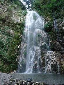
Tourist areas


See also
References
- 1 2 "National Population and Housing Census 2011(National Report)" (PDF). Central Bureau of Statistics. Government of Nepal. November 2012. Retrieved November 2012. Check date values in:
|access-date=(help) - ↑ The Map of Potential Vegetation of Nepal - a forestry/agroecological/biodiversity classification system (PDF), . Forest & Landscape Development and Environment Series 2-2005 and CFC-TIS Document Series No.110., 2005, ISBN 87-7903-210-9, retrieved Nov 22, 2013
External links

Coordinates: 26°58′53″N 87°20′36″E / 26.98139°N 87.34333°E
| Wikimedia Commons has media related to Dhankuta District. |