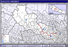
Baglung District
| Baglung बागलुङ जिल्ला | |
|---|---|
| District | |
 Baglung is located in the south of Dhawalagiri Zone | |
| Country | Nepal |
| Region | Western (Pashchimanchal) |
| Zone | Dhaulagiri |
| Headquarters | Baglung |
| Area | |
| • Total | 1,784 km2 (689 sq mi) |
| Population (2011) | |
| • Total | 268,613[1] |
| Time zone | NPT (UTC+5:45) |
| Website | www.ddcbaglung.gov.np |
Baglung District (Nepali: बागलुङ जिल्ला ![]() Listen ), a part of Province No. 4, is one of the seventy-five districts of Nepal. The district, with Baglung as its district headquarters, covers an area of 1,784 km² and has a population (2011) of 268,613.[1]
Listen ), a part of Province No. 4, is one of the seventy-five districts of Nepal. The district, with Baglung as its district headquarters, covers an area of 1,784 km² and has a population (2011) of 268,613.[1]
Introduction
Baglung is surrounded by Parbat, Myagdi, Rukum, Rolpa, Pyuthan and Gulmi districts. It has 59 Village Development Committees and one Municipality. It has many rivers and streams and so many suspension bridges. Baglung is also known as the district of suspension bridges because of the large number of bridges. It is a hilly district, most of the population settled in the sides of the rivers. Fertile planes situated in the either sides of the rivers are used for farming. Headquarters of Baglung Distrikt is Baglung Municipality which is also situated on the bank of the holy river- Kali Gandaki. Like Nepal, Baglung is also diverse in religion, culture, ethnicity, altitude, temperature etc. Hinduism and Buddhism are the major religions. Pun, Thapa, Rana, Chhantyal, Magar, Chhetri, Brahman, Newar, Gurung, and Thakali are the main ethnic groups living in Baglung.
Baglung is rich in herbal medicine plants. Rice, Corn, Millet, Wheat and Potato are the major crops of Baglung.There were many mines in use in Baglung in the past; Iron and Copper mines being the most prevalent. But they are not in use for long time because of the heedlessness of the government. There are numerous slate mines in use in Baglung. These slates are excellent for roofing.
Baglung Municipality, Hatiya- Galkot and Burtibang are the main trading centers of Baglung. Galkot, Kusma and Burtibang are connected with the district headquarters Baglung Bazaar by raw roads. Small part of Baglung is electrified by Nepal Electricity Authority and some other parts are electrified by small local hydroplants. Recently, telephone has been accessible in almost all villages of Baglung. Baglung is considered to be one of the politically most conscious districts and it plays a significant role in the Nepali politics.
Geography and Climate
Highest temperature at the lowest elevation of baglung rises up to about 37.5 degrees Celsius in summer and the lowest temperature at Dhorpatan falls up to about −15 degrees Celsius in winter. The elevation of Baglung varies from about 650 meters at Kharbang to about 4,300 meters in Dhorpatan.
| Climate Zone[2] | Elevation Range | % of Area |
|---|---|---|
| Upper Tropical | 300 to 1,000 meters 1,000 to 3,300 ft. |
2.8% |
| Subtropical | 1,000 to 2,000 meters 3,300 to 6,600 ft. |
37.1% |
| Temperate | 2,000 to 3,000 meters 6,400 to 9,800 ft. |
39.4% |
| Subalpine | 3,000 to 4,000 meters 9,800 to 13,100 ft. |
18.6% |
| Alpine | 4,000 to 5,000 meters 13,100 to 16,400 ft. |
2.1% |
Towns and villages
|
2015 Nepal earthquake
The district was affected by an April 2015 Nepal earthquake but thankfully any people weren't killed but many old buildings were damaged and some of them were collapsed.Some of them also was rebuild by the owner of that building.If that power of earthquake strikes againg those damaged buildings will be collapsed and innocent people will be killed.Government should help in the rebuild program of those buildings as soon as possible.
References
- 1 2 "National Population and Housing Census 2011(National Report)" (PDF). Central Bureau of Statistics. Government of Nepal. November 2012. Archived from the original (PDF) on 2013-04-18. Retrieved November 2012. Check date values in:
|access-date=(help) - ↑ The Map of Potential Vegetation of Nepal - a forestry/agroecological/biodiversity classification system (PDF), . Forest & Landscape Development and Environment Series 2-2005 and CFC-TIS Document Series No.110., 2005, ISBN 87-7903-210-9, retrieved Nov 22, 2013

| Wikimedia Commons has media related to Baglung District. |
Coordinates: 28°16′N 83°36′E / 28.267°N 83.600°E