Rautahat District
| Rautahat रौतहट | |
|---|---|
| District | |
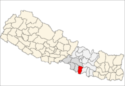 Location of Rautahat | |
| Country | Nepal |
| Region | Central (Madhyamanchal) |
| Zone | Narayani |
| Headquarters | Gaur |
| Area | |
| • Total | 1,126 km2 (435 sq mi) |
| Population (2011) | |
| • Total | 686,722 |
| • Density | 610/km2 (1,600/sq mi) |
| Time zone | NPT (UTC+5:45) |
| Main language(s) |
Bajjika (60%) Nepali (21%) Hindi-Urdu (13%) other (6%) |
Rautahat District (Nepali: रौतहट जिल्ला![]() Listen , a part of Province No. 2, is one of the seventy-five districts of Nepal. The district, with Gaur as its district headquarters, covers an area of 1,126 km² and had a population of 545,132 in 2001 and 686,722 in 2011. Among other districts, Rautahat has the largest percent of Muslims in Nepal, about 19.465% (106,111 persons in 2001).Sri Ram Sugar Mill is located in Garuda.[1]
Listen , a part of Province No. 2, is one of the seventy-five districts of Nepal. The district, with Gaur as its district headquarters, covers an area of 1,126 km² and had a population of 545,132 in 2001 and 686,722 in 2011. Among other districts, Rautahat has the largest percent of Muslims in Nepal, about 19.465% (106,111 persons in 2001).Sri Ram Sugar Mill is located in Garuda.[1]
Geography and Climate
| Climate Zone[2] | Elevation Range | % of Area |
|---|---|---|
| Lower Tropical | below 300 meters (1,000 ft) | 94.4% |
| Upper Tropical | 300 to 1,000 meters 1,000 to 3,300 ft. |
5.6% |
Village Development Committees (VDCs) and Municipalities
- Ajagaibi
- Akolawa
- Auraiya
- Badaharwa
- Bagahi
- Bahuwa Madanpur
- Bairiya
- Banjaraha
- Bariyarpur
- Basantapatti
- Basatpur
- Basbiti Jingadiya
- Bhalohiya
- Bhediyahi
- Birtiprastoka
- Bishrampur
- Bisunpurwa Manpur
- Brahmapuri

Map of the VDCs and Municipalities (blue) in Rautahat District
- Chandrapur Municipality
- Debahi
- Dharampur
- Dharhari
- Dipahi
- Dumriyachaur
- Gadhi
- Gamhariya Birta
- Gamhariya Parsa
- Gangapipra
- Garuda Municipality
- Gaur Municipality
- Gedahiguthi
- Ghiwura
- Gunahi
- Hajminiya
- Hardiya Paltuwa
- Harsaha
- Hathiyahi
- Inarbari Jyutahi
- Inaruwa
- Jatahare
- Jayanagar
- Jethrahiya
- Jhunkhunwa
- Jingadawa Belbichhwa
- Jingadiya
- Jowaha
- Judibela
- Kanakpur
- Karkach Karmaiya
- Karuniya
- Katahariya
- Khesarhiya
- Laksminiya
- Laksmipur
- Laksmipur Belbichhawa
- Lokaha
- Madanpur
- Madhopur
- Mahamadpur
- Malahi
- Maryadpur
- Masedawa
- Mathiya
- Matsari
- Mithuawa
- Mudwalawa
- Narkatiya Guthi
- Pacharukhi
- Pataura
- Pathara Budharampur
- Paurai
- Phatuha Maheshpur
- Phatuwa Harsaha
- Pipariya
- Pipra Bhagwanpur
- Pipra Pokhariya
- Pipra Rajbara
- Pothiyahi
- Pratappur Paltuwa
- Prempur Gunahi
- Purainawma
- Raghunathpur
- Rajdevi
- Rajpur Pharhadawa
- Rajpur Tulsi
- Ramauli Bairiya
- Rampur Khap
- Rangapur
- Sakhuwa
- Sakhuwa Dhamaura
- Samanpur
- Sangrampur
- Santapur
- Santpur
- Sarmujawa
- Saruatha
- Saunaraniya
- Sawagada
- Shitalpur Bairgania
- Simara Bhawanipur
- Sirsiya
- Tejapakar
- Tengraha
- Tikuliya
References
- ↑ Population bdistricts n for regions and districts
- ↑ The Map of Potential Vegetation of Nepal - a forestry/agroecological/biodiversity classification system (PDF), Forest & Landscape Development and Environment Series 2-2005 and CFC-TIS Document Series No.110, 2005, ISBN 87-7903-210-9, retrieved Nov 22, 2013
- "Districts of Nepal". Statoids.

Coordinates: 26°46′N 85°16′E / 26.767°N 85.267°E
| Wikimedia Commons has media related to Rautahat District. |
This article is issued from Wikipedia - version of the 11/21/2016. The text is available under the Creative Commons Attribution/Share Alike but additional terms may apply for the media files.