Datong
| Datong 大同市 | ||||||||||
|---|---|---|---|---|---|---|---|---|---|---|
| Prefecture-level city | ||||||||||
From top down, left to right: Datong panorama; Shanhua Temple; Huayan Temple; Yungang Grottoes; Tower at Lingyan Temple; Temple of Confucius (Wenmiao); Guandi Temple; Yinghui Gate of the City Wall | ||||||||||
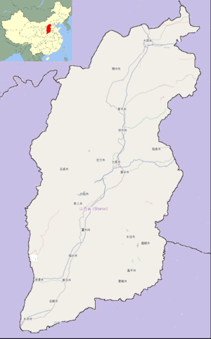
 Datong (red) in Shanxi (orange) | ||||||||||
 Datong Location of the city center in Shanxi | ||||||||||
| Coordinates: 40°05′N 113°18′E / 40.083°N 113.300°ECoordinates: 40°05′N 113°18′E / 40.083°N 113.300°E | ||||||||||
| Country | People's Republic of China | |||||||||
| Province | Shanxi | |||||||||
| Government | ||||||||||
| • Type | Prefecture-level city | |||||||||
| • Party Secretary | Zhang Jifu | |||||||||
| Area | ||||||||||
| • Prefecture-level city | 14,176 km2 (5,473 sq mi) | |||||||||
| • Urban | 2,080 km2 (800 sq mi) | |||||||||
| • Metro | 1,074 km2 (415 sq mi) | |||||||||
| Elevation | 1,042 m (3,419 ft) | |||||||||
| Population (2010 census) | ||||||||||
| • Prefecture-level city | 3,318,057 | |||||||||
| • Density | 230/km2 (610/sq mi) | |||||||||
| • Urban | 1,737,517 | |||||||||
| • Urban density | 840/km2 (2,200/sq mi) | |||||||||
| • Metro | 1,629,035 | |||||||||
| • Metro density | 1,500/km2 (3,900/sq mi) | |||||||||
| Time zone | China Standard (UTC+8) | |||||||||
| Postal code | 037000 | |||||||||
| Area code(s) | 0352 | |||||||||
| License Plates | 晋B | |||||||||
| Administrative division code | 140200 | |||||||||
| ISO 3166-2 | CN-14-02 | |||||||||
| Website |
dt | |||||||||


Datong (Chinese: 大同; pinyin: Dàtóng; Wade–Giles: Ta-t'ung) is a prefecture-level city in northern Shanxi province, People's Republic of China, located in a basin at an elevation of 1,040 metres (3,410 ft) and bordering Inner Mongolia to the north and west and Hebei to the east. It had a population of 3,318,057 at the 2010 census of whom 1,629,035 lived in the built up area made of 3 out of 4 urban districts, namely Chengqu, Kuangqu and Nanjiao District.
History

The town was founded as Píngchéng (平城) in 200 BC during the Han dynasty, after the Battle of Baideng between the Han and the Xiongnu. Located near the Great Wall Pass to Inner Mongolia, it blossomed during the following period and became a stop-off point for camel caravans moving from China into Mongolia and beyond. It was sacked at the end of the Eastern Han dynasty. Pingcheng became the capital of Northern Wei from 398 AD until 494 AD, when the well-known Yungang Grottoes were constructed during the later part of this period (460–494 AD).
The city was renamed Datong in 1048 AD. It was the Xijing ("Western Capital") of the Jurchen Jin dynasty prior to being sacked by the Mongols. It was sacked again at the end of the Ming dynasty in 1649 AD, but promptly rebuilt in 1652 AD.
Datong was close to the Beidi kingdom of Tai, which was conquered by the Zhou dynasty in 457 BC. It bordered on the Hu nomads and traded in horses. Tai was later a commandery or county.

Geography

Datong is the northernmost city of Shanxi, and is located in the Datong Basin, with an administrative area spanning latitude 39° 03'–40° 44' N and longitude 112° 34'–114° 33' E. The urban area is surrounded on three sides by mountains, with passes only to the east and southwest. Within the prefecture-level city elevations generally increase from southeast to northwest. Datong borders Ulanqab (Inner Mongolia) to the northwest and Zhangjiakou (Hebei) to the east, Shuozhou (Shanxi) to the southwest and Xinzhou (Shanxi) to the south.
The well-known Datong Volcanic Arc lies nearby in the Datong Basin.
Climate
Datong has a continental, monsoon-influenced steppe climate (Köppen BSk), influenced by the 1,000 metres (3,300 ft)+ elevation, with rather long, cold, very dry winters, and very warm summers. Monthly mean temperatures range from −10.6 °C (12.9 °F) in January to 22.0 °C (71.6 °F) in July; the annual mean temperature is 6.97 °C (44.5 °F). Due to the aridity and elevation, diurnal temperature variation is often large, averaging 13.3 °C (23.9 °F) annually. There barely is any precipitation during winter, and more than ¾ of the annual precipitation occurs from June to September. With monthly percent possible sunshine ranging from 54% in July to 66% in October, sunshine is abundant year-round, and the city receives 2,671 hours (about 60% of the possible total) of bright sunshine per year.
| Climate data for Datong (1971–2000) | |||||||||||||
|---|---|---|---|---|---|---|---|---|---|---|---|---|---|
| Month | Jan | Feb | Mar | Apr | May | Jun | Jul | Aug | Sep | Oct | Nov | Dec | Year |
| Average high °C (°F) | −3.4 (25.9) |
0.6 (33.1) |
7.5 (45.5) |
16.5 (61.7) |
23.3 (73.9) |
27.2 (81) |
28.2 (82.8) |
26.4 (79.5) |
21.7 (71.1) |
15.0 (59) |
5.8 (42.4) |
−1.5 (29.3) |
13.94 (57.1) |
| Average low °C (°F) | −16.6 (2.1) |
−13 (9) |
−6 (21) |
1.5 (34.7) |
8.3 (46.9) |
13.4 (56.1) |
16.3 (61.3) |
14.8 (58.6) |
8.5 (47.3) |
1.6 (34.9) |
−6.8 (19.8) |
−14 (7) |
0.67 (33.21) |
| Average precipitation mm (inches) | 2.0 (0.079) |
3.4 (0.134) |
9.3 (0.366) |
17.5 (0.689) |
29.5 (1.161) |
48.9 (1.925) |
100.6 (3.961) |
83.1 (3.272) |
50.6 (1.992) |
17.6 (0.693) |
7.5 (0.295) |
1.6 (0.063) |
371.6 (14.63) |
| Average precipitation days (≥ 0.1 mm) | 2.0 | 2.5 | 4.5 | 4.1 | 7.0 | 9.8 | 13.5 | 12.2 | 8.8 | 4.8 | 2.8 | 1.9 | 73.9 |
| Average relative humidity (%) | 50 | 46 | 44 | 38 | 40 | 49 | 65 | 68 | 61 | 53 | 52 | 51 | 51.4 |
| Mean monthly sunshine hours | 184.1 | 189.4 | 222.3 | 243.5 | 272.5 | 265.7 | 244.8 | 233.9 | 234.6 | 226.8 | 185.8 | 167.5 | 2,670.9 |
| Percent possible sunshine | 62 | 63 | 60 | 62 | 62 | 59 | 54 | 55 | 63 | 66 | 62 | 58 | 60 |
| Source: China Meteorological Administration | |||||||||||||
Administrative divisions
Kuang District (Chinese: 矿区; pinyin: Kuàngqū) is largely made up of separate mines throughout the metropolitan area.
| Map | ||||||
|---|---|---|---|---|---|---|
| Name | Simplified Chinese | Hanyu Pinyin | Population (2003 est.) |
Area (km²) | Density (/km²) | |
| Cheng District | 城区 | Chéngqū | 580,000 | 46 | 12,609 | |
| Kuang District | 矿区 | Kuàngqū | 440,000 | 62 | 7,097 | |
| Nanjiao District | 南郊区 | Nánjiāo Qū | 280,000 | 966 | 290 | |
| Xinrong District | 新荣区 | Xīnróng Qū | 110,000 | 1,006 | 109 | |
| Yanggao County | 阳高县 | Yánggāo Xiàn | 290,000 | 1,678 | 173 | |
| Tianzhen County | 天镇县 | Tiānzhèn Xiàn | 210,000 | 1,635 | 128 | |
| Guangling County | 广灵县 | Guǎnglíng Xiàn | 180,000 | 1,283 | 140 | |
| Lingqiu County | 灵丘县 | Língqiū Xiàn | 230,000 | 2,720 | 85 | |
| Hunyuan County | 浑源县 | Húnyuán Xiàn | 350,000 | 1,965 | 178 | |
| Zuoyun County | 左云县 | Zuǒyún Xiàn | 140,000 | 1,314 | 107 | |
| Datong County | 大同县 | Dàtóng Xiàn | 170,000 | 1,501 | 113 | |

Tourism
The Yungang Grottoes are a collection of shallow caves located 16 km (9.9 mi) west of Datong. There are over 50,000 carved images and statues of Buddhas and bodhisattvas within these grottoes, ranging from 4 centimeters to 7 meters tall. Most of these icons are around 1000 years old.
Within the city itself, there are a few surviving sites of historical interest such as the Nine-Dragon Wall, the Huayan Monastery (华严寺; Huáyán Sì), and the Shanhua Temple (善化寺; Shànhuà Sì). Further afield is the Hanging Temple (悬空寺; Xuánkōng Sì) built into a cliff face near Mount Heng. Most of the historical sites in this region date to the Tang and Ming dynasties, but the Hanging Temple dates to the Northern Wei dynasty (386–534).
The railway locomotive works (see below) began to attract increasing numbers of railway enthusiasts from the 1970s. When construction of steam locomotives was phased out, the authorities did not want to lose this valuable tourism market, and pondered the possibility of developing a steam railway operating centre as an attraction. A number of study visits were undertaken to the East Lancashire Railway at Bury, and a twinning arrangement was concluded with that town.
In 2010, work began on reconstructing the city's 14th century Ming dynasty defensive wall. The controversial reconstruction project was in its final phase at the end of 2014.[1] The documentary The Chinese Mayor [2] documents two years of vigorous effort by Mayor Geng Yanbo to push the reconstruction project forward.
 The Hanging Temple
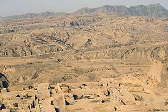 Loess landscape near Hunyuan
 A tower on the City Wall
 Pagoda at Huayan Temple
 Huayan Temple
 Lingyan Temple at Yungang Grottoes
Economy
The GDP per capita was ¥17,852 (US$2,570) per annum in 2008, ranked no. 242 among 659 Chinese cities. Coal mining is the dominant industry of Datong. Its history and development are very much linked to this commodity.
Development zones Datong Economic and Technological Development Zone
Due to its strategic position it is also an important distribution and warehousing center for Shanxi, Hebei and Inner Mongolia.[3]
Datong is an old fashioned coal mining city, and still sits on significant reserves of this commodity. Consequently, it has developed a reputation as one of China's most polluted cities. The Datong Coal Mining Group is based here and is China's third largest such enterprise. Datong is indeed however an emerging economy, as the city seeks to loosen its dependence on coal, introduce more environmentally friendly and efficient methods of extraction and move into other areas of business services. Local government has continued to upgrade its pillar coal sector (and related industries like coal chemicals, power and metallurgy), while also developing "substitute industries" such as machinery manufacturing, tourism and distribution, warehousing and logistics services. This has had some impact. Datong's GDP grew by 5.1 percent in 2008 to RMB56.6 billion.[4]
While coal will continue to dominate, Datong has been identified as one of the key cities requiring redevelopment, with part of this being in environmental cleanup, rehabilitation and industrial refocusing. Datong is a pilot city for rehabilitation studies following years of pollution. To this end it has already struck up strong relationships with other cities worldwide with similar backgrounds, and has begun plans, for example, to develop a tourism base focused on steam engine technology with antique locomotives to be used along designated tracks.[5]
Datong has a large railway locomotive works 'Datong locomotive factory', where the 'Aiming Higher' class of steam locomotive was built as late as the 1970s, steam locomotive production ended in the late 1980s and the plants main products (as of 2010) is main line electric locomotives
Main enterprises
- Datong Coal Mine Group(The third biggest coal-mining enterprise in China)[6]
- Datong Electric Locomotive Co.,Ltd, (DELC) (The second biggest Elec-Locomotive enterprise in China)[7]
- Shanxi Diesel Engine Industries Corporation,Ltd,CNGC[8]
- Shanxi Synthetic Rubber Group Co.,Ltd,CNCC[9]
- GD Power Datong No.2 Power Plant
- GD Power Datong Power Generation Co., Ltd[10]
- Shanxi Datang International Yungang Co-generation Co., Ltd.[11]
- China National Heavy Duty Truck Group Datong Gear CO.,LTD[12]
Transportation
- China National Highway 208
- China National Highway 109
- Jingda Expressway
- Dayun Expressway
- Huda Expressway
- Datong Railway Station
- Datong Airport
Education
Colleges and universities
- Datong University (大同大学)
Major schools
- Datong No.1 Middle School (大同市第一中学)
- Datong No.2 Middle School (大同市第二中学)
- Datong Locomotive Middle School (大同机车中学)
- Datong No.3 Middle School (大同市第三中学)
- BeiYue Middle School
- Datong Experimental Secondary School (大同市实验中学)
- The No.1 Middle School of DCMG(Datong Coal Mine Group) (同煤一中)
- Datong No.14 Elementary School (大同市第十四小学)
- Datong No.18 Elementary School (大同市第十八小学)
- Datong Experimental Elementary School (大同市实验小学)
Communication
South of Datong, there is a VLF-transmitter of the Chinese Navy located at 39°56′43″N 113°15′07″E / 39.94528°N 113.25194°E. The station has as interesting feature that four of its masts look like an inverted "V"-letter.
See also
References
- ↑ "Fake it to make it". South China Morning Post Magazine. Hong Kong. Retrieved November 2, 2014.
- ↑ "The Chinese Mayor". IMDB.
- ↑ China Briefing Business Guide. China-briefing.com. Retrieved on 25 February 2014.
- ↑ 2008 Datong Economy Report
- ↑ China Briefing Business Guide: Datong Economy. China-briefing.com. Retrieved on 25 February 2014.
- ↑ 大同煤矿集团公司. Dtcoalmine.com. Retrieved on 25 February 2014.
- ↑ Datong Electric Locomotive Co.,Ltd Of Cnr. Dtloco.com. Retrieved on 25 February 2014.
- ↑ Archived 10 February 2005 at the Wayback Machine.
- ↑ Archived 17 April 2009 at the Wayback Machine.
- ↑ Archived 3 October 2011 at the Wayback Machine.
- ↑ Www.China-Cdt.Com. Www.China-Cdt.Com (29 December 2002). Retrieved on 25 February 2014.
- ↑ china national heavy duty truck group datong gear co ltd. Dcgroup.com.cn. Retrieved on 25 February 2014.
Further reading
- Cotterell, Arthur (2008). The Imperial Capitals of China: An Inside View of the Celestial Empire. Pimlico, London. ISBN 978-1-84595-010-1.
External links
| Wikimedia Commons has media related to Datong. |
-
 Datong travel guide from Wikivoyage
 - Official website