Shennongjia
| Shennongjia 神农架林区 | |
|---|---|
| Forestry district | |
|
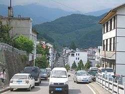
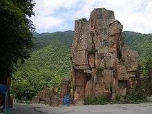
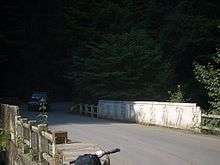
Muyu Town in Shennongjia | |
.png) Location of Shennongjia within China and within Hubei | |
 Shennongjia Location in Hubei | |
| Coordinates: 31°35′N 110°30′E / 31.583°N 110.500°ECoordinates: 31°35′N 110°30′E / 31.583°N 110.500°E | |
| Country | People's Republic of China |
| Province | Hubei |
| Seat | Songbai |
| Government | |
| • Mayor | Zhou Senfeng (周森锋) |
| Area | |
| • Total | 3,253 km2 (1,256 sq mi) |
| Population (2010) | |
| • Total | 76,140 |
| • Density | 23/km2 (61/sq mi) |
| Time zone | China Standard (UTC+8) |
| Website |
www |
| Official name | Hubei Shennongjia |
| Type | Natural |
| Criteria | ix, x |
| Designated | 2016 (40th session) |
| Reference no. | 1509 |
| State Party | China |
| Region | Asia-Pacific |
| Shennongjia Forestry District | |||||||
| Simplified Chinese | 神农架林区 | ||||||
|---|---|---|---|---|---|---|---|
| Traditional Chinese | 神農架林區 | ||||||
| |||||||
| Alternative Chinese name | |||||||
| Simplified Chinese | 神农架 | ||||||
| Traditional Chinese | 神農架 | ||||||
| |||||||
Shennongjia Forestry District (Chinese: 神农架林区) is a county-level administrative unit (a "forestry district") in northwestern Hubei province, People's Republic of China, directly subordinated to the provincial government. It occupies 3,253 square kilometres (1,256 sq mi) in western Hubei, and, as of 2007 had the resident population estimated at 74,000 (with the registered population of 79,976).On July 17, 2016, Hubei Shennongjia were listed as World Heritage Site, the 50th World Heritage Site in China.
The population is predominantly (95%) Han Chinese, the remaining 5% being mostly Tujia.
Administration
The administrative status of Shennongjia is rather unusual, in that it is the only county-level administrative unit of the People's Republic of China designated a "forestry district" (林区), rather than a more usual county or county-level city.
Shennongjia's status within Hubei is also somewhat unusual, in that this county-level unit is directly administered by the provincial government as opposed to be part of a prefecture-level city or prefecture, as are Hubei's all "normal" counties. However, this arrangement is not unique to Shennongjia, as Hubei also has three county-level cities (Xiantao, Tianmen, Qianjiang) which are directly under the provincial government, without being part of a prefecture-level unit.
The district was created in 1970 from the adjacent areas of Badong County, Xingshan County, and Fang County.
Shennongjia is further divided into 5 towns, 2 townships, and 1 ethnic township.
| Name | Hanzi | Hanyu Pinyin |
|---|---|---|
| Songbai Town | 松柏镇 | Sōngbǎi Zhèn |
| Yangri Town | 阳日镇 | Yángrì Zhèn |
| Hongping Town | 红坪镇 | Hóngpíng Zhèn |
| Muyu Town | 木鱼镇 | Mùyú Zhèn |
| Xinhua Town | 新华镇 | Xīnhuá Zhèn |
| Songluo Township | 宋洛乡 | Sòngluò Xiāng |
| Jiuhu Township | 九湖乡 | Jiǔhú Xiāng |
| Xiaguping Tujia Ethnic Township | 下谷坪土家族乡 | Xiàgǔpíng Tǔjiāzú Xiāng |
The county seat is in Songbai Town in the northern of the district; the main tourist center is Muyu Town, near the southern border of the district.
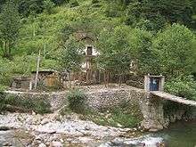
There are numerous tourist attractions throughout the district, but, as of 2009, most of the district is closed to foreign tourists, with the exception of a narrow strip along its southern border (south of Yazikou Junction). The open area includes the Shennongjia National Nature Reserve.
Geography and nature
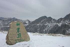
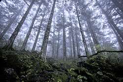
Shennongjia Forestry District is named after the Shennongjia mountainous massif, which is usually considered to be the eastern (and the highest) section of the Daba Mountains (Daba Shan). It lies within the Daba Mountains evergreen forests ecoregion.[1] Some of Hubei's highest mountains - which are also the highest mountains of the Daba Shan - are located within the district. The three tallest peaks, located west of Muyu town, are Shennong Deng (3,105 metres (10,187 ft) elevation), Da Shennongjia (3,052 metres (10,013 ft)), and Xiao Shennongjia (3,005 metres (9,859 ft), on the border with Badong County). Laojun Shan, 2,936 metres (9,633 ft) tall, is located northeast of Muyu.
The mountains of Shennongjia form a divide between two parts of the district: the central and northern part drains north, into the Han River (a tributary of the Yangtze which joins the Yangtze much farther east, in Wuhan), while the southern section drains into the Yangtze in a more direct way, via a number of short streams flowing south, such as Shen Nong Stream.
There are a number of conservation areas in the district's mountains and wetlands, in particular the world-famous Shennongjia National Nature Reserve (神农架国家自然保护区), listed on UNESCO's World Network of Biosphere Reserves.[2] The reserve includes 2,618 square kilometres (1,011 sq mi) of forest,[3] and, due to a variety of natural conditions at different elevations, has high plant diversity. One survey by Chinese botanists reports 3,479 higher plant species found in a certain area.[4]
The protected animal species include golden snub-nosed monkey, whose population in the district was reported to have grown between 1990 and 2005 from 500 to over 1200. A specially protected 100-square-km area is designated for this endangered primate species.[5]
Shennongjia has sites of scientific interests to paleontologists as well. The Rhino Cave in Hongping Town has been described by Chinese paleontologists as the richest fossil site in the country after Zhoukoudian.[6]
Economy
The district is mountainous and (as its name suggested) heavily forested, which, historically, made forestry the main industry. Over 100,000 cubic meters of timber was produced in the district annually from the 1960s to 1980s[5] (over 1,000,000 cubic metres (35,000,000 cu ft) in the 1970s[3]), but in the late 1990s the focus was switched from logging to forest conservation.[5] Officially, felling of natural forest completely ceased in March 2000.[3]
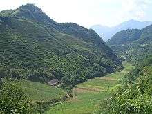
The district's low population, compared to a typical Hubei county of a similar size, means comparatively small amount of agriculture; nonetheless, the district tries to put itself on the world map as a tea producer. There are mining operations throughout the district.
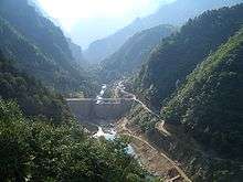
As elsewhere in the mountainous western Hubei, numerous small hydroelectric plants utilize the energy of Shennongjia's rivers and streams.
Numerous tourist facilities operate along the China National Highway 209, in particular in and around Muyu Town.
On average, the area remains comparatively poor, with the GDP per capita lower than any of Hubei's prefecture-level units.[3] Of course, direct comparison between Shennongjia and a prefecture-level unit of Hubei such as Yichang or Huangshi can be misleading, since nearly all of Hubei's prefecture-level units have a large urbanized core (with corresponding higher incomes), while Shennongjia does not.
Transportation
The main north-south route throughout the district is China National Highway 209 (G209), which, however, as of 2009 is still "unimproved" in many places both within district (north of the national park entry at Yazikou) and in Badong County south of it. In practice most visitors enter the district from its southern border, traveling along a provincial highway from Yichang, which merges with G209 near Gaoyang in Xingshan County. This route is a good paved road, designated as the Yi-Shen (Yichang-Shennongjia) Route.
Hubei Provincial Route 307 (S307) runs through the northeastern part of the district, from G209 east to Songbai Town and on into the neighboring Baokang County (part of Xiangyang prefecture-level city).
Due to the mountainous terrain, the district has no rail or water transport, and until recently, no air transportation. Despite the difficult and fragile terrain, construction of Shennongjia Airport started in April 2011 with an investment of 1 billion yuan.[7] Located west of Hongping Town, the airport opened in May 2014.
Mythology
The name Shennongjia comes from the name of the mythical deity/legendary emperor Shennong and jia, meaning ladder: literally, "Shennong's ladder", after a mythical rattan ladder which Shennong was said to use to climb up and down the mountain (later, the ladder was said to have magically transformed into a deep forest).
References
| Wikimedia Commons has media related to Shennongjia. |
- ↑ Olson, D. M, E. Dinerstein; et al. (2001). "Terrestrial Ecoregions of the World: A New Map of Life on Earth". BioScience. 51 (11): 933–938. doi:10.1641/0006-3568(2001)051[0933:TEOTWA]2.0.CO;2.
- ↑ Shennongjia Nature Reserve (UNESCO World Heritage site)
- 1 2 3 4 What's wrong in Shennongjia? Retrieved 2009-10-04.
- ↑ Altitudinal Pattern of Plant Species Diversity in Shennongjia Mountains, Central China. Authors: ZHAO, Chang-Ming1; CHEN, Wei-Lie; TIAN, Zi-Qiang; XIE, Zong-Qiang. Source: Journal of Integrative Plant Biology, Volume 47, Number 12, December 2005 , pp. 1431-1449(19). Publisher: Blackwell Publishing
- 1 2 3 Number of golden monkeys doubled (Xinhua, www.chinaview.cn, 2005-08-08)
- ↑ Tong, Haowen; Wu, Xianzhu (2010), "Stephanorhinus kirchbergensis (Rhinocerotidae, Mammalia) from the Rhino Cave in Shennongjia, Hubei" (PDF), China Science Bulletin, 55 (12): 1157–1168
- ↑ 神农架机场4月正式动工 从武汉起飞50分钟航程 Retrieved 2011-10-24.
