Yungang Grottoes
| Yungang Grottoes | |
|---|---|
| Name as inscribed on the World Heritage List | |
 | |
| Type | Cultural |
| Criteria | i, ii, iii, iv |
| Reference | 1039 |
| UNESCO region | Asia-Pacific |
| Coordinates | 40°06′35″N 113°07′20″E / 40.109722°N 113.122222°ECoordinates: 40°06′35″N 113°07′20″E / 40.109722°N 113.122222°E |
| Inscription history | |
| Inscription | 2001 (25th Session) |
 Location in China | |
The Yungang Grottoes (simplified Chinese: 云冈石窟; traditional Chinese: 雲崗石窟; pinyin: Yúngāng Shíkū; Wuzhoushan Grottoes in ancient time) are ancient Chinese Buddhist temple grottoes near the city of Datong in the province of Shanxi. They are excellent examples of rock-cut architecture and one of the three most famous ancient Buddhist sculptural sites of China. The others are Longmen and Mogao.
The site is located about 16 km west of the city of Datong, in the valley of the Shi Li river at the base of the Wuzhou Shan mountains. They are an outstanding example of the Chinese stone carvings from the 5th and 6th centuries. All together, the site is composed of 252 grottoes with more than 51,000 Buddha statues and statuettes. In 2001, the Yungang Grottoes were made a UNESCO World Heritage Site. The Yungang Grottoes are considered by UNESCO to be a "masterpiece of early Chinese Buddhist cave art... [and] ...represent the successful fusion of Buddhist religious symbolic art from south and central Asia with Chinese cultural traditions, starting in the 5th century CE under Imperial auspices."[1] It is classified as a AAAAA scenic area by the China National Tourism Administration.[2]
History

.jpg)
After the decline of the Jin Dynasty, the northern parts of China came under the control of the Northern Wei. They made the city of Pingcheng, now known as Datong, their capital. Due to its promotion, Pingcheng saw an increase in construction work. The Northern Wei early adopted Buddhism as their state religion. Buddhism arrived in this location via travel on the ancient North Silk Road, the northernmost route of about 2600 kilometres in length, which connected the ancient Chinese capital of Xi'an to the west over the Wushao Ling Pass to Wuwei and emerging in Kashgar before linking to ancient Parthia.[3]
The work on this first period of carving lasted until the year 465 AD, and the caves are now known as caves 16–20. Beginning around the year 471 AD, in a second construction phase that lasted until 494 AD, the twin caves 5/6, 7/8, and 9/10 as well as the caves 11, 12, and probably 13 were constructed under the supervision and support of the imperial court. The imperial patronage ended 494 AD with the move of the Wei court to the new capital of Luoyang. All other caves emerged under private patronage in a third construction period, lasting until 525, when the construction came to a final halt due to uprisings in the area.
Since the end of the works, the sandstone of the grottoes has been exposed to heavy weathering. The ensuing centuries therefore saw several attempts to preserve the caves and to repair sustained damage. During the Liao Dynasty the caves saw some renewing of statues and the buildup of the "10 temples of Yungang" from 1049 to 1060, that were meant to protect the main caves. However, they were destroyed again just some 60 years later in a fire. The wooden buildings extant in front of caves 5 and 6 were constructed in 1621, during the early Qing Dynasty. Since the 1950s, cracks in the sandstone have been sealed by grouting, and forestation has been implemented in an effort to reduce the weathering due to sandstorms.[4]
Gallery
-

Top of the column (dougong) in the building protecting the caves of Yungang Grottoes
-

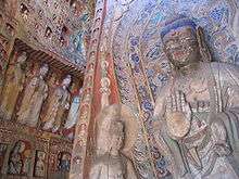
Yungang Grottoe Buddha
-
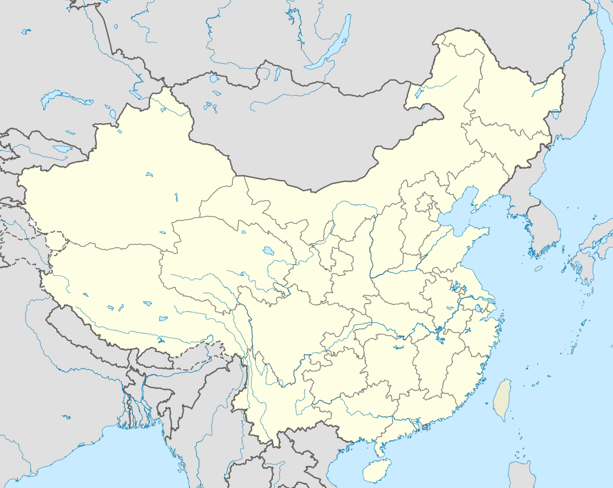
Buddhist paintings in the Yungang Grottoes
-

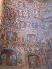
Stone carved dougong inside Cave 9
-

One of the larger statues at Yungang
-
-
-

Statue at the Yungang Grottoes
-

-

-

Cave 12. Phase II, after 650 AD. Yungang Grottoes, Datong: a riot of decoration is illustrated here, with Buddhas, musicians, and apsarasas.

References
- ↑ "Yungang Grottoes". UNESCO. Retrieved 2007-09-06.
- ↑ "AAAAA Scenic Areas". China National Tourism Administration. 16 November 2008. Archived from the original on April 4, 2014. Retrieved 9 April 2011.
- ↑ Silk Road, North China, C.Michael Hogan, the Megalithic Portal, ed. A. Burnham, 2007]
- ↑ report of the UNESCO advisory board
Further reading
- Caswell, James O. (1988). "Written and Unwritten: A New History of the Buddhist Caves at Yungang". Vancouver: University of British Columbia Press Vancouver: 225.
- Leidy, Denise Patry & Strahan, Donna (2010). Wisdom embodied: Chinese Buddhist and Daoist sculpture in the Metropolitan Museum of Art. New York: The Metropolitan Museum of Art. ISBN 9781588393999.
External links
| Wikimedia Commons has media related to Yungang Grottoes. |
- Official website (Chinese)
- UNESCO World Heritage page about Yungang Grottoes
- Protecting the Yungang Grottoes from Air Pollution Damage

Coordinates: 40°06′35″N 113°07′20″E / 40.10972°N 113.12222°E