Dongchuan District
| Dongchuan 东川区 | |
|---|---|
| District | |
|
Red earth at Hongtudi | |
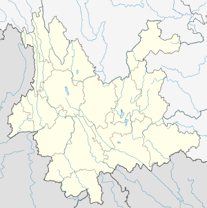
.png) Location of Dongchuan (pink) within Kunming (yellow), Yunnan (light grey) | |
 Dongchuan Location within China | |
| Coordinates: 26°11′N 103°04′E / 26.183°N 103.067°E | |
| Country | China |
| Province | Yunnan |
| Prefecture | Kunming |
| Area | |
| • Total | 1,858 km2 (717 sq mi) |
| Population | |
| • Total | 302,000 |
| • Density | 160/km2 (420/sq mi) |
| Postal code | 654100 |
| Area code(s) | 0871 |
| Website | http://www.kmdc.gov.cn/ |

| Dongchuan District | |||||||||
| Traditional Chinese | 東川區 | ||||||||
|---|---|---|---|---|---|---|---|---|---|
| Simplified Chinese | 东川区 | ||||||||
| Literal meaning | East River District | ||||||||
| |||||||||
Dongchuan District[lower-alpha 1] is a district under the jurisdiction of Kunming, Yunnan, China.
History
Dongchuan was upgraded to a city in 1958. In 1998 Dongchuan was merged into Kunming and became one of its districts.
Geography
Dongchuan borders Sichuan.
The highest point is 4344 meters high, and lowest is 695 meters. As of 2000 Dongchuan has a population of 275,564. As of 2006, the population was 302,000.[2]
The area around Huagou in the Wumeng mountains has become famous through photographers who discovered the unique local landscape and its Red Earth scenery in the 1990s.[3]
Administrative divisions
Copper Capital, A-wang, Wulong, Hongtudi, Tangdan, Tuobuka, Yinmin'ge Town and Shekuai Village
Economy
Dongchuan Special Industrial Park.[4]
The Dongchuan mineral resource is rich and it has one of six biggest coppers bases in China. It is verified that there are 3.35 million tons of copper, accounting for a third of the copper reserves in the province.[2]
Photo gallery
 Red earth at Hongtudi
 Red earth
 Pyrite concretion in shale
 Chrysocolla and Malachite from Dongchuan
Notes
References
Citations
- ↑ EB (1878), Vol. V, "China".
- 1 2 Kunming Pengcheng Trade Co. Ltd
- ↑ Dongchuan Red Soil at Chinatrekking
- ↑
Bibliography
External links
| Wikimedia Commons has media related to Minerals of Dongchuan District. |
- Dongchuan District Public Information Network - Official Website
Coordinates: 26°11′N 103°04′E / 26.183°N 103.067°E