Dongtai
| Dongtai 东台市 | |
|---|---|
| County-level city | |
 Dongtai Location in Jiangsu | |
| Coordinates: 32°47′42″N 120°31′08″E / 32.795°N 120.519°ECoordinates: 32°47′42″N 120°31′08″E / 32.795°N 120.519°E[1] | |
| Country | People's Republic of China |
| Province | Jiangsu |
| Prefecture-level city | Yancheng |
| Area | |
| • Total | 1,869 km2 (722 sq mi) |
| Population (2004) | |
| • Total | 1,159,400 |
| • Density | 620/km2 (1,600/sq mi) |
| Time zone | China Standard (UTC+8) |
| Postal code | 224200 |
| Area code(s) | 0515 |
Dongtai (simplified Chinese: 东台; traditional Chinese: 東台; pinyin: Dōngtái) is a coastal county-level city under the administration of Yancheng, Jiangsu province, China. It has a population of roughly 1,170,000 estimated for 2007. Out of the total population, about 260,000 live in the Dongtai urban core, others are distributed in the 23 suburban towns and rural regions (Some famous towns include Touzao, Anfeng, Qingdong, Sancang, Qianggang, Fu'an, Tangyang, etc.). With some Yellow Sea coast, it borders the prefecture-level cities of Nantong to the south and Taizhou to the west, and is the southernmost county-level division of Yancheng.
Transportation in Dongtai is fairly convenient. There are four International airports (Shanghai Pudong, Shanghai Hongqiao, Nanjing Lukou, Yancheng Nanyang) within 200 kilometers. There are also several other domestic airports nearby. The Xinchang Railway traverses the downtown. China National Highway 204, No. 333 provincial highway, An-qiang provincial road, and G15 Shenyang–Haikou Expressway, alternatively known in the province as the Coastal Expressway (沿海高速公路).
The dialect in Dongtai is quite different from Mandarin. The local accent is close to that in nearby Taizhou, Haiyan, Xinghua, Dafeng area.
The food style in Dongtai belongs to Huai-Yang series. The taste is not strong, and that is different from most of other regions in China. In Dongtai, people also have chance to eat different seafoods.
Tourist can also find fun in Dongtai. Xi-xi ancient town is the cradle of Dongtai and it is also a Holy land of Buddhism. The Yellow Sea (Huanghai) National Park is on the east coastal region of Dongtai and there are also a national everglade protection region and a five-A (the highest level) precious animal protection region nearby.
Climate
| Climate data for Dongtai (1971–2000) | |||||||||||||
|---|---|---|---|---|---|---|---|---|---|---|---|---|---|
| Month | Jan | Feb | Mar | Apr | May | Jun | Jul | Aug | Sep | Oct | Nov | Dec | Year |
| Average high °C (°F) | 6.2 (43.2) |
7.7 (45.9) |
12.2 (54) |
18.9 (66) |
24.5 (76.1) |
27.9 (82.2) |
30.9 (87.6) |
30.8 (87.4) |
26.7 (80.1) |
21.8 (71.2) |
15.4 (59.7) |
9.3 (48.7) |
19.4 (66.8) |
| Average low °C (°F) | −1.3 (29.7) |
−0.1 (31.8) |
3.6 (38.5) |
9.1 (48.4) |
14.6 (58.3) |
19.6 (67.3) |
23.8 (74.8) |
23.4 (74.1) |
18.6 (65.5) |
12.6 (54.7) |
6.4 (43.5) |
0.5 (32.9) |
10.9 (51.6) |
| Average precipitation mm (inches) | 34.6 (1.362) |
41.6 (1.638) |
69.1 (2.72) |
69.6 (2.74) |
87.2 (3.433) |
176.0 (6.929) |
199.9 (7.87) |
140.5 (5.531) |
101.3 (3.988) |
54.2 (2.134) |
53.1 (2.091) |
23.8 (0.937) |
1,050.9 (41.373) |
| Average precipitation days (≥ 0.1 mm) | 7.1 | 7.8 | 10.5 | 8.9 | 10.5 | 11.7 | 13.4 | 11.5 | 9.4 | 8.0 | 7.0 | 5.1 | 110.9 |
| Average relative humidity (%) | 76 | 76 | 77 | 77 | 77 | 81 | 85 | 85 | 83 | 79 | 76 | 74 | 78.8 |
| Mean monthly sunshine hours | 150.0 | 141.6 | 158.2 | 187.9 | 211.4 | 178.8 | 200.4 | 227.9 | 186.2 | 188.5 | 170.0 | 168.9 | 2,169.8 |
| Percent possible sunshine | 48 | 46 | 43 | 49 | 50 | 42 | 46 | 55 | 50 | 54 | 54 | 55 | 49.3 |
| Source: China Meteorological Administration | |||||||||||||
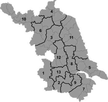
Administrative divisions
There are 14 towns under the city's administration:[2]
|
References
- ↑ Google (2014-07-02). "Dongtai" (Map). Google Maps. Google. Retrieved 2014-07-02.
- ↑ 2011年统计用区划代码和城乡划分代码:东台市 (in Chinese). National Bureau of Statistics of the People's Republic of China. Retrieved 2013-02-21.
External links
- Dongtai City English guide (Jiangsu.NET)