Altay City
| Altay 阿勒泰市 • التاي قالاسى • ئالتاي شەھىرى (Chinese) • (Uyghur) • (Kazakh) | |
|---|---|
| County-level city | |
.png) | |
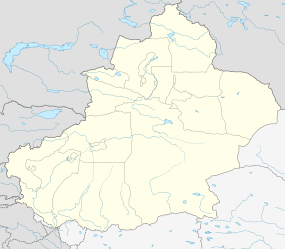 Altay Location in Xinjiang | |
| Coordinates: 47°52′N 88°07′E / 47.867°N 88.117°ECoordinates: 47°52′N 88°07′E / 47.867°N 88.117°E | |
| Country | People's Republic of China |
| Region | Xinjiang |
| Prefecture | Altay |
| Area | |
| • Total | 11,400 km2 (4,400 sq mi) |
| Elevation | 887 m (2,910 ft) |
| Population | |
| • Total | 187,600 |
| • Density | 16/km2 (43/sq mi) |
| Time zone | China Standard (UTC+8) |
| Postal code | 836500 |
| Area code(s) | 0906 |
Altay or Aletai (Chinese: 阿勒泰; pinyin: Ālètài; Uyghur: ئالتاي شەھىرى / Алтай Шəһири / Altay Shehiri / Altay Xəⱨiri; Kazakh: التاي قالاسى / Алтай қаласы / Altay qalası / Altay ⱪalase; Dungan: Аләтэ, Aləte, اَلْتَىْ) is a county-level city in Ili Kazakh Autonomous Prefecture, in far northern Xinjiang, China. It is the administrative centre of Altay Prefecture, and has 142,000 inhabitants.
Geography
Climate
Altay has a cold semi-arid climate (Köppen BSk), without the strong monsoonal influence on seasonal precipitation patterns that defines the climate across much of China and an annual precipitation total of only 191 millimetres (7.5 in). Winters are long, bitterly cold and dry, with a January 24-hour average of −15.5 °C (4.1 °F); however, the presence of the Altay Mountains to the north helps moderate the severity of winter cold as compared to locations further to the east. Spring and autumn are short but mild. Summers are very warm, but dry, with a July 24-hour average of 21.8 °C (71.2 °F). The annual mean is 4.53 °C (40.2 °F). With monthly percent possible sunshine ranging from 50% in December to 74% in August and September, sunshine is abundant and the city receives 2,993 hours of bright sunshine annually.
| Climate data for Altay City (1971−2000) | |||||||||||||
|---|---|---|---|---|---|---|---|---|---|---|---|---|---|
| Month | Jan | Feb | Mar | Apr | May | Jun | Jul | Aug | Sep | Oct | Nov | Dec | Year |
| Average high °C (°F) | −9.4 (15.1) |
−6.8 (19.8) |
0.0 (32) |
14.0 (57.2) |
21.7 (71.1) |
26.5 (79.7) |
28.2 (82.8) |
26.8 (80.2) |
21.1 (70) |
12.1 (53.8) |
0.8 (33.4) |
−6.9 (19.6) |
10.7 (51.2) |
| Average low °C (°F) | −21 (−6) |
−19.1 (−2.4) |
−11.3 (11.7) |
2.2 (36) |
8.7 (47.7) |
13.3 (55.9) |
15.1 (59.2) |
13.4 (56.1) |
7.9 (46.2) |
1.0 (33.8) |
−9.1 (15.6) |
−17.5 (0.5) |
−1.4 (29.5) |
| Average precipitation mm (inches) | 12.5 (0.492) |
9.1 (0.358) |
8.7 (0.343) |
13.1 (0.516) |
16.6 (0.654) |
15.7 (0.618) |
25.8 (1.016) |
16.1 (0.634) |
15.6 (0.614) |
15.0 (0.591) |
22.3 (0.878) |
20.8 (0.819) |
191.3 (7.533) |
| Average precipitation days (≥ 0.1 mm) | 7.4 | 6.7 | 5.8 | 5.8 | 6.6 | 6.8 | 7.9 | 6.5 | 6.0 | 5.9 | 8.5 | 9.9 | 83.8 |
| Average relative humidity (%) | 74 | 73 | 71 | 48 | 43 | 48 | 52 | 49 | 49 | 54 | 68 | 75 | 58.7 |
| Mean monthly sunshine hours | 163.6 | 182.4 | 247.7 | 281.9 | 325.4 | 338.2 | 343.5 | 326.6 | 278.6 | 220.8 | 153.5 | 131.1 | 2,993.3 |
| Percent possible sunshine | 60 | 64 | 68 | 69 | 70 | 71 | 71 | 74 | 74 | 66 | 55 | 50 | 68 |
| Source: China Meteorological Administration[1] | |||||||||||||
Transport
- China National Highway 216
- China National Highway 217
- Altay Airport
- Train until Beitun city which is about one hour's by car from Altay City.
From Ürümqi (capital of Xinjiang Province) to Altay, it takes about one hour by plane, 9 hours by day bus, 12 hours by night bus and about 14 hours by train (train is until Beitun city).
Culture
Like other cities in Xinjiang Uyghur Autonomous Region, there are a lot of minorities in Altay, especially Uyghurs and Kazakhs.
Education
In Schools, students are taught mainly in Chinese (mandarin) and there are courses for Uyghur and Kazakh languages.
Tourism
The most important tourism site is Kanas Lake where is a legend of a large creature.
People
- Ma Fuxiang (1876–1932), military governor of Altay
- Rebiya Kadeer (born 1947), political activist
- Kanat Islam (born 1984), boxer
See also
References
- ↑ 中国地面国际交换站气候标准值月值数据集(1971-2000年) (in Chinese). China Meteorological Administration. Archived from the original on 2013-09-21. Retrieved 2010-05-23.
External links
| Wikivoyage has a travel guide for Aletai. |
- Government website of Altay, Xinjiang (in Simplified Chinese)