Shaowu
| Shaowu 邵武市 | |
|---|---|
| County-level city | |
|
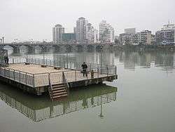
Bayi Bridge | |
| Nickname(s): 铁城 | |
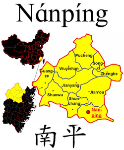 Location of Shaowu City within Nanping City | |
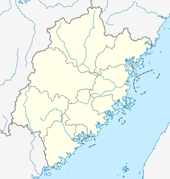 Shaowu Location in Fujian | |
| Coordinates: 27°18′N 117°30′E / 27.300°N 117.500°ECoordinates: 27°18′N 117°30′E / 27.300°N 117.500°E | |
| Country | People's Republic of China |
| Province | Fujian |
| Prefecture-level city | Nanping |
| Government | |
| • CPC City Committee Secretary | Xu Chunhui |
| Area | |
| • Total | 2,859.6 km2 (1,104.1 sq mi) |
| Population | |
| • Total | 300,000 |
| Time zone | China Standard (UTC+8) |
| Postal code | 354000 |
| Area code(s) | (86)0599 |
| Website | www.shaowu.gov.cn |
Shaowu (Chinese: 邵武; pinyin: Shàowǔ) is a county-level city in northwestern Fujian province, People's Republic of China, located in the central part of the Wuyi Mountains. It has more than 100,000 inhabitants. The local dialect combines elements from Northern Min and Gan Chinese.
Administration
4 Street Offices
Zhaoyang (昭阳街道)
Tongtai (通泰街道)
Shuibei (水北街道)
Shaikou (晒口街道)
12 Towns
Chengjiao (城郊镇)
Shuibei (水北镇)
Xiasha (下沙镇)
Weimin (卫闽镇)
Heping (和平镇)
Nakou (拿口镇)
Hongdun (洪墩镇)
Dabugang (大埠岗镇)
Yanshan (沿山镇)
Xiaojiafang (肖家坊镇)
Dazhu (大竹镇)
Wujiatang (吴家塘镇)
3 Townships
Guilin (桂林乡)
Zhangcuo (张厝乡)
Jinkeng (金坑乡)
Climate
Shaowu has a monsoon-influenced humid subtropical climate (Köppen Cfa), with short, mild winters and very hot, humid summers. The monthly daily mean temperature ranges from 7.3 °C (45.1 °F) in January to 27.7 °C (81.9 °F) in July. There is a marked decline in rainfall in autumn and early winter, and rainfall is both feqt and heavy during spring and early summer.
| Climate data for Shaowu (1971−2000) | |||||||||||||
|---|---|---|---|---|---|---|---|---|---|---|---|---|---|
| Month | Jan | Feb | Mar | Apr | May | Jun | Jul | Aug | Sep | Oct | Nov | Dec | Year |
| Record high °C (°F) | 26.6 (79.9) |
30.2 (86.4) |
32.8 (91) |
35.1 (95.2) |
35.6 (96.1) |
37.0 (98.6) |
40.4 (104.7) |
38.2 (100.8) |
37.6 (99.7) |
35.3 (95.5) |
31.7 (89.1) |
25.5 (77.9) |
40.4 (104.7) |
| Average high °C (°F) | 12.8 (55) |
14.0 (57.2) |
17.4 (63.3) |
23.2 (73.8) |
27.1 (80.8) |
30.3 (86.5) |
33.7 (92.7) |
33.3 (91.9) |
30.3 (86.5) |
26.0 (78.8) |
20.5 (68.9) |
15.7 (60.3) |
23.7 (74.6) |
| Daily mean °C (°F) | 7.3 (45.1) |
8.9 (48) |
12.7 (54.9) |
18.0 (64.4) |
21.9 (71.4) |
25.2 (77.4) |
27.7 (81.9) |
27.2 (81) |
24.3 (75.7) |
19.5 (67.1) |
13.8 (56.8) |
8.7 (47.7) |
17.9 (64.2) |
| Average low °C (°F) | 3.8 (38.8) |
5.6 (42.1) |
9.5 (49.1) |
14.4 (57.9) |
18.5 (65.3) |
21.7 (71.1) |
23.5 (74.3) |
23.3 (73.9) |
20.6 (69.1) |
15.4 (59.7) |
9.5 (49.1) |
4.5 (40.1) |
14.2 (57.5) |
| Record low °C (°F) | −6.4 (20.5) |
−4.8 (23.4) |
−4.3 (24.3) |
2.2 (36) |
8.4 (47.1) |
13.5 (56.3) |
19.1 (66.4) |
15.9 (60.6) |
11.6 (52.9) |
0.9 (33.6) |
−4.2 (24.4) |
−8.5 (16.7) |
−8.5 (16.7) |
| Average precipitation mm (inches) | 72.1 (2.839) |
125.5 (4.941) |
215.0 (8.465) |
258.7 (10.185) |
280.7 (11.051) |
333.8 (13.142) |
155.3 (6.114) |
149.6 (5.89) |
81.8 (3.22) |
62.2 (2.449) |
54.2 (2.134) |
43.6 (1.717) |
1,832.5 (72.147) |
| Average precipitation days (≥ 0.1 mm) | 13.7 | 15.4 | 20.0 | 20.2 | 20.1 | 17.8 | 13.2 | 14.1 | 11.5 | 8.8 | 8.2 | 8.2 | 171.2 |
| Source: Weather China[1] | |||||||||||||
Transportation
Expressway
- G70 Fuzhou-Yinchuan Expressway
- S0311 Pucheng-Jianning Expressway
- S0312 Shaowu-Guangze Expressway
National Highway
County-level Road (县道)
- X804
- X805
- X829
Tourist Attractions
- Yunlingshan (云灵山 Mt. Yunling): located in Longdou Village, Shuibei Town
- Pubulin (瀑布林, literally Waterfall Forest): located in Shaikou Subdistrict
- China Maze Town (中国迷宫小镇): located in Weimin Town, the biggest botanical labyrinth in Fujian
Culture
- Zhuandiao (砖雕)
- Shaowu Huagudeng (邵武花鼓灯)
- Shaowu Puppetry (邵武木偶戏)
- Dabugang Nanci (大埠岗南词)
- Nanci Beidiao (南词北调)
- the making of Nuo-Dance Masks (傩舞面具制作技艺)
- Jostling-for-Wine Festival (抢酒节): originated from Hefang Village, Hongdun Town
Specialty
- Shaowu Baoci (邵武包糍)
- Youjiang Tofu (游浆豆腐)
Notable Person
References
- ↑ 邵武 - 气象数据 -中国天气网 (in Chinese). Weather China. Retrieved 2011-12-22.
- ↑ "Wu Meijin - the sports star of Northern Min" (in Simplified Chinese). Nanping Sports Bureau. 2010-07-13.